
It was a wintry and early start for our Crockers and Redington hike this past weekend. We left MA at midnight, and arrived in time for a 5AM start at the metal bridge on Caribou Valley Road. The wind was howling like crazy through the valley, and some lightly falling snow was getting ripped about through the air, which made for an interesting and slightly intense atmosphere as we headed up the road toward the AT crossing.
We had no problem locating the AT crossing in the dark, as the small colored flags on the thin trees were visible on both sides. This time, we headed right up the trail to South Crocker (as opposed to our left turn to Sugarloaf in October). Once in the woods, it got quiet. There was a thin layer of frozen snow and about 3 inches of fresh snow on the ground at the start. It took some warming up and getting used to the invisible rocky terrain beneath the snow and light crunch.
 |
| Many of these bugs caught or eye |
 |
| Passing the Crocker Cirque Campsite spur |
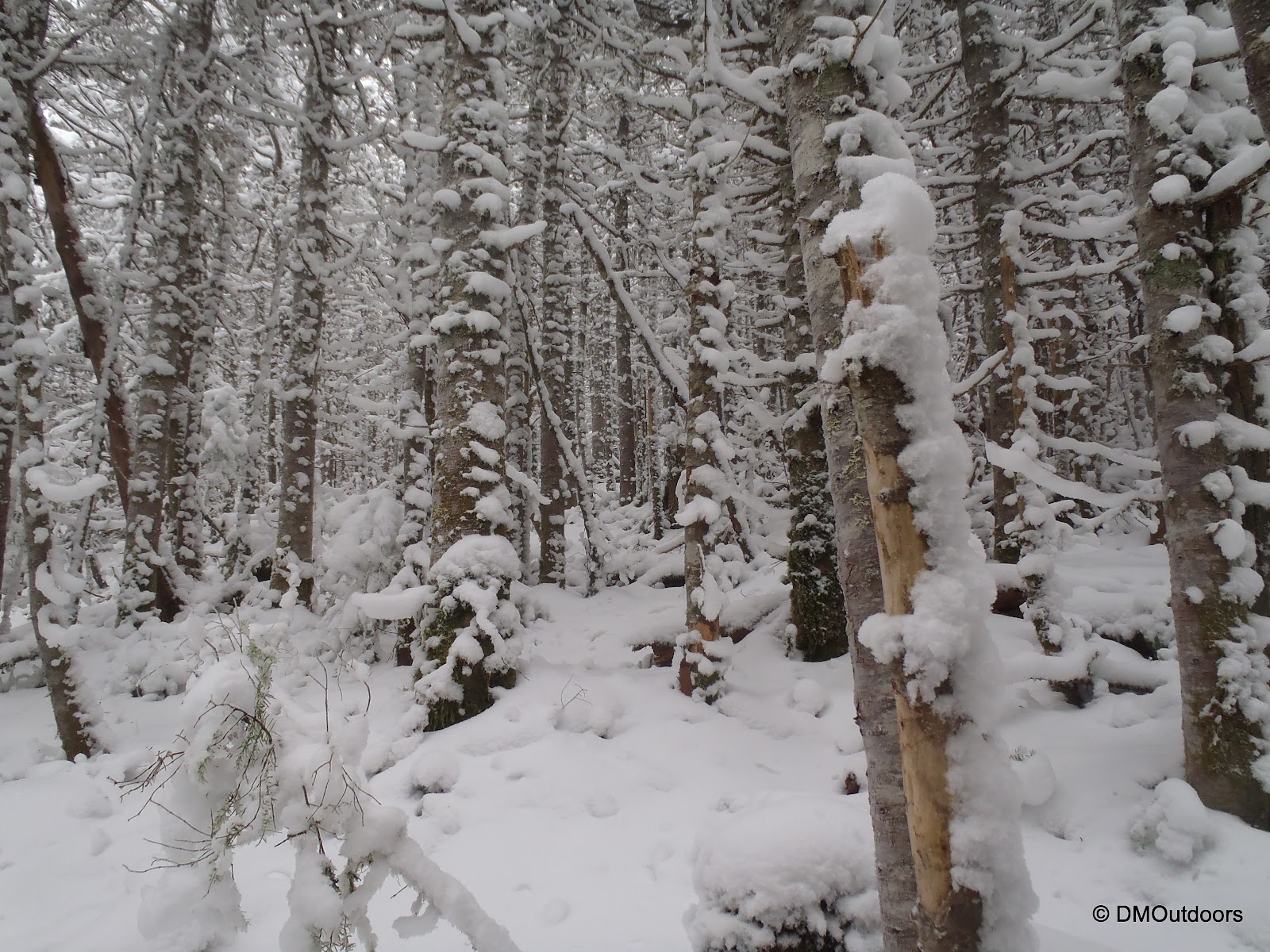
After Crocker Cirque, the trail steepened. It also passed right over a slide section. As the light slowly started to turn into day, we continued to climb steeply through a peaceful blue forest loaded up with an increasing amount of white snow as we gained elevation. The scene was amazing. What stood out to us was that all of tree trunks were sparkling like crazy in our headlamps.

It was a little bit of slow go with the elevation gain so early in the morning. Microspikes went on sometime after Crocker Cirque. We made it to South Crocker and our 64th New England 4000-footer in a few hours, just after daybreak. It was then we got a sense of how wet the snow was. We knew it would be getting warmer as the day went on, so we did keep that in mind because we'd be bushwhacking through the wet snow on the trees, etc. After a break at the summit area we headed towards North Crocker over unbroken trail. The col between is a nice even down, middle, and then up to North Crocker, in my opinion. The North Crocker summit was an appealing summit, but still surrounded by trees. I said to Bill, believe it or not, this is the 4th highest summit in Maine. After about no more than 5 minutes on the summit, we were on our way back to South Crocker. All of this went off without a problem.
 |
| South Crocker summit (4010') |
 |
| Untouched trail to North Crocker |
 |
| Approaching the summit North Crocker |
|
| North Crocker summit (4228') |
From our previous Maine hikes, I've prepared myself to expect anything. What I didn't expect, really, was for the bushwhack to be flagged the entire way. Although its flagged, there were a few spots where we lost the flag and seemed to venture off the whack, but not too far. Having the flags gave us confidence to move more quickly, as we were true peak baggers for this one, wanting to just get it and get home. We followed the no-brainer path (that is not the AT) from the South Crocker summit to what appears to be an outlook, but it opens to somwhat of a clear-cut, and the flags and so-called bushwhack began. It was a lot of fun, and we had high spirits as we made our way out there through some amazing, and once again, untouched wintry scenery.


Once we hit a logging road, we continued to follow the flags, which are on the left-hand side, and when it was time to turn right again and back into the woods, we noticed the flag was on the right side of the logging road, so that was a clear sign that this was where the rest of the way goes to the summit. Once into the trees, we passed through my favorite section of the entire hike. Perfectly straight trees were loaded on one side with snow, and everything was untouched, as it had been all hike.
 |
| Bushwhack to Mt. Redington in winter |
 |
| Mt. Redington Bushwhack |
 |
| Mt. Redington summit - Peak #66 |
 |
| The view from the steep section above Crocker Cirque |
 |
| Clearly, it was just us on these peaks today... |
Hike Stats
Trails: Appalachian Trail, South Crocker Spur, herd path (bushwhack) to Redington, herd path (bushwhack), Caribou Valley Road
Distance: 10 miles
Elevation Gain: 3,518 ft.
Actual Book Time: 8hrs 7min
It's a fine hike, nice to see there's a canister now, I dont recall seeing it back in 09. I hear the CVR is in much better shape too?
ReplyDeleteSince I've been on the road 3 times now in the last few months, I can concur that the road is in very nice condition. There are definitely some ruts you don't want to hit head on, and the wooden bridges are not a worry. It does look like Sandy (in October) may have caused some erosion around the metal grate bridge, because when we attempted to start this hike in Nov, we noticed it was washed out more around the left corner than in mid-October.
Delete