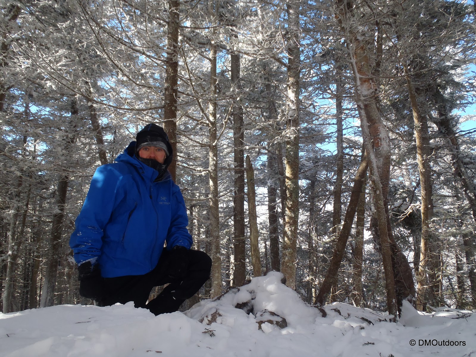
Although one might not gather this from the photos you see, this was one of my top hikes this winter. The Wildcats, Carters, and Moriah are tough peaks in any season, but for my first time in winter to these peaks, this long, challenging hike did not disappoint in the least. It was winter at it's finest, in my opinion, as I trekked 19.5 miles over six 4000-footers. I hit each of these peaks for the 3rd time on this hike, leaving me only one summit away from the completion of my 3rd Round of the 48. Success on this hike meant that I would make a big push towards my goals for this season. I was ready to go for this one.
I started the trek at 4:30 AM, leaving Pinkham Notch and taking the Lost Pond Trail to the Wildcat Ridge Trail. Nice snow conditions and prior experience made the steep Wildcat Ridge Trail a pre-dawn work-out for me, and around sunrise (but with thick overcast), I was standing on the top of Wildcat D.
Wildcat Ridge Trail
Crappy looking building on Wildcat mountain
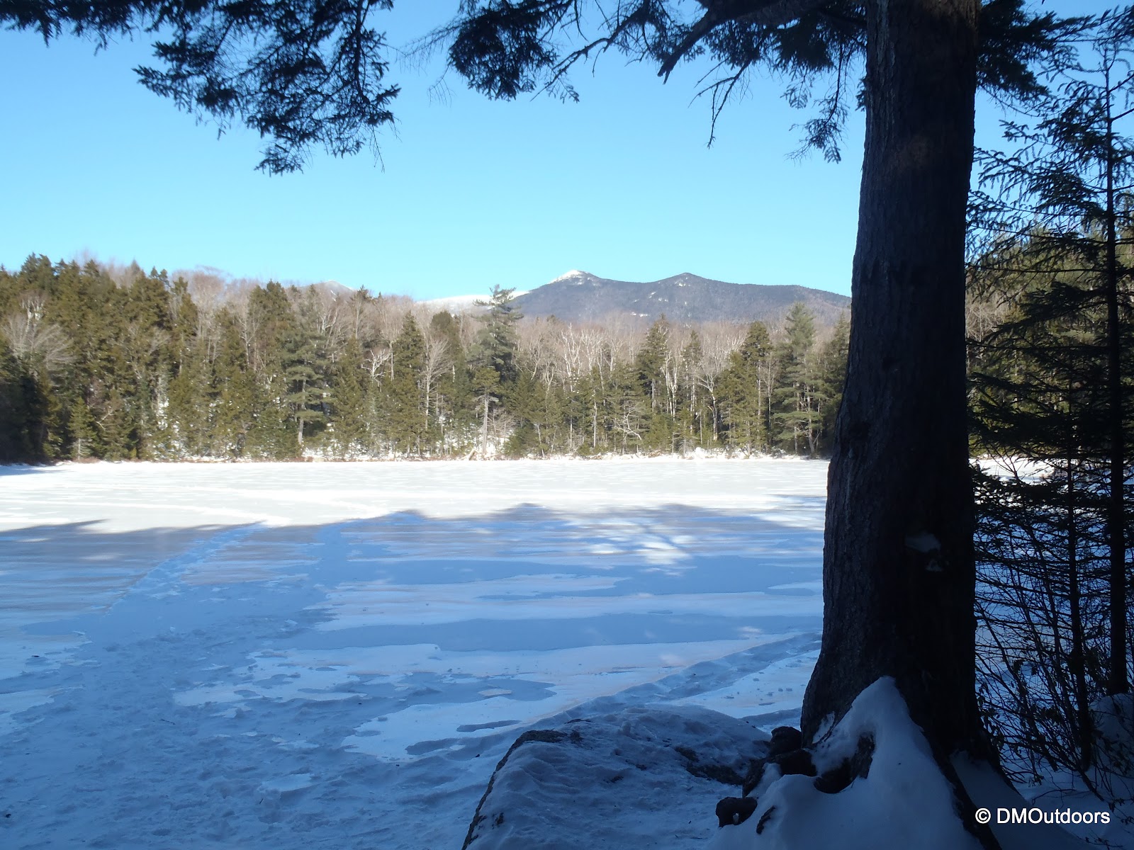
From Wildcat A, I couldn't see anything down in Carter Notch, better yet about 10 feet off the ledge. I snapped a summit photo and continued with the quickness by descending the backside of Wildcat to Carter Notch. Again, the snow was mostly powder making any descents along this hike very easy (and fun - almost like skiing on my boots sometimes). When I got to the bottom, I opted for the scenic route and decided to cross Carter Lake! This was one of the coolest scenes I've been through all winter. It was top Notch!
Start of the Carter-Moriah Trail to Carter Dome
Carter Dome summit
After that, I continued on, now on the Carter-Moriah Trail up to Carter Dome. The snow conditions were fantastic, and there was very little ice, making for easy snowshoeing. All hike long, by flipping the televators on the MSR's up and down, I was able to keep my pace up no matter what type of steepness I was dealing with. After I crossed over the summit of Carter Dome, I opted to once again skip Mt. Hight and save it for a day I'll actually get some views up on this range. The result though, was some very challenging side-hilling on the Carter Dome Trail until I reached Zeta Pass.
Zeta Pass in winter
After Zeta Pass, the scenery was amazing. The trail was broken out with a touch of powder over it, making it fresh just for me. I passed over the rest of the Carter Range through beautiful snow, hitting South and Middle Carter for the 3rd time, and first in winter.
Tree at Middle Carter summit
I had wondering if I would eventually have to deal with any unbroken trail between the Carters and Moriah, and it turned out I did - a 1.2 mile section was completely untouched, although very easy to follow the corridor. It was beautiful. The further I went, I started to cross over some of the ledges before Mt. Moriah. Unfortunately, I didn't have any views, and it was getting colder and a wind was picking up from the east.
Carter-Moriah Trail between Imp Shelter and Mt. Moriah
Ledges south of Mt. Moriah
It was cold and windy when I arrived on the summit of Mt. Moriah, but for me it was great, because that meant I only had 4.5 miles to descend, and I was making great time for my rendezvous with my dad for a pick-up.
The clouds and snow from the incoming storm were coming up the pike all morning long it seemed, and was as if I was racing away from it, and was going to win the race. I was lucky to get a decent view down to Gorham as I passed over the ledges of Mt. Surprise. The snow was starting to pick up at a good pace, so it was exciting, even at the end of the long hike.
Shortly after, with still nearly two miles to go, I was coming down the trail quickly, and immediately saw something run across the trail ahead, and go up a tree. It had something small and fuzzy in its mouth, and it wasn't long until I recognized what I was seeing. It was a small Pine Marten, and I must have interrupted his eating spot, or something. It had a long brown/red body and easily noticeable whitish head and bushy tail. The Pine Marten is on the NH State's threatened species list, and animal sightings on the trail have been extremely limited so I was glad to have a reward at the end of this hike.
Pine Marten on Carter-Moriah Trail
I had finished just under my expected time of about 12 hours. Despite the lack of views once again on this traverse, the great conditions, snowy surroundings and reasonable temperatures made this one of the top hikes this winter. To top it off, this was a true solo hike. From Pinkham Notch at 4:30am, to Bangor Road in Gorham at 3:50, I had not seen a single other person. After getting picked up and brought back to my car, I went into North Conway to pick up some mountaineering boots and went out to eat with my dad at Horsefeathers for a nice after-hike meal. What a day! On Sunday, I finished my 3rd round on Mt. Jackson as snow was flyin'. Stay tuned for that report next week, including video of me reaching the summit.
Hike Stats
Trails: Wildcat Ridge Trail, Carter-Moriah Trail
Distance: 19.5 miles
Elevation Gain: 6,900 ft.
Actual Book Time: 11:40
In July of 2012, the four of us went on a weekend trip that included a thrilling traverse of the Knife Edge to Mt. Katahdin and Hamlin Peaks. It was then vowed to return in the winter. Since July, we've talked continuously about this trip, and now it's here. So much is said about the beauty and grandness of Baxter State Park winter - the four of us are ready for this adventure!
Dan
AMC WM 48 x 2 65 winter 4000-footers since Jan '11 4 winter climbs of Mt. Washington Solo Winter Presidential Traverse EMS Winter Climbing 101
Bill
AMC WM48
22 winter 4000-footers
Mike
AMC WM 48 2 winter climbs of Mt. Washington AIARE 1 Avalanche Safety Experience on Mt. Hood, Oregon
Owl's Head is never that "dreaded hike" for me. I find it always exciting to be headed out there which ever season it may be. The main concern, especially going solo, is that such a remote hike has increased risks and they must be properly planned for, and timing is important. Heading out to Owl's Head in the winter is something I haven't done before, so I was really looking forward to this hike and whatever challenges it was going to present to me.
I started at 6AM sharp from Lincoln Woods, just as the sky started to lighten a little. The Lincoln Woods Trail was nicely packed down hard, which made for a really nice 2.6 mile warm-up to the Black Pond Trail. I found the Black Pond Trail nicely broken out, as well, allowing me to continue quickly to Black Pond. When I arrived, the sky was completely overcast, and the wind was blowing snow in circles out over the pond. I took a few pictures, and without much happening, and the sky now light, it was perfect timing for me enter the Black Pond bushwhack.
Overcast and windy morning at Black Pond
I was pleased to see boot tracks leading up the banking to the left into the woods. I felt that the path for the bushwhack could have been broken out in more of a direct route, and not so much up-hill to the left at first, but following the tracks as-is made for a problem-free bare-boot trek through the cold woods. There were a few spots where older boot marks came onto the path from either the left of right, but what I seemed to be following was working great. Near the end of the bushwhack, I came to the familiar sloping hill where the path leads downward and eventually right out to the where the Lincoln Brook Trail crosses the river - Nice!
Black Pond Bushwhack
Lincoln Brook Trail
Frozen Lincoln Brook
There were visible boot prints left for me on the Lincoln Brook Trail as I continued towards Owl's Head. It was not completely broken out, and at this point, I strapped on my snowshoes for the rest of the way. The snow made for some tricky side-hilling in some spots, but there was never a problem following the trail along the river and across the couple of small crossings. After the second crossing, I started looking for any sign of the Brutus Bushwhack, which is supposed to be about .1 after the last crossing. I saw one spot that looked like a herd path going diagonally up the slope, but I wasn't sure if that was the location - there were no signs of foot traffic heading off trail quickly after the crossing. I continued looking and eventually came to a set of tracks that led into the trees up the slope. Feeling confident, I decided to follow those tracks up the mountain with the hope of being on the Brutus Bushwhack.
After what seemed like a long time following partially drifted in boot prints, they came to an absolute dead-end, and there I was standing somewhere in the trees on the side of Owl's Head. It was probably around 3,000 feet of elevation, which meant that there was still a lot of work to do here to reach the summit. At times, the snow on the steep, steep terrain felt as if it would all fall out from beneath me and slide down the mountain. I was using trees left and right to pull myself up, and I was even chopping small twigs off here and there with my wrists to push my way through. It was some seriously tough stuff. It is moments like this when things seem to slow down, and I become zoned in. I started to think how crazy it was that I was by myself, 9 miles (or more) from help, off-trail, in the middle of the Pemi Wilderness, and on the side of a steep mountain! While that's awesome (to me), that could spell disaster if the hike wasn't going as planned. As I continued ascending, I attempted to take the path of least resistance. The further I ascended, the more I attempted to bushwhack to the left (north) in hopes of landing on the Owl's Head Path. When it started to open up more, I could sense I was getting closer to the area of the slide, and I grew more confident. Finally, after nearly falling through some spruce traps much taller than I, I came out onto a super bright Owl's Head path which appeared to be well-broken out! I freakin' knew I should have just ascended the slide, but oh well!
The spot where I came out onto Owl's Head path
After a solid break taking time to pee, drink water, and check in quickly with family on my status, I was on my way up. Now, being up on the ridge and slightly more exposed, the wind was pretty furious through the trees and above them. All day I had been watching and listening for snapping trees. Because of the wind, it was drastically colder at this point than any other point in the hike. I am not sure whether the broken out trail passed the 1/4 to summit sign or not. It's pretty small anyways, but I never saw it, making it a challenge for me to find the summit cairn. I hiked all of the way until there was no more visible footpath, and at that point, I started to get a little worried that I wouldn't find the cairn. However, luck would have it, that I practically stepped on the cairn as I made my way back south along the ridge. I dug it out a little bit to confirm, and yes! I had reached the summit of Owl's Head - my 35th 4000 footer this winter.
Owl's Head summit in winter
Owl's Head summit - 3rd round, first time in winter
My break here was VERY brief. It was unbearably cold and the wind was sucking any warmth right out of me. It is always a huge relief on a hike like this to know that you will be able to mostly follow your own tracks right out. I was looking forward to that. There was no way in hell I was going down the way I came up, so I passed my entry point onto the path, and continued down to the top of the slide. When I came out at the top of the slide, I was treated to a very beautiful view of Franconia Ridge, particularly Lafayette and Lincoln. The path going down the slide was pretty well broken out, and with careful and slow foot placement, I had no difficulty making my way down. I even carefully did a few butt-slides!
Lafayette and Lincoln from the slide
Owl's Head slide in winter
The junction for the slide as I came through on the way down and out
Back on the Lincoln Brook Trail, the consistent wind of the day filled all of my tracks about 3/4 of the way from the time I had been on the mountain. That was pretty amazing, but following the trail was easy. Same went for the Black Pond bushwhack in reverse, where the tracks were less filled in from the winds. I thoroughly enjoyed the hike out where I passed Black Pond again to find a crystal clear view of the Bonds, and also along the Lincoln Woods Trail, the sun shone brightly off the streams, providing me with inspiration to keep hauling to my car. It was a fantastic day, and my first winter ascent of Owl's Head was a great success, which left me feeling really good.
Black Pond bushwhack towards Black Pond
Black Pond
Stream alongside Lincoln Woods Trail
Pemi Bridge at Lincoln Woods
Hike Stats
Trails: Lincoln Woods Trail, Black Pond Trail, Black Pond Bushwhack, Lincoln Brook Trail, bushwhack, Owl's Head Path
Distance: 16 miles (approx.)
Elevation Gain: 2,850 ft.
Actual Book Time: 9:45
On Saturday, February 16th, I was hopeful to combine a climb of Mt. Washington with a traverse over to Jackson to complete the remaining Presidential peaks I need this winter season. From the start of the day, it became more and more unlikely that we'd be able to fit everything in. Tough snow squalls in the early morning added nearly an hour to the drive north, delaying the car-spot time and start time. Secondly, Asolo rental mountaineering boots from REI caused bad blisters on my brother's heels. This unfortunately resulted in him having to turn around at Harvard Cabin. Lastly, the climb up South Gully took a lot longer than expected. Despite all of that, the climb up South Gully was super exciting, and the views as we approached the summit were completely worth the setbacks. It was another memorable summit of Mt. Washington, my 34th 4000 footer this winter.
Pinkham Notch weather and avalanche bulletin
A nice pool along Huntington Ravine Trail
I couldn't believe how many people were on the mountain last Saturday! We saw people in the their single digit ages all of the way up to their 70s heading up the mountain, and heard people talking about it. I also noticed a lot of people carrying some pretty old-school climbing tools and mountaineering boots - which was cool. Once we got onto the Huntington Ravine Trail, we saw less people. We arrived at Harvard Cabin to find that the MWAC had posted the day's avalanche advisory. We were all okay with doing anything that had moderate avalanche danger, but not considerable There were others ahead of us in the ravine, but even so, we ended up deciding on South Gully, which had low danger, but it suggested hikers still watch for the concerns mentioned in the advisory. We took a lengthy break here, at which point my brother inspected both of his heels to find skin just peeling off from the rental boots. Because of the severity of them, it was sort of easy for him to decide to return to the car, but it was such a bummer for us for the rest of the day.
MWAC Avalanche Advisory - February 16, 2013
Huntington Ravine photo showing routes
Along the way, we passed two memorials for victims of avalanches on Mt. Washington. Although there's more on the mountain, passing two on the way to do a gully climb is enough to keep it fresh in the mind that this can happen to anyone and there no room for errors. When we stopped at the bottom of the ravine, another group of four in front of us had just geared up and was heading up. We exchanged our plans with them. I suppose its always good to know where the closest group is going to be, if it's possible. As the group in front of us left, we began to gear up putting on our crampons, helmets, and harnesses.
All geared up and ready to go at the base of Huntington Ravine
None of us had ever been in Huntington Ravine, and the photo at the advisory shows the ravine much more filled in with snow, so it was hard for us to know exactly which gully we were headed up. Of course, we ended up going up the start of Odell's Gully. We got up around the first little corner, and ahead we saw a couple of groups doing multi-pitch technical climbing up a wall of ice. Yikes! We confirmed this was Odell's, and backtracked down to where we followed footsteps across deep, deep snow, over to South Gully.
Mike leads the way up - into Odell's Gully first....oops
Now we were headed up South Gully! It was a very consistent grade and had foot holes for most of the way. Going slow and steady seemed to work well, we never had any major concerns with the conditions. At certain spots along the way, the three of us checked and confirmed that we felt safe to proceed without roping up. It was going to be great practice if we did, but it was unnecessary. Up we went through the lingering fog that offered occasional glimpses back at the Wildcat ski area below. We made it successfully to the top of the gully where we took a break for a snack and to map out our direction to the summit (because we couldn't see it).
Mike gives a thumbs up for a rad climb!
Looking up South Gully
Large wall of ice on the left side of South Gully (the climb goes to the right)
Looking down South Gully from near the top of it
We crossed the Alpine Garden Trail, and decided to continue straight on a direct path to the summit, rather than staying on the trail to Nelson Crag as one might do in summer. It seemed to take us a while from the top of the gully to the summit, but the visibility wasn't all that great and we were looking for crampon marks and trying to make sure we stayed on a straight path. Thankfully, we were dealing with no wind at all. If it was windy, all of this would be a completely different story. It was calm, which made things easy.
As soon as we started up the summit cone, it slowly started to clear, and at the same time excitement grew. Lion's Head started poking out from the clouds, and a partial and broken undercast really gave us a high-altitude feel for this true alpine climb. It was completely awesome, and we slowed to a crawl as we approached the summit because it was the best view all day, and I think we were each mesmerized by the scene around us.
At about 4pm, me, Mike, and Nicole reached an uncrowded summit of Mt. Washington. This was my 11th Washington summit, and 4th time in winter. This was the second time the three of us have climbed Washington in the winter together. On NYE 2011, the three of us climbed Lion's Head to the summit. It was a rejuvenating and fulfilling few moments as we stood on the summit to enjoy it.
Right after we crossed the walkway over the cog, it was in an instant that someone turned down the temperature in the freezer to frigidness which prompted us to take another break to add balaclavas and better face coverage. It wasn't needed for most of the hike, but the temperature was dropping rapidly and noticeably. This meant nothing other than to just keep moving and descending. We got a few short glissades in at around 5000' of elevation and enjoyed the cloudy views down into Tuckerman Ravine. We could see many small figures (people) still having fun in the ravine around 5pm, as we got our last sights on it. It was a long day, but a great climb, and another great accomplishment. Thanks to Mike and Nicole for a great hike.
Nicole glissades at 5000'
Lions Head below
Hike Stats
Trails: Tuckerman Ravine Trail, Huntington Ravine Trail, South Gully, Lion's Head Trail
Distance: 8.1 miles
Elevation Gain: 3,700 ft.
Actual Book Time: 11:45