Monday, April 29, 2013

Moonlight Franconia Ridge Traverse - 4/27/13


What tremendous weather we had this past weekend. I hope everyone got out to enjoy it in some fashion. I certainly did, and lucked out with the perfect night to complete a Franconia Ridge Traverse in the moonlight, starting Saturday afternoon (4/27). The main reason behind taking on this hike was because I needed to hike the Franconia Ridge peaks in April and also because I wanted to get back to some 4000 footers since my winter finish on March 10th. Shoulder soreness, once again, sidelined my brother from coming along. Despite that, it was tough for me to pass this one up, so I elected to carry-on with the original plan, solo. The summer weekends are filling up fast, personally, and it looks as though I may only get to hike 2-3 times per month over the next few, so passing this one up was just not an option.

On a different time-clock than just about everyone else, I arrived at the Tram Parking Lot at Cannon around 5:00pm. The lot was pretty much empty, and the skies were showing some passing clouds, which the weatherman said would be expected. My plan was not to go up to Lafayette first, and I definitely wasn't going to walk 6 miles back to my car at the end of this, so in addition to hiking, this trip included a 6 mile late afternoon bike ride on the Franconia Notch Bike Path to the Whitehouse Trail.

The bike ride was very pleasant. I've walked about the same portion once before. Going south, there was a lot of downhill, and I probably nearing the speed limit of 25mph! I passed a total of about 4 pedestrians on the 6 mile stretch. When I came to the Liberty Springs Trail, I could have stopped there, locked up, and started up the trail. However, to reduce the effort, it was a no-brainer to continue further on the bike path and come out to next gate on the right, which is the parking lot for the Liberty Spring Trailhead (also Whitehouse Trail). Here, I would be able to easily pull into the parking lot the next morning around sunrise and retrieve my hidden bike. I locked it to a tree in a good spot, and started up the Whitehouse Trail back to the start of the Liberty Spring Trail.
Whitehouse Trail bridge
Flume Slide Trail junction
Now that it was after 6:00pm, I was finally on my way to Flume on the Flume Slide Trail. Sunset was 7:44pm, and I was shooting to get there by about that time, but I had started just a tad later than I needed to  to make it. On my way up, I ran into Mike Cherim, Bill Robichaud, Allison Nadler, and Brenda Vail, who had descended the actual Flume slide after traversing the entire ridge that day. It's nice to be running into all of you on the trails and becoming acquainted. You can read Allison's report here and Bill's report here for photos of the ridge and slide during the day! I saw their boot tracks coming over to the trail from the area near the base of the slide. Based on their pictures of the slide, I should have done it, but I chose to stick to the Flume Slide Trail and what I knew because I had only 30 minutes of light remaining or less when I reached that spot.
Flume Slide Trail steam crossing
Mt. Flume summit seen through the trees on Flume Slide Trail
Flume Slide Trail, approximately a 3/4 of the way up
The Flume Slide Trail was icy, but not so icy where crampons or an ice axe would have provided any benefit as the crampons or axe probably would have done more dislodging of ice than gripping in many spots. The ascent required careful calculated steps in some places, but with the help of sturdy roots and branches, and occasional bare rock, I managed with no issues. The water running underneath provided some of the few sounds I heard all night. By the time I reached the summit of Mt. Flume, the light of day was completely gone. As I climbed over the jagged section to the summit, I could tell it was going to be a beautiful night on the ridge. Although I didn't quite make it in time for sunset, I still enjoyed taking a well-deserved break on the summit. This ascent of Flume was my 200th summit of a White Mountain 4000 footer.
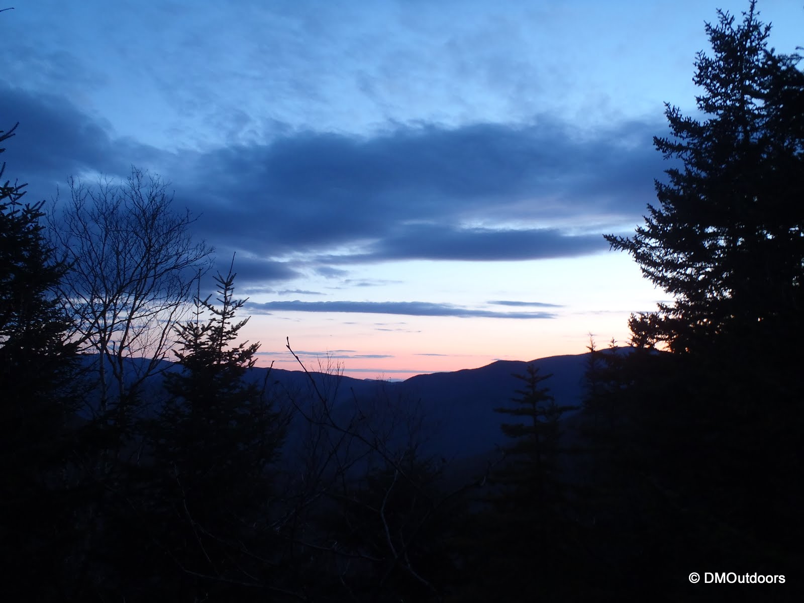
Mt. Flume summit at night 
Mt. Liberty summit
The hike over to Liberty from Flume was smooth and uneventful. The path over the post-hole mangled trail was well traveled. I arrived on the summit, vacant of course, and took in the quiet and calm view of the lights down in Franconia Notch, and the tiny lights moving up and down the highway. At this time, the moon was not yet present. This was perfect because I still had 2 miles to go until I hit treeline. The 2 miles was the same as the 1 mile I just did to Liberty, uneventful....until I stopped at little ledge to take a breather. While looking up, a bright flash of orange went across the sky. I saw its tail extinguish in several orange dots in sequence behind it as it went over. I'm used to seeing white shooting stars, but this thing was on fire! It was the only shooting star I saw. As I started to re-gain elevation on the approach to Little Haystack, a new light could be seen through the trees. Excitement grew, of course, because it was the nearly full moon beginning to rise over the Pemi Wilderness. At that point, I realized what was happening...this was going to be more perfect timing that I could have imagined, and I started to pick up my pace toward treeline.
Little Haystack with a rising full moon in the background
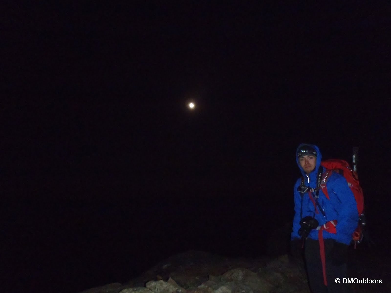
At about 11:30pm, I popped out onto the exposed ridge just before the Little Haystack summit, pretty much in awe. There were clouds in front of the moon at first, but since I could start to the see sky lighting up, I could tell the clouds were minimal and low, and once it past them, it would be bright for the rest of the night. Sure enough, that was the case, and I found myself in the middle of a perfect Moonlight Franconia Ridge Traverse. When I stepped onto the Little Haystack summit, the moon was rising over my right shoulder above the Sandwich Range, and as I traversed towards Lafayette over Lincoln, the Gargoyles, and North Lincoln, the moon went from my right to my left. On the summit of Lafayette, at about 2:00am, the moon had just crested the spine of the ridge.

In order to get a half decent photo, the camera had to be on my little tripod and taken using the timer to make sure there was no movement. After a while, I took less photos in each spot, and just enjoyed the scene that unfolded at every stop. If you think I'm the only nutty one out there, I did pass one group of 5 hikers right after Little Haystack, the only other people I saw all night. My guess was that the temperature didn't go below 30 degrees. I was completely comfortable throughout the hike, and was beyond prepared for any conditions. There was no wind. There were almost no sounds. The only sounds I recall were the crunching of my boot on rocks or the occasional sheet of ice. There were billions of stars, and sort of just like on my Bonds sunrise hike, a plane flew right in front of the moon, and the moonlight illuminated the plane's exhaust. I was also able to make out the entire outline of the Pemi peaks, Owl's Head, and very faintly I was able to see the Presidential Range. 


Mt. Lincoln 
Mt. Lafayette summit marker 
Mt. Lafayette summit
Looking south towards Liberty and Flume and I-93
The descent all of the way down the Greenleaf Trail was pretty arduous. The 1.1 miles from the summit to the Greenleaf Hut, was all rocks and boulders making the legs scream. I also slipped completely on a sheet of black ice (since I was going by moonlight still), landing right on my back on my snowshoes secured to my pack, thankfully. Except, I slammed my elbow giving me a few minutes of pain. The elbow pain subsided by the time I reached the hut, but the relentless descent of the rest of the Greenleaf Trail did not make the pain in my legs go away. The trail was a mess of hardened post holes all of the way down, which required me to aim my heels for the holes. I did have one final moment of awesomeness when I came to the impressive, and new-to-me Eagle Pass and could see the moon blaring its glow on the Cannon Cliffs and through the trees, it's light reflecting off Profile Lake below. I sort of wasn't expecting Eagle Pass since I had not hiked the lower Greenleaf before. After that awesomeness, it seemed like forever to get through the last half mile of trail which seemed like it had more boulders than the summit cone. Eventually, I was walking under I-93, and within sight of my lone car in the Cannon Tram lot. By this time, the moon was no longer in sight, well hidden from my view behind Cannon. The sky now more blue than black, sunrise was coming. I hopped in quickly, and drove south to retrieve my bike in the woods at the Whitehouse Trail, before changing, taking a few minutes to close my eyes and rest, and eventually getting home.

Hike Stats
Trails: Franconia Notch Bike Path, Whitehouse Trail, Liberty Springs Trail, Flume Slide Trail, Franconia Ridge Trail, Greenleaf Trail
Distance: 13.2 mi. (doesn't include 6 miles from Cannon Tram to Whitehouse Trail on bike)
Elevation Gain: 4,850 ft.
Actual Book Time (hike portion): 10:35 


Friday, April 26, 2013

Paddling the Entire Ipswich River - 4/14/2013


The Ipswich River, located on the North Shore of Boston, is 35 miles long in its entirety. The river supports dozens of communities along its banks. One can pass over the Ipswich River on bridges in many different towns, but to experience the river in its entirety, between all of those bridges is a completely unique experience. Whether you paddle it in a small section, all at once, or even multiple times, the river seems to always be enjoyable.

In August of 2012, I did a solo paddle from South Middleton to Little Neck, where the Ipswich River empties into the Atlantic Ocean. This was a total distance of 25.8 miles. It was a dry time of year, and the river was extremely low. However, I was fortunate enough to make it without any problems, got to see an abundance of wildlife, which is good. With the river as low as it was, I didn't want to take the chance of running aground in the marsh in Middleton, one of the most inaccessible areas from nearby riverbank.

Despite that being quite an epic paddle for me, I had not done it as completely as I wanted. This time, I was back with my brother to paddle it completely, and this would be the first time I've paddled since August 2012, and my brother even longer. Would we be able to do this in one day?


The actual start of the Ipswich River is located off of Woburn Street in Wilmington, MA. The only available parking is down the street on a cul-de-sac, so launching here is tough unless you're doing a short paddle. We needed to leave our car all day and get picked up in Ipswich. We opted to put-in at the Ipswich River Park in North Reading, instead of there. This is the furthest easy-to-park launching spot to launch a full length paddle of the Ipswich River. We didn't want to be parking in a cul-de-sac, unloading kayaks at 5:30am in the morning. This leaves the very first 1.5 miles of the river technically un-paddled, but its most often un-passable in a boat.

With that out of the way, at sunrise we unloaded the car, and put-in to the calm, but flowing river in North Reading, and off we were for a loooong journey to the ocean. The first leg of the paddle was just a little bit over 5 miles to the Bostik Dam. This is always a definite portage. The take out is on the left, before the concrete pad. You can put back in anywhere after the drop. From here, the quickwater provides a nice little push to get back going again as it flows through the corner of West Peabody and into Middleton.
Just starting near Ipswich River Park in North Reading 
Approaching the "infinity river" at Bostik Dam 
Bostik Dam near the Middleton and West Peabody line
From Russell Street in Peabody to Route 114 in Middleton is one of the lesser paddled sections of the river. Just after the bridge on Russell Street, while I was still riding the quickwater, I noticed two deer off to my left in the woods, camouflaged well. They were tough to see, but were pretty close as I floated by. Once the walking path disappears from the right, the river winds through the wet land area in South Middleton. In this section, we came across two different white herons and many other birds. We pulled into the South Middleton launch, where we took a break.
A small deer is alerted as I paddle by 
A White Heron in flight over the wetlands 
Takin' a quick break, but ready to keep on goin'
The wetland area as seen from the South Middleton boat launch
The next section is the rest of Middleton. It passes under several bridges, winds behind neighborhoods, and passes around a peninsula containing a gun range, leaving you to hope that nothing goes astray over the fences. There are lots of twist and turns in the river through Middleton.
Redwing blackbirds dominated the river morning to afternoon 
Paddling at 3mph for 33 miles 
Hey, can I get a high five?! 
A large Blue Heron takes flight in front of us 
A different Blue Heron hanged off to the side as we passed
Leaving Middleton and heading into Topsfield, the river continued to present lots of sights to see. As we paddled under the bridge to Route 1, on the right there is always runoff from a natural accumulation of water that pools off to the side. It even added to the flow, allowing us to cruise right through Topsfield. Beautiful estates and couple of pretty bridges are just a couple of things among many others to see. For our next break since Middleton, we stopped at Sally's Landing.
Sally's Landing on Ipswich River 
Beached at Sally's Landing for a break and stretch
From here, the river leaves Topsfield and enters Ipswich for the rest of the way to the ocean. The first attraction in Ipswich is the Ipswich River Wildlife Sanctuary and then there is Bradley Palmer State Park. Once you pass the Wenham-Beverly canal or also called the Grand Wenham Canal, you're into the sanctuary, and a flurry of birds can be heard the entire time until you come back towards Ipswich Road. This is one of the best sections of the river, and the section I recommend you paddle through if you're looking for a short paddle. (High Street to Ipswich Road)
The Wenham-Beveral Canal or the Grand Wenham Canal 
Ipswich River Wildlife Sanctuary 
A hawk (usually Red-tail Hawk) flies high above 
Willowdale Dam
At the Willowdale Dam and Foote Brothers Canoe, we took out to the right for the portage around the two-level dam. Shortly after putting back in, we passed a backyard field and came across four deer. I've now seen deer several times along the Ipswich River, in just about each section. Onward and ocean-bound, we came to our last portage at the Sylvania Dam in downtown Ipswich. The proper location to exit the river is directly across from the first corner of the building, in a public field by a small pond, which is called Ipswich Reservoir.
Deer on the Ipswich River
Approaching Sylvania Dam in Ipswich
Ipswich Reservoir
From here, the portage is left around the little pond, and then out to Main Street, and down County Street to the public landing, which I believe is called Street Landing. We rested the arms after the tiring portage through the bustling intersection, and at that point we were now in ocean waters! When planning any paddle beyond downtown Ipswich, its best that the tide is going out, so you have to plan this in advance. Fortunately, we only battled some wind and slightly choppy water in the bay for our last two miles, and we pulled into the beach on Little Neck having paddled the entire river in 11 hours. My dad was there waiting to give us a ride back to North Reading. It was a great day, a success, and to the guy who way back when mocked me when I said I was paddling to the ocean (attempting to), I now officially consider it done! 
Green Street Bridge, last bridge 
Paddling around Little Neck, to Little Neck Beach
(I recommend clicking Bigger Map and changing to satellite imagery)

Paddle Stats
Distance: 33.5 miles
Book Time: 11:02
Avg. Speed: 3.0mph/19:47 per mi.

Sunday, April 21, 2013

Jennings Peak & Sandwich Dome - 3/30/2013


After a nice warm-up on the Welch-Dickey Loop on March 30th, we headed further up the road to the Sandwich Mountain trail head. I had been wanting to get Sandwich Dome done for a while now, and it was a beautiful morning to continue this peak-bagging mission of getting some new peaks for the first time in a long time.
Sandwich Range Wilderness...always nice 
Sandwich Mountain Trail 
Incredible from near Noon Peak
The trail was well broken out and throughout the entire ascent was well packed (not mushy yet, but it was progressively mushy on our way down). We passed over Noon Peak taking in great views, and we could see Jennings Peak ahead and Sandwich up to our left.
Jennings Peak ahead
The Jennings Peak Spur skirts the side of the mountain before going up, but its steep final approach was cool, and it opened up to a south-facing ledge, which seemed to offer a tranquil and exclusive view, which we took full advantage of for a nice break.
Jennings Peak Spur
Bill hikes the Jennings Peak spur 
View from Jennings Peak 
Jennings Peak summit
After Jennings, there is still quite a bit of a climb left up to Sandwich. Hey, especially after doing Welch-Dickey in the morning, and Bill not being on a summit since January!! We were doing great though, and it wasn't before long I was starting to see glimpses of Lake Squam and Winnipesaukee through the trees, and we were just about to summit. When we arrived, right in front of us was the best view in the White Mountains. I could see the 4000-footers in Vermont, and all of the ranges between Moosilauke, Washington, and even over to the Carters! If Sandwich was higher, I bet we could have seen the ocean, it was so unbelievable. I was simply blown away by being able to see all of these ranges from one spot.


Drakes Brook Trail
This day was awesome because every summit was new, and every trail was new. It was a peak-bagging, red-lining type of day. After this hike, I know I'm going to enjoy exploring some of the other smaller peaks in NH. Sandwich Dome is definitely my favorite non-4000 footer!

Hike Stats
Trails: Sandwich Mountain Trail, Jennings Peak Spur, Drakes Brook Trail
Distance: 8.5 miles
Elevation Gain: 1,800 ft.
Actual Book Time: 4:15