Ahh, the Pemi Loop, one of the best and most challenging summer day or overnight hikes in the White Mountains. I hiked this one with a friend Jeff Sullivan from CT, who invited me on a hike for this weekend a while ago. Since the weather went severely downhill for this Memorial Day weekend 2013, our plans changed from a full-moonlight Presidential Traverse to a Pemi Loop. At least with a Pemi Loop, we'd be sheltered at times from the forecast of 24+ hours of rain, sleet, snow, and 30-40 degree temperatures. I will add to the beginning of this report, that you should never venture into these type of conditions unless you have the appropriate gear for the conditions, and you are mentally and physically prepared to endure the constant wetness, cold, and varying trail conditions that can be found along the Pemi Loop. Over the 30 or so hikers we saw, there were at least a half dozen individuals that I'm surprised we're not reading about a rescue this week...no packs, corduroy pants, cotton sweatshirts...
We met around 12:30AM in the Cannon Tram lot to meet and set-up an emergency car spot at Gale River Trail just in case things went crazy or we wanted to bail half-way through. From my past experiences on Pemi Loops, this is a crucial safety net, especially when planning to stay overnight. We arrived at Lincoln Woods, and started to make the final pack checks. At 2:30AM, and as a constant but light rain sprinkled on us, we set off towards the Bonds on a wet Pemi Loop adventure!
We cruised right along, chatting getting to know each other, and arrived at the Bondcliff trail in about an hour and 20 minutes. In three hours, we were crossing the final river where we stopped to filter water before winding our way up towards treeline on Bondcliff.
Jeff well prepared and all smiles for a rainy Pemi Loop adventure
As we popped out into the exposed alpine zone and made our way to the Bondcliff summit, the rain became a little more steady. There was only an occasional light gust at the time, so we took each other's photo atop the cliff of Bondcliff, in the rain, which was cool, and we moved on.
Bondcliff summit
The traverse from Bondcliff to Bond was straightforward and we continued to move at very good pace, reaching Bond in 5 hours from the start. As soon as we went over Bond, we could tell that the temperature was dropping, and the winds were picking up slightly. We started to see the tops of the trees form ice around this spot.
The Bonds ridge line in sub-par weather
Jeff's hiking style is more along the lines of a long distance backpacker or endurance trekker rather than a peak-bagger, but a Pemi Loop offers the best of both worlds where a peakbagger and a backpacker can enjoy the same thing together. Quickly, I soloed out to West Bond and back in about 20 minutes while Jeff adjusted some gear.
Ice forming on trees on the final approach to West Bond
West Bond Summit
It was pretty sweet to be back in the spot where I finished my single winter season of the 48 this March. It was a such a beautiful winter morning that day, but this time it was quite different with the wind whipping over the ridge and ice on the trees in May! It was intense in a whole different way. This was my 6th time and 6th different month of the year that I've been to West Bond. After I got back from my out-and-back on the West Bond Spur, we decided to check out the Guyot Campsite for a solid break. I had never been down the spur. At the campsite, there were easily a couple of dozen young adults around from a school group who were staying there a couple of nights. The covered shelter was jam packed, but they didn't mind us popping in to make some hot chocolate. Some hot chocolate and trail snacks readied us for the next leg of our journey to South Twin. At this time the rain was slowly turning into harder pellets, and there was more evidence of iced-over trees. About halfway onto the Twinway Trail we began to deal with lingering snow on the trail, as well as some new snow in spots, especially as we reached the South Twin summit.
On the Twinway
South Twin summit
Without really stopping, we crossed over the South Twin summit and quickly descended to the Galehead Hut. It had taken us approximately 12 hours or a little less to reach the Galehead Hut, and that included our Guyot stay of about an hour, so we were really making good time, but the weather was getting worse.
Galehead Hut - Saturday, May 25 at approximately 2pm
When we arrived at the hut, there was a girl inside warming herself and cooking a can of food on the stove in the hut. At first I thought she was the caretaker, but here was the deal - She was wearing capri spandex running pants, running sneakers (which meant exposed ankles), a shirt, and a light jacket that was probably more along the lines of water resistant than waterproof. Her pack sitting on the counter was a 3L Camelbak, which is enough for 1.5L bladder and a few small items such as keys, a map, compass and a few survival items (you would think). However, it turned out she had pretty much nothing, including no map. She was from Pittsburgh and doing a Pemi Loop. She was there for a while, and after talking with her, Jeff and I just silently looked at each other many times and couldn't believe that someone would come out in these conditions with such little gear. We also found out that she was hiking with a partner, who had continued on without her, leaving her at Galehead Hut presumably because she had no choice but to seek refuge from the conditions for a while. As she prepared to leave, we opened up a poncho for her from the hut's cabinet, and strongly suggested that she take it, and get down from the peaks as soon as possible. She took the poncho, and it was our understanding that she continued as planned over Franconia Ridge, 17 miles to Lincoln Woods in the worsening conditions that afternoon. We hope that she made it ok, and was able to meet back up with her partner.
Shortly after she left around 2:30PM, I did a quick pack-less jolt up to the summit of Galehead, my 5th wet 4000-footer on the day.
Frost Trail to Galehead summit
Galehead summit photo
Back at the hut, Jeff was snoozing already, and I was reading the guestbook, when Lisa, the caretaker came in. She was with a guy named Ed, who also stayed at the hut Saturday night and was doing a 2 night trip around the Pemi. Instead of a bustling Memorial Day weekend, there was three of us in the hut. This was my very first time staying in one of the AMC Huts! I have to say with it being around 30 degrees outside it was pretty darn cold inside the hut. Our original plan was to potentially stay at the shelter at the Garfield Ridge campsite, but we were completely soaked, and the hut was so much more accommodating, so we had no problem paying to stay. Jeff and I made some more hot chocolate, had a hot freeze dried meal, and we talked hiking and mountains with Lisa and Ed until around 9PM, when it was time to get into the sleeping bag.
While I certainly slept like a kitten in my sleeping bag with warm and dry base layers on, before I fell asleep, the wind was howling and shaking the hut. We woke up the next morning around 5:30am to frost covered windows and up to 4 inches of snow on the ground outside! This is one of the biggest surprises I've seen hiking. All we could think about was hoping that girl made it somewhere safe by late afternoon the day before. Around 6:30AM, after filling up our water bladders and organizing the packs, we were on our way on the rugged, and now snow-covered Garfield Ridge Trail.
Garfield Trail & Garfield Ridge Trail junction under fresh snow
As we made our way along this section, our decision to forego our stay at Garfield Ridge Campsite, and stay at the hut became such a good one, as the three groups we passed all stayed at the campsite, so it would have been a can o' sardines for sure if we had stayed there. It must have been a pretty cold night there. We made it to the summit of Garfield, feeling good.
Me on Mt. Garfield in MAY!!!!!
Jeff with what would be Franconia Ridge behind him if you could see it
The spot right before the Garfield Ridge Trail goes down to Garfield Pond
Continuing on, we made steady progress along the 3 miles of the Garfield Ridge Trail towards the Franconia Ridge Trail. The snow depth was just right and our boots were not making it all the way down to the nasty mushy stuff at the bottom, so that was not much of a bother. While this section can be tough in nasty conditions, its a gem to hike through, and we had footprints to keep us company, unlike the unbroken trail often found here in winter. Steadily, we were approaching Lafayette's northern flanks and we could feel the wind begin to pick up, and the precipitation begin to increase from the steady lighter snow we had going on.
The video below will take you from this point on and up to the summit of Mt. Lafayette, through which we battled some pretty difficult conditions and low visibilty - check it out!
Mt. Lafayette summit
Sleet, snow, wind, and near zero visibility for my 9th time on Lafayette!
After Mt. Lafayette, we traversed the Franconia Ridge, passing a few groups of other hikers. We battled those conditions for another 1.8 miles to Little Haystack. After that, the cold, snow, and fog slowly dissipated, and eventually on the Osseo Trail, there was rain and more wetness. At this time I was drastically beginning to slow. My 36 pound pack was rubbing on my wet back, which felt like someone slicing my lower back with razor blazes every step for the last 6 or so miles. My feet got more and more sore, and I got slower, but on these types of hikes, you have to keep going, mind over body. With Jeff cruising ahead of me most of the final home stretch, I had time to think of how awesome this hike was. It came to my mind that in 4 out of 5 Pemi Loop attempts I had hiked the Osseo Trail only in the night. This was my first time ever hiking the Osseo Trail with the ability to see the woods around me. Luckily, the fog was even lifting a little bit so I could just see the terrain and Whaleback Mountain, and I must say it offers a pretty impressive look out of the Pemigewasset Valley.
Mt. Lincoln
Little Haystack
Mt. Liberty
Mt. Flume
ALAS... 33.5 miles of insanity comes to an end...
As we drove back up to Route 3 through Franconia Notch, the sunset was so amazing, there were cars stopping everywhere along the road to get a glimpse. It looked as if the trees along the right side of the highway were ablaze by the reflection. It was quite the uplifting scene after such a undertaking. Thanks to Jeff Sullivan for inviting me to hike, and wanting to take on such a challenging hike.
Amazing scene in Franconia Notch our way to retrieve our emergency car-spot
Hike Stats
Trails: Lincoln Woods Trail, Wilderness Trail, Bondcliff Trail, West Bond Spur, Twinway, Frost Trail, Garfield Ridge Trail, Franconia Ridge Trail, Osseo Trail
Distance: 33.5 miles
Elevation Gain: 9,760 ft.
Actual Book Time: Approximately 24:00 (12hrs day 1, 12hrs day 2)
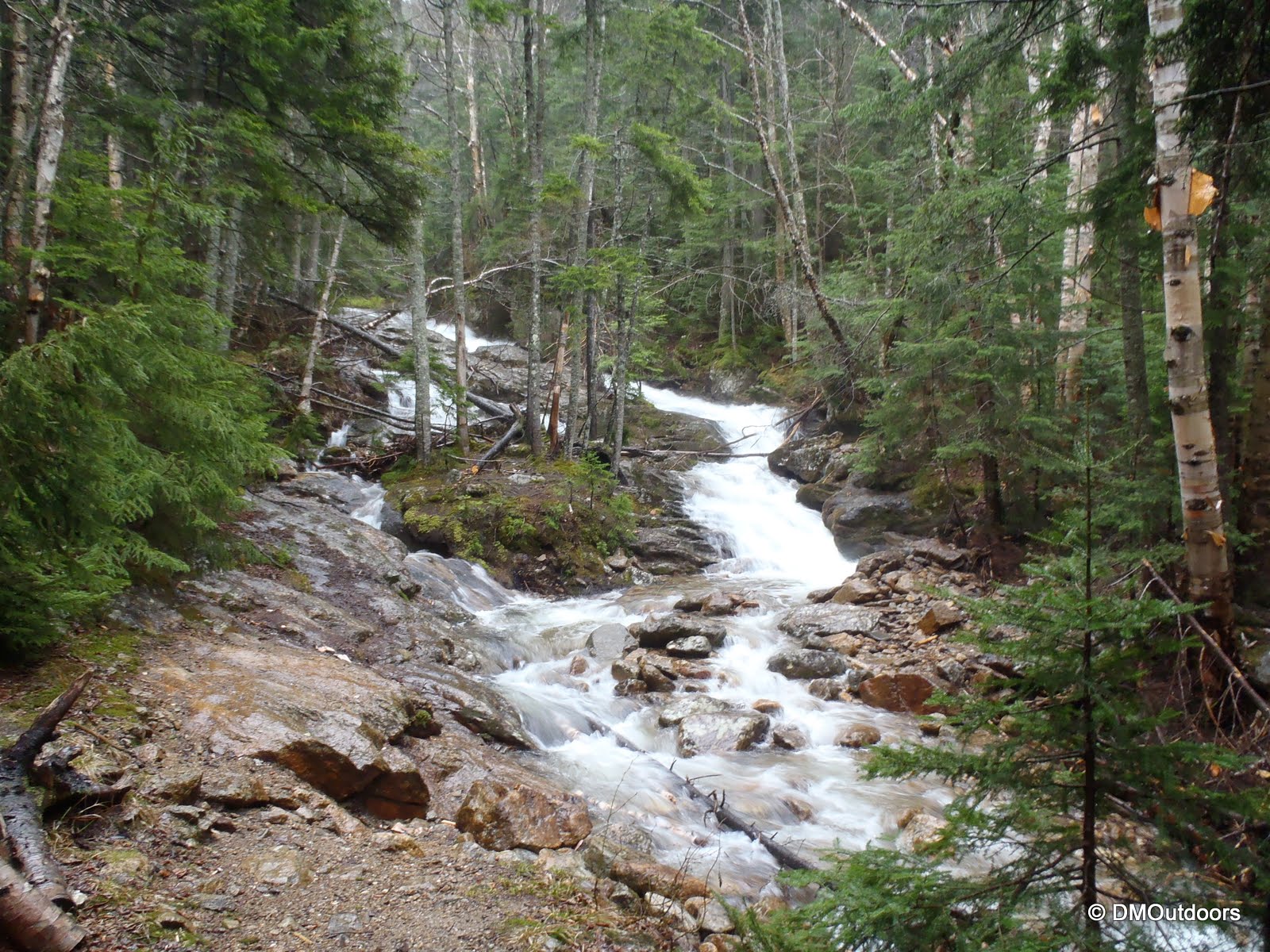
Last weekend, my brother and I got back to the mountains with a plan to bag the Carters, and whatever else we found ourselves up to. The forecast was iffy, with rain expected. It was warm, and the snow is just about gone on the lower parts of the trails. It was nice to be out, now warmer, and to be able to allow nature to touch the skin - its a different world than winter hiking. The awesome sign of spring and warmer temperatures was prevalent as the 19 Mile Brook roared its way down the slopes and out from Carter Notch.
The Nineteen Mile Brook Trail head
Nothing quite like standing alongside a beautiful river in the mountains...
The small creature was on my hat before I set it down here.
Nineteen Mile Brook Trail bridge
The hike up to Carter Notch on the 19 Mile Brook Trail took a while. We stopped a lot. It was a lot different than in the winter. In the winter, its a flat highway that ascends easily, but in the warmer months, its quite rocky, in my opinion, and requires more effort. As we got closer to the end of the trail, and into the notch, the sprinkles we had turned into a pretty nasty pouring rain. It poured down on us as we rounded the lake, and made our way to Carter Notch Hut for a break.
Carter Lake
AMC's Carter Notch Hut on a rainy day
Of course it was so nice to get out of the rain and into the hut for a break. Inside, there was no caretaker present at the time, but there were two hikers inside also taking a break. Both, from Seattle, one of them was here to finish his 48 on Wildcat after starting to hike the 4000-footers 35 years ago. After reading his log entry at the hut it confirmed that regardless of whether you do them in less than a year, all in one winter, or over 35 years, hiking the White Mountain 4000-footers will leave a mark on you forever with memories that will always remain fresh.
After a good snack, they had gone on their way, and we were going up to Carter Dome. We got a little bit of a later start than our norm from the trail head, but it wasn't a big deal. We dealt with patches of snow just before the Notch, and then higher up on the Carter-Moriah Trail. The hike to Carter Dome from here is basically like a natural stair master.
A patch of snow at the start of the trail up to Carter Dome
Hiking over some pretty crappy trail...
In 4 times I've been to Carter Dome, I only once had a view...
The summit marker on Carter Dome that I can't remember ever seeing before - Crazy!
As we left the Carter Dome summit, we were making a decision for the rest of the hike. It was definitely a little late to head beyond Zeta Pass today, but we made the decision to get Mt. Hight for the first time ever. Of the 4 times I've passed through here, I opted out of Hight because there were no views. This time, we decided to bag it, and we would descend to call it a day. The trail beyond Carter Dome summit was a pretty nasty monorail, like walking on a mini knife edge that was constantly collapsing. Not to mention it was still raining steadily at times, but we got there, and it was a pretty cool summit. We defined this as our Trailwright 72 jaunt to Mt. Hight. I can't wait to get this peak with some views, but there is never a bad day in the mountains.
Carter-Moriah Trail in May leaving Carter Dome summit
Mt. Hight summit ahead
Mt. Hight
Bill on Mt. Hight for the first time
Me on Mt. Hight for a Trailwright 72
As we left the summit of Mt. Hight, we chuckled over the only tiny little glimpse of sun we had all day. The trail descended from the summit pretty steeply as it went back to the Carter Dome Trail. We dealt with the nasty pine needle and dirt riddled monorail (which got all over our hands, if we had to ease a fall) back to the junction. After that, it was a quick .2 to the always memorable and beautiful Zeta Pass. There is just something about this spot that is awesome, but I can't nail it. I've been here in all seasons, and even camped nearby in a stealth-spot in the summer of 2011. It's always quiet and peaceful, and its an easy spot among the always challenging Wildcat-Carter Ranges that calls for a stop to enjoy it for a few. I bet for sure that the Native Americans and early peoples of the White Mountains also made stops here.
A tiny glimpse of sun on the summit of Mt. Hight, but no view
The always interesting and intriguing Zeta Pass
After that, we descended the Carter Dome Trail to head back down and get this rainy mess over with. It didn't get any easier, really, as we were faced with a couple of tricky crossings of the raging stream. One thing that dawned on us, was that somehow, the trail led us a way that didn't pass the junction sign at the Carter Dome Trail and 19 Mile Brook Trail. After about 15 minutes, we confirmed that was the case and we were on 19 Mile Brook, but we wondered whether the first of these two crossings was necessary, but it clearly had a path on each side. Anyways, we made it across both without a hitch but with some excitement, which was cool.
At the end of a cloud and rain-filled journey, we arrived back at the trail head to be treated with some late afternoon sunshine and clouds moving out. A big thank you to Eric T. and his friend from Seattle, for spotting and leaving my brother's hat for us at the car, and more importantly, Congratulations for completing the 48 after 35 years!
A warn greeting at the trail head after a wet and messy hike
Hike Stats
Trails: 19 Mile Brook Trail, Carter-Moriah Trail, Carter Dome Trail