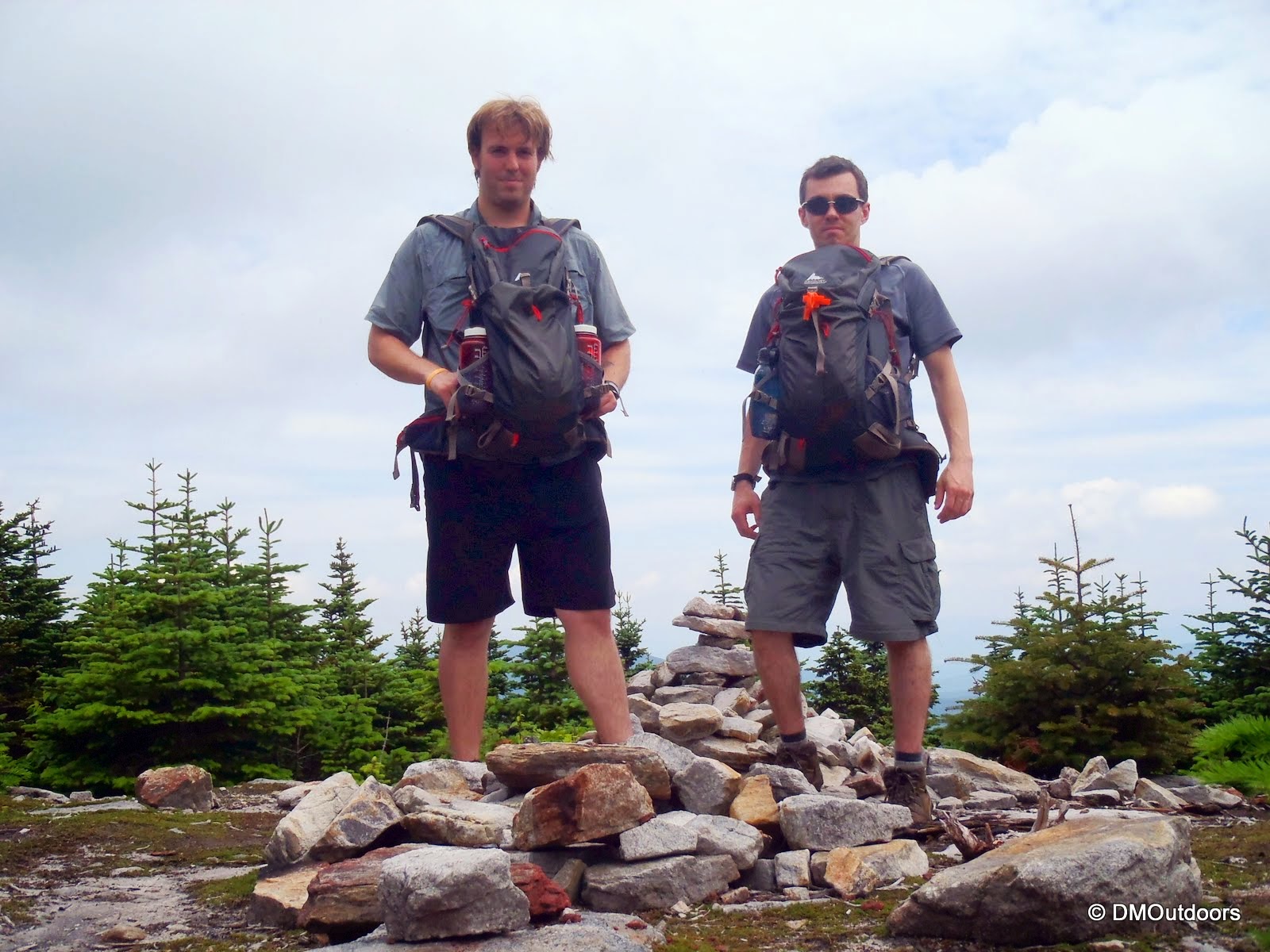
On Saturday, June 22, 2013, my brother and I completed the 67 New England 4000 Footers atop North Brother in Maine's Baxter State Park. As we neared closer to the end of this journey, it grew on us that it would be ever-so-fitting to end this part of our journey with a two-brother climb over the Brothers to end on Brother. Being the northernmost peak on the list in Maine, it also fit with both of our tastes by being hard to get to, remote, and beautiful (we nearly went for it this winter). Although we experienced this same accomplishment together on the same final peak, we created our very own journeys having completed our White Mountain 4000 footers at different times and on different peaks (but both in less than a year). And, despite me having finished the White Mountains 4000 footers earlier than he, both he and I have now reached ALL 67 summit together, at least once, which is a pretty amazing thing. After reading that, what comes to mind is that this is what climbing the 4000-footers is all about. So what if everyone's doing it, yes it's the same goal, but everyone's journey is different, filled with different highs, different lows, and different obstacles on trail and off trail. This was how we both closed out another chapter - A great weekend in the mountains, a Brotherly New England 4000 Footer Finish.
 |
| Nesowadnehunk Lean-to #6 |
We booked two nights in a lean-to at the Nesowadnehunk Campground, and arrived Friday evening about an hour prior to the required 8:30PM cut-off. For us, the adventures always start on Thursday with packing. This one required an early exit from the office, in order to make the long 5 hour drive. Don't forget at 20MPH, the 16 mile drive into Nesowadnehunk Campground takes about 45 minutes or so. The full moon was incredible, and after a nice fire and setting up the sleeping gear, we were sleeping not too much later.


On Saturday morning, feeling very excited, we awoke to a pretty nice morning. We pretty quickly geared up for our final hike, which was a counter-clockwise loop over Mt. Coe, South Brother, North Brother, and Fort Mountain, which is a bushwhack. North Brother would be our final 4000-footer, and the other peaks would be make for a nice bonus, getting 4 total 100 Highest Peaks. Our packs were already set so after some quick food and orange juice, we made the short drive from the campground to the Marston Trail parking lot, where there was one other car. The weather was looking great as we looked up to Doubletop and over the Nesowadnehunk Stream. We signed in at the register, and the person before us was about 20 minutes ahead going straight to North Brother, though.
 |
| Doubletop from Marston Trail parking area |
 |
| Start of the Marston Trail |
The woods along the start of the trail are nice, and eventually it reaches a stream and follows it for a little while. We made our way to the Mt. Coe Trail junction, where we took a right beginning our approach to Mt. Coe.
 |
| Marston Trail below the lower Mt. Coe Junction |
 |
| Lower Mt. Coe Trail junction |
 |
| Small stream crossing on the Mt. Coe Trail |
 |
| Hiking up into col between Coe and O-J-I |
 |
| I see you lil' fella - this guy nearly got squashed |
As we made our way into col between O-J-I and Coe, we couldn't help but notice how sweet of a slide it was! The rock was wet in many places, which resulted in slip and scrape of my leg in one spot that drew blood. The slide seemed to get much steeper the higher we went, but the top is pretty cool, and within about a minute of going into the trees at the top, we rounded the corner coming out onto the Mt. Coe summit. The views from the summit were great, in all directions.
 |
| Impressive! - Looking out towards our start from the base of Coe Slide |
 |
| Caution: Slippery when wet - Indeed it was a little tricky in spots |
 |
| Great shot of Bill on the Coe Slide |
 |
| The Coe Slide and the col, with O-J-I |
 |
| Mt. Coe summit, with the Brothers in the background |
 |
| The Katahdin massif from Mt. Coe |
 |
| South & North Brother from Mt. Coe |
From Coe, descending the little ridge into the trees on the way towards South Brother reminded me a little bit of descending the Hamlin Ridge Trail from Hamlin Peak. It's a nice little section with cool views that gave us a little boost of momentum, because we pretty much cooked it along the easy stretch of trail following Mt. Coe until we reached the South Brother spur. In the trees, it was tough to tell what was going to happen with the weather. We decided to drop the packs to bag South Brother. As soon as we did and started up the spur, of course, the skies opened up. As we kept going up the spur, it started to rain a bit harder, and the wind was gusty, making it pretty chilly. Of course, we left our jackets in our packs (it had not rained yet on the day). As we neared the summit, and about 10 minutes after the rain started, it seemed to let off a little bit, and we were able to enjoy the summit of South Brother. Even though the rain lasted just a few minutes, we did get wet, which resulted in us having to make minor clothing adjustments when we got back to the packs.
 |
| South Brother spur junction |
 |
| Spur Trail to South Brother |
 |
| Me on the South Brother summit |
 |
| Clouds and rain moving in over the Klondike |
 |
| Anyone know what peaks these are well west of Doubeltops? |
Next up on our agenda was North Brother, our final 4000-foot peak to climb in all of New England. Of course here the excitement grew a little. We continued on the Mt. Coe Trail .7 miles to the junction with the Martson Trail. Although foggy and wet, the trail and woods were still really nice.
 |
| Mt. Coe Trail nearing Marston Trail junction |
 |
| Mt. Coe Trail & Marston Trail junction |
Now on the Marston Trail, we contended with wet and running trail from the recent passing rain shower. The vegetation on these paths are a lot more grown in than the White Mountains, which makes things interesting, and obviously keeps your outer layers wet. Phasing us not, we continued on and upwards. Eventually we broke treeline and the last of the scrub to come within sight of the summit sign through a faint cloud. Although it wasn't the clearest and best of sights we've seen, it really stood out, beckoning us, with its impressive summit. Around us as we trekked toward the summit, moving fog covered the sun, reduced our views tremendously, and blew against us. A few minutes later, with smiles ear to ear, we touched the summit, finishing the New England 4000 Footers.
 |
| Approaching North Brother Summit |


While the views were not extravagant for our initial summit of North Brother, we would later get some sunshine on the way back from Fort, which was our next destination. Fort Mountain is a New England 100 highest peak (along with the other 3 summits on this loop), and it is a bushwhack. There was no way we would pass this up for another time. The beginning of the bushwhack is very clearly marked by cairns leaving the summit of North Brother and into the scrub. There were orange flags marking the route from this point on. They often make sharp turns, so on occassion you should look in each direction to see where the next one might be. When in doubt, if you do look down among the grown in path, you will see a pretty decent herd path at your feet. I would caution, though, that the path is not flat underneath. It's not necessarily a walk in the park because there is elevation loss and gain involved, and the path is littered with roots, making trips and falls almost unavoidable (never mind it was soaking wet). This type of terrain could easily tire you if you're not ready for it. Even I might add that I'd be a little worried heading into this area solo.
Without incident, however, we made it to treeline on Fort and immediately went to the two left summits, with the far left one being the true summit. At the time, and even though I had just read a report before leaving, I completely forgot which of the summits was the true one. Because of that, I suggested to Bill that we go over to the other ridge (south) just in case (a peak-bagger's worry). We found orange flags leading over there, but when we arrived nearly 30 minutes later through thick nasty stuff, we clearly could tell the other summits were higher. At that point, I wondered that the flagging going south along the ridge might lead to the plane wreckage that rests on Fort's mountainside. That would be left to find out for another day, and we of course went back to the true summit (which took another 30 minutes through the nasty thick scrub). During this pointless out-and-back to the southern summit, my brother lost his entire food bag out of his pack! Thankfully this was a day-hike. It's a bright orange bag. I wonder if anyone will ever find it!
 |
| Approaching summit of Fort Mountain |
 |
| Bill on Fort Mountain |
 |
| Me on Fort |
 |
| Fort Mountain summit ridge |
 |
| Looking back at North Brother from treeline on Fort |
 |
| Fort Mountain bushwhack (on way back to North Brother) |
 |
| Bill pops out of the trees back onto the slop of North Brother - amazing! |
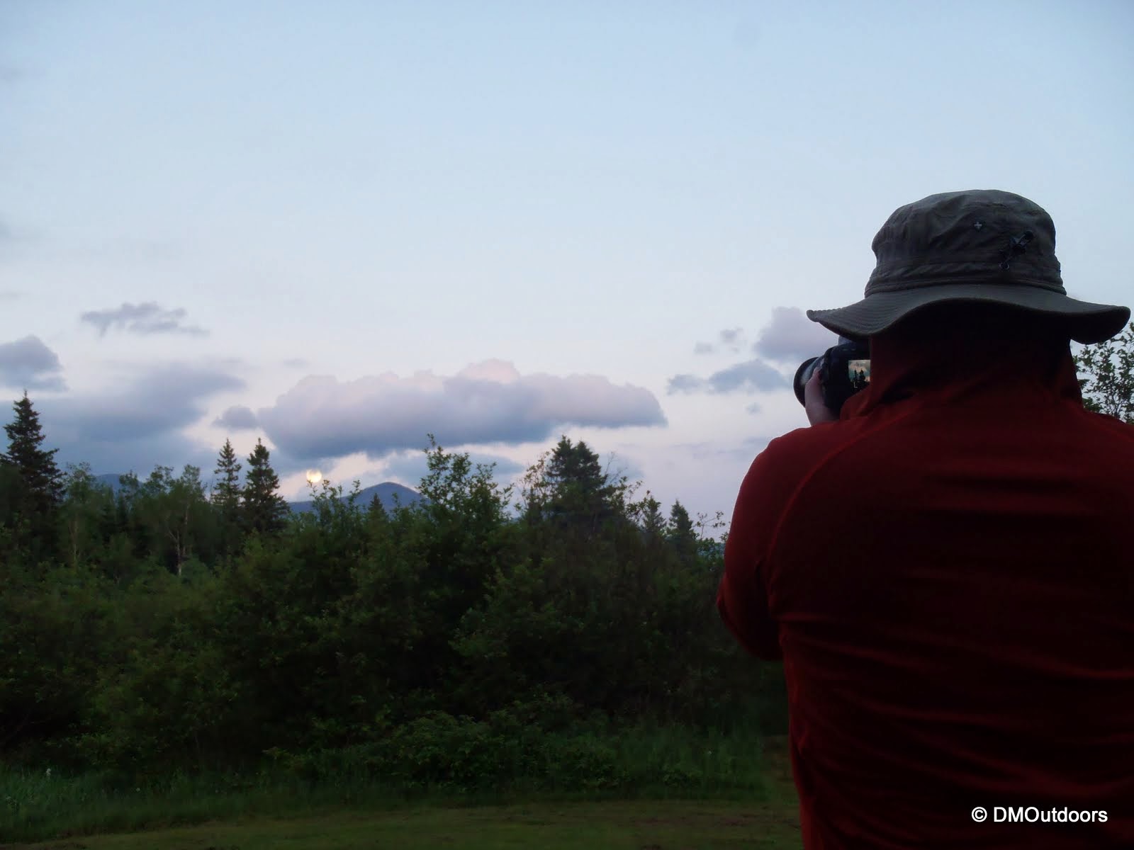
After our excursion on Fort Mountain, we made the bushwhack back without any issues at all. In fact, things got a much better as the sun poked through the clouds and we made our way back to North Brother. When we did, we stayed a little longer than before because the views were spectacular. I think at that moment, we experienced the best views we've ever had in Maine. With that said, it was also time to celebrate, and that we did, with a shot of whiskey at the summit and a couple of nice ales back at the lean-to - it was a beautiful night at Nesowadnehunk Campground. The incredible Supermoon was a memorable setting for our night, as we enjoyed the fire and talked about our journey.
 |
| Baxter State Park |
 |
| Katahdin's summit in the pufy white clouds |
 |
| South Brother and Coe |
 |
| South Brother and Coe, with Doubletop behind |
 |
| Leaving North Brother, amazing scenery to be present in |
 |
| A surprise view descending the Marston Trail |
 |
| Steak and Kabobs |
 |
| A beautiful evening on Nesowadnehunk Stream |
 |
| Mt. O-J-I from Nesowadnehunk Campground |
 |
| This lil' guy chilled with us for a while |
 |
| Hangin' by the fire |
 |
| A surprise deer on the 45 minute drive out of the park |
Looking back at my records, shout outs go to Sean R, Rachel L., Mike W., Nicole W., and my awesome niece Kiara for being a part of me and Bill's New England 67 journey. Shout outs to those we've met on the way! Most importantly, thanks to my brother Bill for joining me in this adventure and visiting every single one of these summits together. Your path to # 67 was a little bit different than mine, but being part of yours, and being able to end this one together on North Brother was nothing short of perfect! On to the next adventure we go....Thanks all!
Hike Stats
Trails: Marston Trail, Mt. Coe Trail, South Brother Spur, North Brother Spur, Fort Bushwhack
Distance: 13.2 miles
Elevation Gain: 5,460 ft.