Sunday, November 25, 2012

Inside The Moments: Episode 9 - Bald Eagle Sighting

This afternoon, me, my brother, and niece went for a short 3.5 mile door-step to door-step hike near our house out to Crystal Lake in Haverhill, MA. Although this was no hike to the mountains, making the decision to just do it, rewarded us tremendously. We just love being able to walk down the street and escape into nature for a quick jaunt through the woods.

Any beaver's home?
Beaver activity
We walked along the shoreline of the lake as the cold wind blew - wow is was it cold out today. There wasn't a whole lot to see, but it was cool because there are not many places where you can go for a shoreline and woods hike all in one within a few miles from our doorstep. After about two miles, we came to a spot where there was a sandbar between an island and the mainland. We wanted to see if the low water would allow for a crossing onto the island, but it was not quite shallow enough.
An island on Crystal Lake in Haverhill, MA
As we were poking around in this spot along the shore, I looked up and alerted Bill to a large bird in a tree on the island. It appeared to be a bald eagle. What an awesome sight!


After watching it do nothing but turn its head back and forth for a while, we turned around and started to head back towards the trail. As we walked, the setting sun shined off its white head, allowing us to always easily see it when we glanced back. Once on the far shoreline, we looked back at the island to clearly see the eagle on the same branch standing watch over its island.
Eagle (on branch left side of island)
What an interesting experience for such a short hike. According to Massachusetts Wildlife, bald eagles begin breeding with courtship in the late fall/early winter, followed by nest building in December-January. Therefore this one was likely scouting out a nice spot to set up shop for mating and a nest. Also according to Mass Wildlife, 104 bald eagles were counted in 2011, and 2012's official bald eagle count was cut short due to bad weather.  With numbers like this, it makes this experience more memorable. Talk about being inside the moment!

Hike Stats
Trails: Unnamed, Crystal Lake
Distance: 2.75 miles
Book Time: 1hr 28min

Monday, November 12, 2012

Inside The Moments: Episode 8 - My Favorite Peaks

Through my adventures, I've climbed over 100 different peaks, and have climbed 165 times to a peak at least 4000 feet. So sometimes I am asked which is my favorite peak? It is impossible to have just one. When I was hiking the White Mountain 48 for the first time, I remember each week it would change. "This is my new favorite peak," I would say. Really though, that is just because all 48 were awesome. This week, I'm going to give a quick rundown of my top 5 favorite peaks, and what makes it my favorite. We all have different reasons that make us enjoy a mountain, but hopefully you find mine interesting.

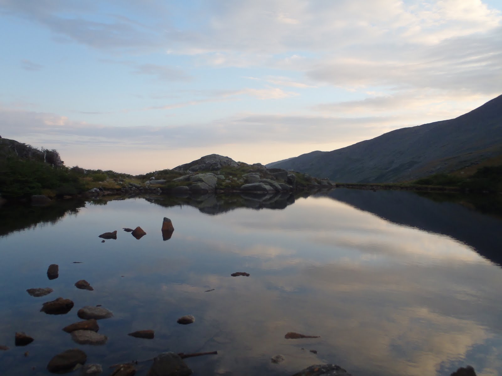
Mt. Katahdin (5,268')
Mt. Katahdin is the tallest peak in Maine. I was lucky enough to get there this year and traverse the Knife Edge to reach it. Although smaller than Washington, its dramatic drop-offs make it a thrilling experience. The adventure was a climb and not a hike, which makes this one stand out as being different in many ways, particularly the challenge. This adventure required a lot of attention to detail and careful steps, and being able to stand on its summit is greatly dependent on good weather. To look over at Mt. Katahdin and the Knife Edge from Hamlin Peak and to think that we just traversed that is out of this world.
Mt. Katahdin summit  
Posing with the Knife Edge near Hamlin summit
Mt. Monroe (5,384')
Mt. Monroe is the fourth highest peak of the 48 4000 footers list. It sits next to Mt. Washington to the south, and was the peak on which I first completed the 48. That morning, we had traversed the Presidential Range in the full moonlight, and just after sunrise, a morning glow, created by the shadow of Washington, capped the top of Mt. Monroe as I approached my last peak. It was like a golden sign or something, ta-daaaaa! It was a really beautiful morning. Lake of the Clouds never looked better. I climbed to the top, and ended my journey. 

Lake of the Clouds
Bill captures the final steps of my first round of the 48
Secondly, from the summit of Mt. Washington, Mt. Monroe sits in the foreground of one of my favorite views in the White Mountains - looking over the Southern Presidentials. It always makes me remember the first finish. I've been to the summit four times now.

Leaning into the wind on Mt. Monroe
Mt. Washington (6,288')
Sometimes I can't believe myself that I've reached the summit of Mt. Washington ten times in eight different months. I've climbed it many different ways, and the cool part is that there are still dozens of ways I can reach the summit again. Of course this is a favorite of mine. I've stood on the summit in a variety of different conditions too, including a full moon and sunrise at the same time and pouring rain with a 40lb pack on a day where dozens needed assistance. I've been there in low visibility and snow on New Year's Eve, and also on beautiful summer days, and also with my brother and 8-year old niece.


Out of all of the ways I've climbed this peak, I cannot forget my solo Tuckerman Ravine climb in winter. I watch the video back often and try to re-live it, but nothing will compare to what it was like in the moment. As I neared the top of the Sluice, the slope was nearly vertical as the hard snow covered small shrubs. My single axe got stuck once, and I remember needing to keep my body as close to the mountain as possible as I wiggled it loose so to continue. While the whole idea may be foolish to some, I wouldn't trade for a moment that experience of having no margin for error on the side of a mountain.
Tuckerman Ravine - MLK Day 2012 
Taking a moment to scout the area below me

Mt. Lafayette (5,260')
Mt. Lafayette is my favorite peak...in the White Mountains. I think that has always stood since my first ascent in February 2011. It was my 7th 4000 footer, and I had just started my quest for the 48. It was snowing really hard as I started up the Old Bridle Path that time. I remember it was so cold. My camera was frozen for some time as I neared the hut, so only I will remember how deep the snow was as I hiked along the trail that was exposed on the right with Walker ravine below, and how scary it was trying to stay left on the trail as much as possible so to not fall off into the abyss as the wind howled just above me. When I left the trees after passing the Greenleaf Hut, the wind was steady, with gusts near 70. It was blowing at my back, which forced me to my knees as I climbed to the summit. It got nicer in the hours shortly after I reached the summit and crossed the ridge, however I don't regret for one bit starting any later than I did that day. 


My favorite peak in the White Mountain is also my brother's favorite in the same. The day after Christmas last year, the spirits of Mt. Lafayette rewarded us with one of our most spectacular adventures ever, and best of all it was brother's 48 finish also in less than a year. While I enjoyed it all the way, I wanted nothing more than for this to be his hike, and his finish. It was extremely cold and we battled thigh deep snow. We traversed Franconia Ridge above the clouds and ended on Mt. Lafayette; it was the most unreal display of under-cast clouds I'd seen. On the summit, we watched the sun go down behind the horizon as planets rose in the dark blue sky.
Lafayette is difficult in deep snow 
Near North Lincoln, on the way to Mt. Lafayette 
Mt. Lafayette 
As Bill closes in, I moved over to capture his final aproach
My brother finishes his 48
Despite these two amazing remembrances, I will too always remember the early December night where I went the wrong direction down off the summit on a Pemi Loop attempt, and realized it way too late. It was cold, I was thirsty, my water frozen, and it could have been much worse. Because of this, I have tremendous respect for Lafayette. Despite it being so awesome, it can be an unforgiving place to be at the wrong time.

Mt. Whitney (14,505')
Until I reach greater elevations, and if, Mt. Whitney is going to be my favorite peak. Nothing will beat camping at Trail Camp, watching the sunrise as we reached Trail Crest at 13,000 feet, and then reaching the summit, which is the highest point in the lower United States. No further words are necessary. I would return in a heartbeat.


My Honorable Mentions

Mt. Isolation (4,004')

Moosilauke (4,802')


Monday, November 5, 2012

Saddleback & Saddleback, The Horn - 11/3/2012

With 6 peaks left in our journey to complete the New England 4000 Footers, we hoped to knock them out this weekend, but a minor strain in my brother's abdomen at the end of this hike resulted in our weekend ending early. However, we thoroughly enjoyed a nice prelude to winter peakbagging on the Saddlebacks, as we did get to knock two good ones off the list.
Saddleback Mountain lodge
We started at the parking lot near the lodge. We walked up the gravel road, and the trail we were going up was the Green Weaver - we sported blaze orange articles at the start because its hunting season. It was a steady climb and a nice warm-up. From the looks of it, we knew we'd be heading into the clouds and whatever else that would have in store for us. As we climbed further, I couldn't help but think how weird it was to be hiking up a mountain as the snow is slowly starting to creep down the mountain (winter coming). It was like hiking in the true middle of fall and winter in the mountains.
Bill coming up into the clouds 
Snow capped trees and grass!
Once we made it to the road that crosses the top of the mountain, we knew we were close, and we just needed to go a bit further to see where exactly the summit would be. After another push upward we reached the top of the ridge as the wind ripped right over, and quickly we were in a different world. We could just see another incline a summit sign ahead through the fog. We made it to the summit of Saddleback Mountain, and it was awesome and white, and tough to stand still.
Reaching the top of Saddleback Mountain, summit ahead  
Saddleback Mountain summit
After enjoying a few minutes with the summit sign, there is a spot nearby where the trees provided a nice barrier from the wind coming over the mountain. We were able to take a nice break because coming up into cold wind and fog was like a rush, and we needed to re-situate ourselves for the ridge walk across. Once we got going, we realized that this was going to be a little different, as the trail had invisible spots of ice everywhere, but not quite enough to warrant micro-spikes (which we left in the car). Although we didn't get views from these peaks which are known for their views, we were being treated to a nice little teaser of above tree line hiking in winter, which I'm looking forward to, so we were loving it regardless of any views.


There are a few really good spots that offer shelter along the way for breaks, which was good. Shortly after the iron ladder, we reached the summit of Saddleback, the Horn, our 62nd 4000-footer.
Summit of Saddleback, the Horn 
The return trip back across the ridge was identical to the way out there - lots of fun, slips on the ice, and times of snow flurries. We walked a bit further past the summit this time in an effort to descend by the Grey Ghost ski trail, which seems to be the most used trail for this hike. That was evident from the path right down the middle. I must have mistakenly said Grey Goose about 5 times, oh well. We quickly scooted down the trail, back to the gravel road, and then back in front of the lodge. We saw a solo hiker and a pair on the way back from the Horn. All-in-all, it was a pretty fun and quick hike, and nice to get the feel again for these conditions. We drove to the Caribou Valley Road trail head, but as we were getting ready to head up to the Crockers, Bill made the call to postpone due to his pain, so we'll be back up here in a few weeks, and this will get finished before winter.
Grey Ghost ski trail 
Grey Ghost ski trail
Hike Stats
Trails: Grey Ghost ski trail, Tri Color ski trail, unnamed connector trail, Appalachian Trail
Distance: 5.4 miles
Elevation Gain: 3,003 ft.
Actual Book Time: 4hrs 15min

Friday, November 2, 2012

Inside The Moments: Episode 7 - River Crossings

If you've climbed some White Mountain 4000 Footers (or NE4000 footers), then you've crossed some rivers and streams both big and small. Depending on the hike, the day, and the weather, they can either be a whole lot of fun or major obstacle that will cut precious time out of your hike. Looking back at my adventures, I've definitely had my share of both. For this week's episode, let's take a quick look back a few of the most memorable river crossings to date!

The Crossing: Rocky Branch on the Rocky Branch Trail (NH)
When: October 16, 2010 on the way to Mt. Isolation

I crossed the Rocky Branch before I set out on the 48 on tough October hike to Isolation in 2010. We arrived at the crossing and we looked down the frigid river as snow flakes flew. We had some pretty big packs, and it was a pretty nerve-wracking. As newbies, it took a lot of hours more than we thought to get to this point, but newbies or not, we knew a fall into the river at this moment would have some serious consequences. We managed to get across safely after a good amount of time pondering the best route. Arriving at the sight below for the first time, was one of the most beautiful sights I've seen, as I've said before, but the crossing on the way in was difficult and high risk, especially late in the afternoon. It was sunny the next morning, and the second picture shows where we crossed. You can see the crossing on the way out on video here. I've been here twice since this crossing, and this was the most difficult time.


The Crossing: Little River on the North Twin Trail (NH)
When: November 5, 2011 on the way to North Twin

One of my coolest crossings was at about 5:30am over the Little River on the North Twin Trail. In an effort to help my brother finish the 48 before year's end, we got an early start on a hike up the North Twin Trail last November. We went all of the way to Garfield that day, and back via Gale River and forest roads, but this crossing at the start, set us back about 45 minutes to an hour. The Little River Crossing is actually 3 separate crossings over a short distance of trail. The first one we came to is the part that makes me remember this one. It was a downed tree that was not exactly level, and the water just below it was about 3 feet deep. I described it best when I first wrote about it:

The first one required us to traverse a log over a swift moving section of the river. It took a while to find this too, but once we did, I switched into adventure mode and went for it. At the next one, we walked across one smaller log as we held onto another larger log at chest height over a deep pool, then rock hopped the other half of that crossing. On the third crossing, I had leaped over a large pool close to the bank which enabled me to hop across the rest of the way. However, this was risky, as that leap and then the final rock hops required momentum. Bill was lining up to take the same leap, however couldn't commit. After a few more minutes, he found a satisfactory route, but he still had to use a partially submerged rock.


The Crossing: Wildcat Ridge Trail over the Ellis River (NH)
When: July 2, 2011 on the way to the Carters

In high water this could be up there as one of the tougher crossings. Over the July 4th weekend in 2011, we did a Wildcat-Carters Traverse with an overnight in the woods near Zeta Pass. Starting immediately after crossing Route 16, we had to cross the Ellis River to get to the start of the trail. With overnight packs, this one was difficult and required caution and slow movements. It included traversing a log over some white water. In the video below, the first few seconds show the crossing done by my brother. We had no issues, but it was fun to cross. My dad dropped us off that day, and we were able to check out Glen Ellis Falls, and then he watched as we crossed (successfully).


The Crossing: Signal Ridge Trail over Carrigain Brook (NH)
When: December 3, 2011 on the way to Mt. Carrigain

On an early December hike to Mt. Carrigain, we faced a challenging crossing of the Carrigain Brook. At the first wide spot, the flow was high enough to cover most of the stepping stones that make the small drop. After pondering whether we could run right through it, we decided not too, which, I think was the smart thing  to do. We didn't really feel like taking off our boots either. We found another location, but it was not easy, as the area was still smashed from Irene. We found a much better spot, but it still required a 3-tier crossing with one solid leap of faith. After enjoying the summit with some patches of snow, descended, and were faced with the crossing again. We crossed in the very same area, but then we found another log that appeared solid, and it by-passed that leap of faith we had to make on the way in. The log was coated with ice (as you can see), and the water was raging. A fall in this spot would be result in one of us being wedged in the rocks being battered with frigid mountain water.

Middle of the Brook; at the far end of this patch, we leaped to the other side
Crossing the very icy log


The Crossing: Firewarden's Trail over the outlet of Stratton Brook Pond (ME)
When: October 6, 2012 on the way to the Bigelow's

While planning for this hike, I watched a video of this crossing, so I had some idea of what to expect. We set off before sunrise on the Firewarden's Trail. Mind you its extremely dark out, we had a little difficulty figuring out exactly where the trail started because after going down the road just a bit, there is another parking lot with cars, but we read that the parking was where we parked, up the road a bit. After some scouting around, we were assured that this was where to cross. At night, it was a bit intimidating because about 50% of the rocks where at least partially submerged. Immediately, I thought this one was going to give us a challenge. It was, but we tackled it just as good the first time at night as we did later on in the day. If the lake is high and the rocks are completely covered, this one is definitely a wader.


The Crossing: Appalachian Trail over the Carrabasset River (ME)
When: October 7, 2012 on the way to Sugarloaf, Spaulding, & Abraham

From the Caribou Valley Road parking area at the grate bridge, the Appalachian Trail south leaves the road on the left, and hikers are faced with a crossing of the Carrabasset River. When we arrived at the bank of the river, we took note of a wooden plank which bridged a gap of white water. We closely checked it out to see that it was a movable bridge so that hikers could use it varying river conditions. To us, it looked like a disaster waiting to happen, so we opted to scout about the area for a better way across. We found one within about 100 feet to the right. My brother was leading the way and started crossing. He made it no problem. When it was my turn, I was second guessing this. Of course, I had a reason to, as my right leg just didn't make it over to the rock, and my ankle and foot dunked in the Carrabasset, so off came my pant leg to dry. This is a pretty challenging crossing, and I would say likely treacherous in high water conditions.
Approaching the crossing  
The movable bridge, secured by a rope on one end 


These are just a few of many many crossings required to take on some 4000' peaks in New England. I've learned that river crossings take a lot of thought and confidence, which includes knowing what the consequences are and the appropriate decisions to make should thing go wrong. As I've said before, I'm sure that I will have a major FAIL at some point!

WHAT IS YOUR FAVORITE RIVER CROSSING?