Monday, June 20, 2011

Mt. Waumbek & Mt. Cabot - 6-18-11

This week I bring to you a double feature; two separate hikes on Saturday to peak two 4000 foot peaks and one peak on the 52 with a view list. The choices are not getting easier when it comes to knocking these mountains off the list. Mt. Waumbek and Mt. Cabot are the two northern most peaks on the NH48 list. Waumbek and Cabot are not easily done together, but my plan was to start and complete Waumbek as early as possible, and be able to start Mt. Cabot as soon as possible after the Berlin Fish Hatchery gate opens.

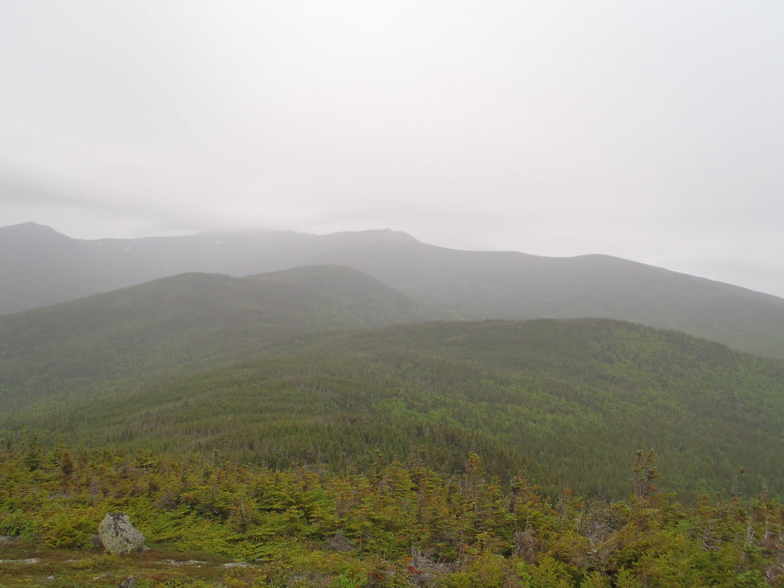
My family has a place near Laconia, so I was relaxing Friday night by the fire and got decent sleep before my early departure at 3am. I started up the Starr King Trail exactly at 5am, just as the sky started to lighten from the sun coming up. The Starr King Trail was a pretty gradual ascent, and I realized that once I was into it. My legs were screaming at first, but overall the trail was generally very easy. Although there is not a whole lot of exciting stuff on the Starr King Trail, the woods surrounding the trail was beautiful with rich green colors from the moss and ferns. I got slightly steeper, and then I came to the summit of Mt. Starr King, which is 3907'. I had a slight glimpse of some under-cast through the trees.
I then continued on past the open area towards Mt. Waumbek. The stretch between Starr King and Waumbek was even more green and lush than below. It also seems flat and slightly open, which is odd for 4000 feet, but flat is good, and I was at Waumbek in no time, my 22nd peak of the quest. With no views and not much else to do other than get down hike another mountain, that's what I did. However, with about a half mile or so left, the heavens just opened up and it poured so hard. It had sprinkled a few times since I started, but it poured like crazy, so on went the rain jacket and rain cover, and continued to quickly descend the rest of the way. I got back down to my car, and completed this trip, a total of 7.2 miles in 2.5 hours, well ahead of my plan for the day, despite the fact it was now pouring and everything was completely soaked.
So I changed my shirt, dried my shorts with a towel, and headed towards Berlin to hike Mt. Cabot. I stopped at a store to pick up a sandwich and some more water, and it was still raining good. I knew the weather was going to be on and off for the day, so I knew it wouldn't rain all day. The York Pond Trail begins wayyyy down the York Pond Road, past the fish hatchery gate. Since I don't have experience dealing with the gate issue, this is why I planned it the way I did. I started up the York Pond Trail at 9am, and it was sprinkling but clearing a bit now. The trail is flat for .2 miles as you walk through a meadow up to the Bunnell Notch Trail. Once here, the trail begins to climb steadily as the trail leads over the notch toward the Kilkenny Ridge Trail. Some parts of the Bunnell Notch Trail are much more rugged than others, but overall, I liked the roughness of the trail; it appeared overgrown in some areas, which was cool (at least for a hike with no views).


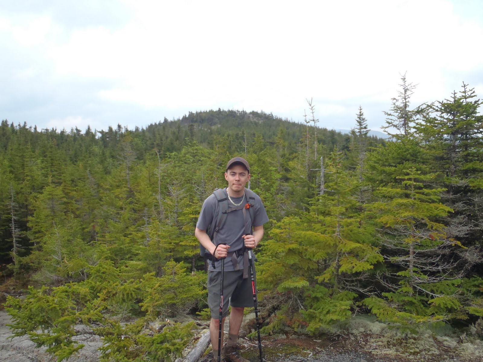
Once I made it to the Kilkenny Ridge trail, there was definitely some more elevation gain to be had, particularly towards the top. Having hiked 7.2 miles earlier and already another 3, I was feeling it as I got closer to Cabot Cabin. The Kilkenny Ridge Trail did not give me any issues. The trail is rocky in some parts, but overall pretty easy to contend with. I made it to the Cabin and checked it out. What a place to have camp and hang out on a beautiful day or night. I wish I had been able to see the view, but at least it wasn't raining. I continued on to the site of the fire tower to get a minimal view of the mountains below. About 50 yards from the site of the old tower, there are a few humongous blow downs across the trail that have probably been there for a while, since there were visible paths around them. About 2-3 minutes later, I finally arrived at the sign to mark the summit. Another hiker was there, the first I had seen all day long. I had reached my 23rd peak of this quest.

With not much to look at on the summit, I set off back down the trail past the cabin and down. I snapped a few photos on the way down because the weather got slightly better, offering me slightly better views than on the ascent, which was a great treat. I arrived back at my car at 4:10pm, finishing this hike, a total of 9.6 miles in 4 hours, 10 minutes. The total for the day was 16.5 miles, 6 hours 40 minutes, and about the same elevation gain as an ascent of Mt. Washington. My plan for the day worked out even better than I thought, as finished these peaks in a very timely manner, which got me back to Laconia by 4pm for a much needed steak dinner and nap! Despite the view-less summits, these two hikes in the north country offered attractive trails, which included a variety of wild flowers and trail-side features such as the sound of small streams and waterfalls. I came across a white admiral butterfly and a nicely spun spider-web.


Hike Stats
Waumbek
Trails: Starr King Trail
Miles: 7.2
Elevation Gain: 2650 ft
Book Time: 2hrs 30min

Cabot
Trails: York Pond Trail, Bunnell Notch Trail, Kilkenney Ridge Trail
Miles: 9.6
Elevation Gain: 2400 ft
Book Time: 4hrs 10 min

To view selected photos from these trips please view or click the slide shows below:


Thursday, June 16, 2011

Mt. Isolation 6-11-11

Bill and I on the summit of Mt. Isolation
A lot of hikers tend to choose to hike Mt. Isolation last or near the end of their list. That is because it is one the most remote of the 48 4000 footers, requiring 14.6 miles of hiking. My brother (Bill) and I camped at the Rocky Branch Shelter #2 in October of 2010, and it was a cool, fall day that turned into a chilly, snowy, and wet overnight. At the time we didn't bag the summit, and I had no idea I'd be hiking all of the 48 peaks this year, but we were also rookies, sort of, but we made the right decision that afternoon to not continue past the shelter when it started snowing. We were prepared, but when it got wet, it was really cold, and we were unable to start a fire in the sleet. Click here to view that trip report and photos.

I like to keep plans open and go with the flow, so when Bill said he wanted to do Isolation, I knew it was on. Despite the fact that it was cold and raw back in October, it hooked us because the snow and weather not only made it a challenge, but it was also beautiful. We didn't get the summit that time, so you better believe I had no problem with obliging on his choice of Isolation.

Knowing what to expect in terms of difficulty, we headed up the Rocky Branch Trail in a slower and steadier pace. The trail had burnt us out-of-shape rookies out that time, so relaxing a little bit in the beginning made it much more enjoyable this time. As much as I like to move forward, its fun passing the things you remember from last time. The overall trail conditions were much better than those in October. In the morning, and all the way to the summit, there were no problems rock hopping the watery parts of the trail and the river crossings were all passable with no problem. We stuck to the trail. Although rough in some places, I thought the Isolation Trail (east of Davis Path) was beautiful and was surprised to be able to have limited views from it and Davis Path as we approached the summit.
Rocky Brach Trail
Isolation Trail
Our excitement grew as we approached the summit. There was a sense of redemption and triumph as we placed our hands upon the cairn. Despite the clouds and full overcast, we were extremely pleased with the views we were greeted with. We opened up our sandwiches, then it began to rain. No problem, we put on our rain gear, finished up, took some photos, and got ready to descend.

By the time we descended to the Davis Path it was raining steadily. With our lightweight rain jackets on, it didn't phase us one bit, as we were having a blast on the way out staying completely dry. Once passed the Rocky Branch crossing, the rain had swelled the water on the trail, so hiking back over Engine Hill and that area became about the same as it was in October, but having done it before now, it was smooth sailing.
Shooting some trail video with monopod
Me on the lower wet, Rocky Branch Trail
For me, Isolation will be now archived in my memory with my photos and two trip reports. I hope to summit Isolation again some day, but for now my quest continues on with 27 more to go within about 6 and a half months. Although I am not setting this one in stone, I am aiming to end this quest much sooner than December 31st. We shall see!

Hike Stats
Trails: Rocky Branch Trail, Isolation Trail, Davis Path
Miles: 14.6
Elevation Gain: 3400 ft

To view the album for this trip, please view or click the slideshow below.


Monday, June 13, 2011

Mt. Hale 6-5-11

My brother and I made plans for this hike almost a whole week ahead. We chose Mt. Hale, one the easier 4000 footers left on my list. This was because Kiara, my 7-year old niece was coming along. There was a week of anticipation, and the weather turned out great. Our friend Sean was available to join too and we set out to make it a great day.

Kiara happy and confident
So we headed up the Hale Brook Trail around 11am. The trail was in good condition; completely dry, except at the crossings. It is pretty steep, 2300ft in only 2.2 miles, so there were frequent breaks, of course, but that was fine. There was plenty of things to take in, so we came to enjoy the breaks ourselves. The brook crossings were fun for all of us, and they were good photo opportunities. At the first crossing, we were hanging around, and when helping Kiara across, I didn't expect the move she made and I let her slip. Her back and leg went into the brook, but thanks to her backpack, I didn't ruin the trip and all was good.

Then, about 30 seconds before this great photo, she and Bill were caught conspiring to dip me into this brook.

From there, and seemed to get a little bit steeper than it was earlier, but we all seemed like we just wanted to get there at this point, including Kiara. There was excitement when we all saw the big cairn at the top. Kiara reached her 1st 4000er, I had reached my 20th, Bill reached his 9th, and Sean reached his 5th. Field and Willey were visible from the cairn in the clear skies. The excitement lasted about 5 minutes; cut short because of the insane gnats that inhabited the summit. Out came the long sleeves, mosquito nets, and bandannas while we tried to have our lunch. We didn't feel them biting at the time, but after we got home we learned that we got eaten, all of us including Kiara. Bill said his bites felt like baseballs under his skin, and I had a bite behind each ear that felt like tiny marbles under my skin. Nasty! But despite the nasty gnats, we snapped the great summit shot you see above.

We were off the summit, descending back down the Hale Brook Trail. The gnats were less intense as we descended. We were able to enjoy going down, also stopping at the crossings again and checking out some other cool things such as this Lady slipper and toad.


Sean is pictured here enjoying one of our breaks from high above the trail:

Kiara really enjoyed the hike, as we all did. It was also another one in the books for me, and each of us for that matter, and I am very happy that it indeed was a great day.

Hike Stats
Trails: Hale Brook Trail
Miles: 4.4
Elevation Gain: 3400 ft

To view photos from this trip, please view my album:

Sunday, June 12, 2011

Mt. Flume & Mt. Liberty - 5-30-11

Summit of Mt. Flume
Memorial Day 2011 was a beautiful day for a hike. I had peaked 16 and 17 the day before in Field and Willey, and I was ready for more. I left the Flume Visitor Parking lot at 7:40am up the Whitehouse Trail. It is .9 miles to the Liberty Spring Trail, and the another .6 just to get the Flume Slide Trail. It was interesting when I connected with the paved Whitehouse Trail, but it is well signed so it was clear where to go. Once I left the misting river I saw from the bridge, I was into the woods. When I arrived at the Flume Slide Trail, I had already hiked 1.5 miles. It was easy, but still, another good chunk of mileage to go.


The Flume Slide became my favorite 3.4 miles of this quest so far. I was enjoying the rolling terrain and really going at a good pace. In my opinion, and compared to other trails, it appeared less traveled and overgrown in some areas, which made the hike feel like an adventure. The sun was beaming through the trees and near one of the river crossing, the mist of the river and sun combined to create a new favorite picture. 


The trail began to steepen a lot. I was faced with rock slabs with blue blazes painted on it. Ok, so I guess this means this is trail? On top of that this part of the trail was wet and had some trickling of water down it on most sections of rock. It was fun and challenging, but the paths of least resistance up the rocks were fairly clear, so that was helpful. There were certainly some spots where I had to be sure-footed with my feet or make double sure I had a grip on the rock above.

It was already pretty hot, and it was getting hotter. I had just come out of the trees and was excited to my reach my 18th summit in this quest. The views from Flume were tremendous.

I headed into the woods on the Franconia Ridge Trail. The section between Flume and Liberty descends gradually and easily for a while, but then steepens as you realize you're now heading up Liberty. With the easy grades on this trail, I went into a slight jog and a skip. As I approached the final ascent, it reminded me of the rock scrambles on Monadnock. I reached the summit of Mt. Liberty, my 19th peak this year. The views were even better from here, especially looking back at Flume's slides, which are very impressive in person. I completed the 4.6 miles to and over Flume and to the summit of Liberty in 3 hours and 40 minutes. I've now hiked the summits that line Franconia Ridge, and I now have an understanding of why it is a favorite in the whites.
I had the liberty of enjoying the views from Liberty (ha ha) as I relaxed for about 20 minutes while I had my lunch and some water. As it was Memorial Day, liberty, whether you're thinking about political or personal liberty, either is not possible without the sacrifices of those who have fought or currently fight to protect our country. After my nice break, I was ready to head down the Liberty Springs. My legs were feeling great so I proceeded to move quickly on my descent. I passed the Liberty Spring Tent site and snapped a few pictures there. It seems like it would be a fun place to stay some night. I continued on quickly, passing several groups of hikers on the way up the Liberty Spring. Although I made it to the bridge at the Whitehouse trail, there was still a little bit more to go (.9mi). I came out of the woods at the Flume Visitor center at 1:30pm. This trip was was one of my favorites. With the great weather on this trip, I hope for more, as the chase for 48 is being shifted into high gear.


Hike Stats
Trails: Whitehouse Trail, Flume Slide Trail, Franconia Ridge Trail, Liberty Springs Trail
Distance: 9.8 miles
Elevation Gain: 3700 feet
Book Time: 5:50 (including my lunch)


Below is my photo album for this trip:


Friday, June 3, 2011

Mt. Field & Mt. Willey - 5-29-11

So after about another 3 week drought, it was back to the mountains to keep pace with this quest. I get nervous of falling behind and having to bust out multiple hikes in December, so the plan for Memorial Day weekend was to try and get 4 more 4000ers.

After the Bruins game on Friday night, we relaxed Saturday and prepared ourselves to hike Sunday. Bill and I set out from MA early on Sunday morning and headed to Crawford Depot. I think we set off up the trail around 8:40am. Having gone up Tom this winter on a crisp and beautiful winter day, there was certainly some excitement to grab Avalon, Field, and Willey as we headed up the trail. The air was humid and heavy and the temperature comfortable as we started. We took the little side trail on the way up Avalon, but we decided to peek at the cascades on the way out. As we ascended further, the forest began to be engulfed in a misting cloud that hung over the mountains all morning, which gave us no views on any of the summits. Looking forward to getting Avalon again some other day, but for now, its just one less mountain on another list (52 with a view).

Snow on the Willey Range
We then connected with the Willey Range Trail, which goes up and down a few times, but it did not seem give us any problems when it comes to elevation gain or loss. There are just a couple short, steep and rocky sections.   As far as conditions go, everything was bare-bootable. The only snow left on the trail was after Mt. Field, as shown here. The ground and all of the trees were soaked with water, and on top of the misting, it caused our clothes to get damp, but thankfully the temps were well above normal, otherwise we would have had to pay more attention to that fact.

The summit of Mt. Field has a nice open area at the summit where you can sit and enjoy the summit a bit, and I did as I reached my 16th peak since January. There are no views, but its all good. We added a rock to the cairn and off when went to Willey.

Speaking of Willey, it sure was a wet one as the misting picked up on the Southern Willey Range. We made it to Willey, my 17th peak of the year. There is an outlook just past the summit that would provide excellent views during a clear day. Other than that, the summit cairn is basically right smack in the middle of the trail. Before headed back along the range, Bill and I shared an orange, which I have to say is starting to become a favorite snack on the trail. It reminds me of in between periods playing hockey in high school. The orange is probably worth its weight in energy, especially for a day hike.

Me with Avalon in background
Beecher Cascade
As we made it back to the open area between Field and Avalon, where you get a good shot looking back at Avalon, we noticed the sky slowly start to clear up. It was the first time we could glimpse towards the east and get a sense of the altitude, which was great. The rest of the way back down to the depot went by fairly quickly as the knees and legs enjoyed the whole trip and were feeling great. We treated our feet to the ice cold Beecher Cascades, which was refreshing. Number 16 and 17 in the bag on an overall great hike.

Selected photos from this trip: