Showing posts with label Hiking. Show all posts

Sunday, June 12, 2016

The Kinsmans & Cannon - 06/09/16


This was a fun Thursday evening hike with Alton & Nate. The weather was looking much better a few days prior, but it takes a little more than what was there for us to alter plans.  It was strange for June with gusty winds and temperatures in the 40s at Lonesome Lake Trail head (Lafayette Place).  We packed for a chilly, potentially wet, but fast hike of Kinsmans and the Cannon. We elected to ascend the Fishin' Jimmy and hit the Kinsmans first. 
The gradual ascent on Lonesome Lake Trail 
Jogging by Lonesome Lake
We did some quick climbing up the wet rocks on the Fishin' Jimmy. We reached the summit to no views.  Moving on quickly towards South Kinsman, we encountered a patch of ice pellets. They almost looked liked broken ice cubes. Cole seemed happy to see them and stick nearby.  We took the opportunity for a quick stop and photo to enjoy the freak ice in June.  It made us talk about how we've been encountering ice for the last 7-8 months in a row now, including a winter with a storied abundance of icy trails. 
Fishin' Jimmy Trail 
No views today from North Kinsman 
Enjoying a nice break with the ice
 As we reached the summit, we saw a potential view starting to clear. As we got our phones out to capture it, it went away. We decided to wait 20 seconds to see if would come before we'd shoot back into the trees. Within time, but for only another few seconds, we had this view below from South Kinsman. On the way back, we had a few more little view opportunities before it was going to get dark. On a hike like this, when the view opens, its kind of cool to take it in if its there. This happened a couple of times, and during those times we'd grab a snack or change a layer.
South Kinsman
View from Kinsman Ridge Trail
Hiking north on Kinsman Ridge Trail
Cannon from the Cannonballs 
This loop is one my favorite late afternoon or night hikes.  I like it as a fast and physical hike...5,000 ft of gain over 11 miles.  We had fun slipping into the puddles on the trail, sliding off bog bridges, and trying to beat daylight to the summit of Cannon. We kept on going, and climbed up the steep backside of Cannon.  It was incredible to see the boulder that recently wiped out many trees next to and across the trail.  It was amazing to see such a tremendous force and reality of nature. We reached the summit of Cannon in 4hrs 25 min, which is fast. It felt like it'd been a while since I did a short fast hike, so this one was fun, and I felt good.
Nearing the Rim Trail on Cannon 
Nate and I braving the wind on the Cannon Summit deck
Highlights:
Kinsmans - 13th Round
Cannon - 14th Round

Trail Conditions:
It was extremely windy at the trail head with temperatures in the mid to upper 40s. The trail was wet from start to finish. Slippery bog bridges all along the way, and muddy puddles up on the ridge. Going up Lonesome and Fishin' Jimmy included wet, slippery rocks and flowing water, and Kinsman Ridge Trail had wet, slippery rocks and mud puddles. Only a few spills during this fun and fast hike.

Hike Stats
Trails: Lonesome Lake Trail, Fishin' Jimmy Trail, Kinsman Ridge Trail, Hi-Cannon Trail
Distance: 10.6 miles
Elevation Gain: 5,036 ft.
Actual Book Time: 5:18

Saturday, June 11, 2016

The Captain - 06/03/2016


For three years, I've long desired to reach the Captain. The Captain is a remote, trail-less mountain peak on a ridge between the Hancocks and Mt. Carrigain on the edge of the Pemigewasset Wilderness.  The Captain is visible from only a limited number of vantage points, so to see this peak up close and personal is a special reward for a bit of difficult bushwhacking.
Sawyer Pond Trail at the end of Sawyer River Road 
Entering a LZ 
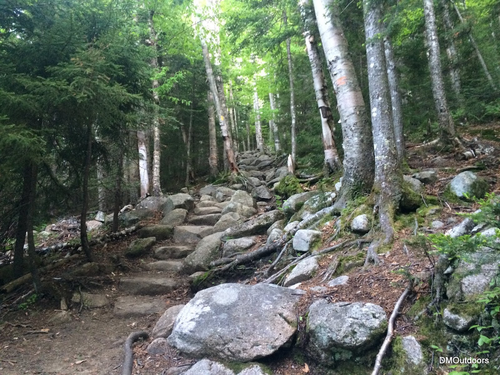
North Fork Trail Emergency Landing Zone

Quickly after passing the footbridge for the Sawyer Pond Trail, we took a right onto the North Fork Logging Road.  Toward the end of the logging road, we came to the North Fork Road Landing Zone. We determined this must be an emergency landing zone for a Heli evacuation. We gathered that this particular location likely serves the snowmobile trails in the area. It was a beautiful open meadow.  I figured, at least for myself at least, that this location is worth being aware of.  After that, the trail closed in to a very faint herd path, a natural skin exfoliater, which continues fairly straightly.


Eventually we arrived to a pre-existing campsite, with a really nice view of the Captain, still very much in the distance.  This was pretty much the spot where we were going to camp for the night, based on our research. I've been reading about the approaches to this peak for the last few years, along with the Google Earth images and contour lines. We set up our camp and left the bulk of our gear behind.  It was about an hour here, and then we continued forward around 12:30pm with lighter loads.


Following the bootleg path beyond our spot, we soon came upon another fire ring and camp location. This particular one we read about in another online report.  While it was closer to the Captain, it was not as tent friendly, but had a very nice rock chair.  Shortly after the camp spot, we are led to the base of the slide that is seen on the Google Earth Image below. We made our way up the loose slide.  From the slide, the view out of the valley was obstructed by the enclosing slopes, and an impressive view of the Captain was blocked by a large tree, but it was amazing, and we continued up until we reached a wall. This was when the real fun began, this is where it becomes significantly more challenging.


Looking left to the Captain from the slide

Bill ascends the slide, with the steep slope of Hancocks in the background
Here, we are forced into the trees, where we need to cross and ascend a steep contour
The going got pretty tough quickly. We had to keep our bearing toward the ridge between Captain and Carrigain so to come out in the col. This meant traveling left to right, while shading uphill on a very steep slope.  Shortly after the slide, we came to a gorge-like riverbed in the steep slope. We had no choice but to descend until we could cross it without too much risk. After a minute of hiking down, we found a ledge that we could finally throwing down our packs, and hanging on to trees with our arms to lower ourselves.
Bill about to send his pack down
Once we got down from the literal cliff (seen in the right of the picture below), we started up the gorge to gain what we just lost.  A few short minutes later, we were near the top, and shading left (north) again towards the ridge.
Deep gorge to the right of the Captain
Heading up through blowdowns
After what was the most difficult part of this bushwhack, we finally made it to flat area in the col between Captain and Carrigain. It does not get any easier here, however, as there was really no defined path. We noticed a few "herd" paths in the tall grass, but it clearly resembled animal tracks, and we passed through a couple of quick but thick spots as we neared the final steep part of the Captain ridge. There is not a whole lot of give on this part of the ascent. Going left (closer to the ledges) was obviously steeper with ledge and much more dangerous, and more to the right (Carrigain Pond side) seemed pretty darn thick. We headed straight toward the highest point, and eventually we saw a magical summit canister atop a tree in the middle of this craziness.
Nearing the summit of the Captain
The canister as we reached it. Just amazing to reach this thing in the middle of nowhere
We enjoyed about 15 minutes or so at the summit. The mosquitoes and midges were just ferocious, so while we did our summit stuff, it was a battle. We were really happy at making it here. We've talked about this hike for so long. I really enjoyed seeing the list of well known White Mountain hikers who have visited before, even going back into the 90s. Out of the whole world, not many have been here.  I fulfilled my long dream of drinking Captain atop the Captain! There was even an eye patch to pose with.  This summit, despite the lack of view, was a beautiful reward, one that was much different than anything I've done in a while. It was needed. I still have many amazing things to see and do in the White Mountains.
On the summit of the Captain!!! 
Bill does a pretty decent Captain Morgan pose 
Aye, Captain! 
Bill and I have done a few extremely tough bushwhacks in the White Mountains
We left the summit, and our plan was to follow the same route back for the most part. At the summit there was absolutely no noticeable path. Other than a few spots with a noticeable trample, there is no path once up on the mountain. We were pretty good on our way out, except facing a couple of tough obstacles.  One of those was a steep drop with a tree to hang onto and lower ourselves down steep step. The slight change in our path, however, allowed us a rare view from practically a 10 foot ledge step on the edge of the Captain. Gripping my phone very precisely, I took a photo and then a self-shot so that I would remember what it took to get that view of the valley. :)
Leaving the Captain summit through a tangled and mangled pine forest  
Living on the edge, you might say....
A view from the steep slopes on the front of the Captain
It had been a beautiful and very warm Saturday. We made remarkable time on our descent. As we approached the large gorge again, we picked up some easier terrain just before it, and avoided it. Although it is still steep, its much easier to move down.  We even missed the slide too, and ended up back to the bootleg path below it.  It was actually a very pleasant evening below, one of the easiest and most relaxed nights in the White Mountains. My brother and I enjoyed a couple beers while we looked back on another tough hike and great memory in the White Mountains.
Evening twilight campfire beneath the Captain

Highlights:
A very challenging bushwhack.
My 2nd overnight in 2016. Before recently, my last "planned" overnight was March 9, 2014.
Bill's first hike since my grid finish last November.

Trail Conditions:
The conditions were mostly dry. (There is no trail) The ground was a little damp on the way in, making our boots wet. It was warm, very buggy, and mostly sunny.

Hike Stats
Trails: None; bushwhack
Distance: 10 miles
Elevation Gain: 2,170 ft.
Actual Book Time: 23:00 (overnight) The hike to the Captain and then down to our camp was 6:40.
Photo Album Link


**Before heading out to the Captain, be sure to read up on it, do research, have a plan, and be absolutely prepared for a night or two, and for possibility of injury due to the steepness and thickness of the vegetation. We have been reading about this trip for 3 years before finally doing it. 

Thursday, June 18, 2015

Kinsmans & Cannon - 6/6/15


After a fun and fast mid-afternoon bush whack hike to Owls Head, I grabbed a chicken parmesan sub in Lincoln before heading on over to Lafayette Place.  I was excited to continue hiking into the night as it would be my 8th round finish on Cannon.  It was a beautiful night with warm temperatures, a breeze, and little bugs.  The Kinsmans and Cannon are my least frequented peaks, at this point in the journey for the grid, which means I'll be visiting them in each of the next few months, and will also finish 9th round on Cannon.
Lonesome Lake Trail
A nice tribute and quote to live by.
The hike up to Lonesome Lake was pretty easy going.  It's only been a couple of times now that I've gone up the Lonesome Lake Trail to start this loop.  As I walked around the pond, I read the nice quote in honor of David Copestakes, which was followed immediately by a breathtaking view of the Lafayette and Lincoln from the boardwalk at Lonesome Lake.  I walked up to the side of the hut, and could see the open door with the noise of everyone busy and chatting at dinner.  Still to this day, after passing it at least 9 times, this remains the only hut I've yet to step foot inside.  It seems fitting that perhaps in my very near future I could plan to enjoy a quick visit...perhaps at the end of a Hut-to-Hut Traverse (we'll see).  I never really stopped to ponder about going in, and kept on my way up the steep and rugged Fishin' Jimmy Trail.
Lonesome Lake Hut Entrance
Fishin' Jimmy Trail
Sunset was taking place as I approached the Kinsman Ridge and Kinsman Junction. The color was bright orange with a bunch of scattering pink, which motivated me to reach North Kinsman and enjoy a really nice evening twilight view out over Franconia Ridge.  Arriving at South Kinsman, the sun had since dipped below the horizon offering a dark landscape topped with the deep orange glow of the set sun. The Kinsmans have never been an exciting pair of peaks to bag, but on this beautiful night it was a nice scene making for one of my favorite visits.
Sunset from the Kinsman Ridge Trail
North Kinsman Summit
View from South Kinsman after Sunset
Summit of South Kinsman after sunset
After South Kinsman and the loss of light, was the rugged traverse along the Kinsman Ridge Trail and over the Cannonballs to get to Cannon. The trail was a little muddy but at all times easy to follow.  It's up and down with a lot of tough footing, but hiking at night allows a different type of focus to keep going at a fast pace.  I had one of the most interesting animal encounters along this stretch.  Wearing headphones, I stopped for about 30 seconds or more, looking down, playing with my phone, sending out a text. While doing so, I caught movement out of the top of my eye coming towards me at a pretty quick pace. My immediate reaction had me yell, "hey!", and in response, it darted in the other direction after making it to just a foot or so away from me.  Turns out, it was a little bunny running full speed at me. I was pretty startled!! Thank the heavens it was not a bobcat or mountain lion or lynx or something! After the scare, I continued on, battling the steepest parts of this section to get onto Cannon.
Kinsman Ridge Trail at night ended route to Cannonballs
It was a little bit cooler as I made my way up to the tower observation deck.  There was no one else around of course, and it was nice to complete my 8th Round atop Cannon looking down on the lights of Littleton and other nearby towns. I head over to begin my descent of the Hi-Cannon Trail, but not before taking a lovely break atop the cliff where I saw the almost full moonlight rising over Lincoln and Lafayette.  In a matter of a few more minutes, I was jogging my way down the Lonesome Lake Trail back to my car.  What a great day it was to hike Owl's Head and the Kinsmans and Cannon. After the fun day, I head over to Ferncroft, where the next morning, I'd tackle Whiteface and Passaconaway.
Nighttime lights from Cannon's summit.
8th Round Finish summit photo atop Cannon
Hi-Cannon Trail ladder at niget. 

Almost full moonlight over the ridge while descending.
Highlights:
Kinsmans - 9th Round
Cannon - #48 of 8th Round
Did not see another person (except the noise emanating from the hut as I passed)

Trail Conditions:
Overall there were decent conditions and no hazards that I recall.  Most of the Kinsman Ridge Trail between South Kinsman and Cannon was damp or wet, but not that bad.  The other parts, well they were pretty steep and dark, especially over the Cannonballs.
Lonesome Lake Trail 
Fishin' Jimmy Trail 
Kinsman Ridge Trail
Hike Stats
Trails: Lonesome Lake Trail, Fishin' Jimmy Trail, Kinsman Ridge Trail, Hi-Cannon Trail
Distance: 12 miles
Elevation Gain: 5,326 ft.
Actual Book Time: 5:57
Garmin Adventure Link (Upload later)