Thursday, September 29, 2011

My Outdoor Videos

Using my monopod on Mt. Isolation
In the beginning of all of this hiking craziness, I created an e-mail (not dmoutdoors1) to use for me and brother's outdoor stuff. That ended up being used for my current YouTube account, which has all of my current videos.  One of the fiascos I'm dealing with is getting everything to work together how I want it for my blog. Unfortunately, when I started this blog it was done under my personal e-mail address, which is not changeable according to Google. Don't get me started on the AdSense, because unfortunately, before I even started the blog, I had AdSense under even a different e-mail, so right now, I have to sign in and out and copy and paste embed codes and ad-links from my in-boxes of 3 different e-mail addresses, which is a hassle.

Shooting trail video w/ monopod
on Mt. Isolation
Throughout this busy year of hiking, and before that, I've taken so many photos and videos that I recently had to buy an external hard drive to store them all (my computer nearly crashed). With the lack of time I really have to spend on updating my content, I have tons of video that I would like to post eventually. I have videos from just about every trip I've done, not to mention many certain individual moments. The truth is I just don't have the time to go through them all, so I often forget about them. I have so many pictures too, when I look through them looking for certain ones, I often notice the ones I didn't notice before. I have some really great and unique pictures.

I will be creating a new YouTube account for DMOutdoors, under dmoutdoors1. This will help those who like my videos to more easily connect and associate my videos with my blog, and also for those who like my posts to more easily link to my videos. Since most of my videos have a low amount of views, and because I want to add dozens more, I want to do this sooner rather than later to make everything fresh.

JOBY Gorillapod wrapped on a limb
Long Mt., Grafton Loop Trail
I want to edit all of my current videos, titles, descriptions, and once all of them are updated, and new ones added, I'd like my YouTube Channel to have a fresh and complete appearance and is more connected to my blog. Who knows when I'll get all this time to go through this all, so maybe after the new year I'll have some good videos chosen and have it how I want it. You can currently find most of my videos by searching "DMOutdoors" on YouTube, since I changed the channel name and some of my titles for now.

I don't see many peak-baggers or other hiking bloggers doing a whole lot of videos, especially in the white mountains. For sure, I understand some might think why video because they want to enjoy the hike or just enjoy nature without electronics, but sometimes shooting video is fun because it can take me back to certain special moments or share with others the experience of the moment I step out onto a dramatic ledge or for example crossing the Franconia Ridge in the heart of winter with strong, gusty winds.


Sunday, September 25, 2011

Owl's Head - 9-24-11


I think I'm finally done with the long walk of the Lincoln Woods Trail for a while. I feel like I've done it so many times, and in all hours of a day. This time it was my brother's call to Owl's Head as he continues his own quest for 48. With the weather iffy, and patchy fog expected, Owl's Head was the perfect choice for this hike. We left from the Lincoln Woods lot at 7am sharp. The suspension bridge is now closed, so we had to walk over the bridge and around. As we hiked down the 'ol logging road, finding our stride, it was only fitting that we heard the very loud call of an Owl, which rang out from deep in the woods to our left. Perhaps it was telling us a great adventure was ahead.


We hit the Black Pond Trail with a good pace to get to the Pond, anxious to start the bushwhack. Anxious because this is the stuff I go for; something that mixes a hike up and makes it adventure. Hiking into the Pemi Wilderness is an adventure, because its a place with a great sense of remoteness. I hiked to Owl's head and did the Black Pond Bushwhack solo at the break of dawn on July 30th. That time, it wasn't as easy. I hiked too far around the pond before going off on the correct bearing, which led me through some seriously thick stuff. I made out alright that time, just a little bit down river from the crossing. To read that trip report, click here.

I found my way then, but could Bill, leading the way, lead me back to Owl's Head? He sure could, and yesterday, he became a trail master. After a quick break at the magnificent Black Pond, we scooted over the bank and were into the bushwhack. Bill led us along a slightly beaten path, but it faded out quickly. After a while of passing through the open woodlands we hit what appeared to be an old logging road. Game trails were everywhere, and they made for easy travel occasionally. Eventually, we came right onto a pretty distinct path, and we popped right out the at the bootleg campsite by the river crossing. Bill had guided the way perfectly through the bushwhack, and we were in super high spirits. Knowing some common sense map and compass skills can help you out of the woods if you lose the trail or you have to wait for morning. This is the perfect place for a novice hiker to learn because at some point you will cross a trail if you lose the way for real.


We headed up the rocky Lincoln Brook Trail with spectacular scenery with the Lincoln Brook flowing loudly to our right and with yellow and red leaves at our feet. It was so pretty there were a few stops for pictures. Here, we really got the sense that fall is now here, especially in the mountains. Miles from the roads of the White Mountains lies this remote, rugged, but beautiful trail. Eventually after crossing the brook and with it now at our left, we came to the base of the slide. We took a few minute break to have some food and water before the trek up.


After so many miles we were now starting to ascend. This makes Owl's Head unlike any other 4000 footer, as the slide is the only major elevation change. After a few minutes, the path opens up onto the loose gravel and rocks of the slide. The valley was a beautiful shade of yellow and green and the fog was still chopping off the mountain tops. All morning it had been wet, and the majority of the way up the slide was wet rocks making it a challenging ascent. We neared the top, hopping over the dozens of blow downs that litter the path. We passed the quarter mile to the summit sign, and you wouldn't think you have that much to go. Finally, we made it to the summit of Owl's Head. Bill reached his 33rd four thousand footer of the year. For me, it was just another peak off my grid, but this trip turned out to be much greater than just a couple of peakbaggers trying to check off Owl's Head.


After a nice relaxing lunch break on the summit we set off on our descent. Descending the terrain near the top was good going, and we were back out onto the slide quickly. We passed two hikers descending, who asked where we had been. We were at the summit obviously, and they weren't, so they appeared puzzled, but we continued on and descended quickly down the slide. The views opened up slightly to give us the best view of the valley we would get, but still the fog never fully dispersed. We got to the bottom, and we had to filter and re-fill our water in the brook before we got going.

It felt great to be down from the slide, and our legs were good and ready to go for the way out. We moved much more quickly on the way back south on the Lincoln Brook Trail. Again it was beautiful hiking surroundings and we took at all in as we trotted back to the river crossing and the start/end of the bushwhack. Going into the bushwhack the first time in July, I had no clue it was going to come out at such a distinguished area on the trail (bootleg campsite). The fact that Bill was able to lead us directly to that spot was amazing. We headed back up the well beaten path to start the bushwhack back. We started on the way back for several minutes staying on a due south bearing towards Black Pond. We followed the well beaten path a good distance until it became unrecognizable. Eventually, we discovered that we were in a different location than anywhere on the way in.  We then started to bear left slightly at about a 160 degree bearing. The terrain became tougher than anything we saw either way. We battled a few tough sections, and then we noticed the terrain was a bit more dramatic, dropping significantly to the left (southwest) and in front of us (south). Looking at the contour lines, Bill put his finger where he thought we were (and we were). We headed through some tough stuff again until we heard running water. We descended on an angle down a steep bank. As we neared the river's edge, an overgrown path became visible. After about 5 to 10 minutes, I pushed through some branches and could see a trail sign just a few feet ahead. It was the sign labeled "End of Trail" for the trail to Franconia Falls. I could not believe that it turned out so perfectly. I was certain that Bill wouldn't go two for two on these bushwhacks, but as the map and compass holder, he mastered the navigational challenge and earned his summit of Owl's Head. We had just took this Owl's Head experience to a different level. There's not much words to explain how awesome it was for this to turn out the way it did.


We went down to the river's edge to take in the majestic Franconia Falls as we talked about what we just accomplished. As we hiked out to the Lincoln Woods Trail, there were more people in the area, but overall, I think the suspension bridge being closed kept many away. We felt great in mind and body until we hit the Lincoln Woods Trail. That's when the feet started to hurt. They always do as soon as you start walking on the flat stuff. Even though it was mid afternoon, the fog was just finally lifting and it gave us a bit of sunshine, brightening the fall colors and again showing us that fall is truly here.


Hike Stats
Trails: Lincoln Woods Trail, Black Pond Trail, Black Pond Bushwhack, Lincoln Brook Trail, Owl's Head Path, Lincoln Brook Trail, bushwhack, Franconia Falls Trail, Lincoln Woods Trail
Distance: 16 mi. (+/-)
Elevation Gain: 2,850 feet
Book Time: 9:50

To view the full album, view or click on the slide show below. This is a good one to view as a slide show.


Here is an edited video of our bushwhack out and back:

Monday, September 12, 2011

Webster & Jackson 9-11-11

What a beautiful day it was to be in the mountains yesterday, but it was also a day with signs here and there that the season is about to change. Me, my brother and his daughter Kiara were on the trail at 7:45am, and we started a Webster-Jackson loop with a twist to attempt to find my lost camera near Jackson. Yesterday was also 9/11, so Flags on the 48 was taking place, and we were excited to be seeing that take place.

It was a chilly 38 degrees as we pulled into Crawford Notch and started up the trail. The beginning of the continued road block on 302E was right next to the parking lot at Crawford Depot. The striking view from Bugle Cliff had us in good spirits motivating us up the trail with the anticipation of greater views to come.
View of Saco Lake and Highland Center from Bugle Cliff
We came to the junction for the two branches of the Webster-Jackson Trail and could hear the waterfall on Silver Cascade Brook roaring just below us. Our route was taking us that way, so we ascended into the steep gully and arrived at in my opinion, one of the prettiest trail side waterfalls I've seen in the White Mountains.

For a short and easy loop on paper, parts of the ascent up to Webster had some steep sections reminiscent of the Garfield Ridge Trail (rocky, rooty, and wet), which kept me happy.
Webster-Jackson Trail to Mt. Webster
When we finally approached the summit, the views were tremendous into Crawford Notch. Kiara was happy to be there and was in awe of how far below and beyond she could see.
View from Mt. Webster 
The Webster Cliff Trail between Webster and Jackson was a breeze. Jackson's rocky summit was in our sights as we approached, and it felt like it didn't take long before we were there. Kiara reached her 2nd 4000-footer, and Bill his 33rd. Don't worry, I checked off on a few lists too. The Presidentials loomed over, looking so close, but Washington's summit remained chopped off by the clouds.
Kiara on Mt. Jackson
On a hot first of May, the melting snow and a stray path led me off the trail into thick scrub off the Webster Cliff Trail, and I lost my camera and gorillapod tripod. An attempt to find my camera was unsuccessful. That is because when the snow was melting that day, it was still so deep, and today, the trees were just so thick. I really could not pinpoint any exact path I may have taken, so it would have been a complete miracle, but we made a solid effort getting scratched to heck for over an hour, and we had some lunch in a cool off trail spot where I once stood aggravated as heck and nearly lost.

We trekked back up to the summit of Mt. Jackson where the American flag was erected for the Flags on the 48 event to remember 9/11. Bill and I carried our own American flags on our packs. Although not officially involved in bringing the big flag up to the summit, it was great to be up there to share our remembrance and enjoy a great day in the mountains. There were dozens of hikers of a wide range of ages enjoying the summit and we could see the flag standing on Pierce, which was cool. I chatted with a hiker from Rhode Island who was marveling in the day and event and we shared some hike ideas, wish lists, and some good routes to take along what we could see. He was on the very summit he sat 10 years ago on that day in 2001.
Sharing my personal flag effort with theirs for a Flags on the 48 photo
The wind was whipping pretty good as we descended the steep Jackson Branch off the summit and into the trees. The hike down was long and tough for the little legs, but we made it. Once we did, and we were off in the car, all three of us felt great and thought about the day, well me and Bill did because she was out like a light until we got back to camp. This was a very rewarding trip, and the views were better than I expected. I enjoyed it more because I was so darn aggravated the time I lost my camera. It was an easy, great, and special day.
As always, live life on the edge!
A couple of side notes to this fun trip:
We saw a big moose on 93, many turkeys (in their waning days) on 302, a blue herring on route 3, 2 different caterpillars, a garter snake, gray jays, and many many different colors and kinds of mushrooms.

Not only did we see the the American flag standing on Pierce, but on the way home, as we looked up to the cliffs on Cannon, someone had erected an American flag wayyyy off the summit near the edge of the highest cliff on Cannon...that was pretty sweet, whoever did that is pretty crazy, but worth the effort for the occasion!

Hike Stats
Trails: Webster-Jackson Trail (Webster Branch, Jackson Branch), Webster Cliff Trail
Miles: 6.5
Elevation Gain: 2500
Book Time: 8:15

To view the full album click on the slide show below:


Tuesday, September 6, 2011

One Day Pemi Loop - 9-4-11

I couldn't let Labor Day weekend pass without a hike. I decided Saturday night around 7pm that I'd go for a hike on Sunday, nothing else was going on, weather looked ok, and I wasn't letting it go to waste.  I'm always ready to go at any moment, so its all good. Quick check of the map, and I decided on a Pemi-Loop. I left my house at 1am and arrived at Lincoln Woods in the dark around 3:30am.

I started across the bridge at 3:45am. The bridge is currently limited to a 5 person max weight. The river was roaring loud, but it was much lower than I thought I would see. I moved quickly down the Lincoln Woods Trail. There is one section marked off where the earth (half of the trail) was eaten by the Pemi. Its quite a big drop down; its pretty significant damage. I continued to the Osseo Trail junction.
Caution barricade and 5 person max weight for now
Warning sign of dangerous conditions
At the junction, I took off my pant legs and got out the trekking poles. On short and most hikes, I have given up my trekking poles for good. This is such a long hike so I thought maybe they would help in a few places, so I started up the Osseo Trail, still deep in the middle of the night. The trail was flat for a good amount time on the lower sections of the trail and the footing was excellent, allowing me to take long strides and move quickly. Even in the middle of the night, I really enjoyed this trail. I made it to the summit of Mt. Flume in exactly 2 hours, before the sun came up. I did have a pinkish glow to the east through the clouds, one of the better views of the day, which is shown at the top of the post.
Osseo Trail
Summit of Mt. Flume
A half hour later, I made it to the summit of Liberty. Although Flume and Liberty's summit cones are mostly wooded, they both have rocky high points, ledges, and impressive views.
Summit of Mt. Liberty
Not wasting any time on these first summits, I continued on quickly. I passed the Liberty Spring Trail and was then on the Franconia Ridge Trail. This section before Little Haystack had its mix of nice flat ridgeline trail and large boulders. The trail is wooded just about all of the way to the summit of Little Haystack. I snapped a photo and kept on moving. It took me just under an hour to hike from Little Haystack, over mount Lincoln, Mt. Truman, and to Mt. Lafayette. There were very limited views of the slides, but the feeling you get when hiking through something impressive remained the whole time. Mt. Lafayette is one of my favorite of the 48 peaks. It was quite different coming from this direction, but nevertheless the summit was great and it was good to be back.
Approaching Mt. Lafayette
Mt. Lafayette summit
There was a volunteer forest worker from the AMC on the summit, enjoying the morning I guess, just standing there by himself. He mentioned I stepped off the path on my way around the last rock to the summit. Oh woops, theres about a million gravel paths that go all over the place above treeline, I guess you'll have to build the wall up a little better. I mentioned the illegal campers I passed before Flume, who were camped in a bootleg spot 2 feet from the trail. With that aside, we talked for a few minutes when a couple of trail runners had caught up with me coming from Lincoln Woods.
Trail runners from Montreal; their first time in Whites
I headed off down the trail making it to the Garfield Ridge Trail. Since I had not hiked this section before, I knew it was going to get more difficult, and it did, and it started to noticeably slow me down. I was with the two for most of the way until they found some flat spots to run, but I had passed them twice on some of the rocky sections :) There was slight clearing before heading into the trees, but nothing more than hints of sun and the slopes of Garfield Ridge. It was definitely one of the toughest sections of this hike. Here are a two examples, one from the middle of this section and one from near Garfield Pond.


The summit of Garfield was vacant but under a thick cloud. It's really nice being able to enjoy some of these summits all by your self, when you have that opportunity. (I had every summit to myself, except Lafayette) I always keep in mind to have breaks off the summit so someone else approaching can enjoy it too. I knew I was getting close to Galehead Hut, but I really needed to have a solid break, because the next easy section of trail I knew about was a good distance away.
Looking up at the summit of Mt. Garfield
The Garfield Ridge Trail on the way to Galehead Hut was wet and slippery. Although I had a break and snack on Garfield, I did not eat lunch yet, so when I got to the hut, I busted out my turkey sandwich from the store. There were several people at the hut, including the two trail runners. They had taken a long break at the hut. After I finished my sandwich and filled up my water, I headed up to Galehead. I put my pack down shortly up the trail, and then bolted to the top for a quick photo at the summit and a peek from the outlook just below it. I came back down as quick as I went up, but then started the Twinway.
On the summit of Galehead Mountain
I really don't know what is tougher, the Twinway from Galehead to South Twin, or going up Carter Dome from Carter Notch, both are similar, but the Twinway, to me, is one of the toughest .8 miles in the Whites. I was doing fine in terms of time and feeling good, but I had set my mind to just pace myself going up this section and to not tire myself out. The rest of the way I knew was not bad, but its still a long way to go.
Twinway Trail
Eventually, I reached the summit of South Twin. I still didn't have any views, except a peak towards North Twin. I was contemplating heading out on the spur, but opted to skip it on this one. The main reason was because I could hear thunder all around me since Galehead Hut. With the sky already cloudy, I had no clue if weather was moving in. Thunder seemed to be getting closer and closer as I ascended. Making my decision final, I headed down into the scrub off South Twin towards the Bondcliff Trail.

This section of trail is nice with some flat sections and good footing. Once down from South Twin its mostly flat to the Bondcliff Trail junction. I had some glimpses of the slides on South Twin, but that was about it. I took a quick break for some trail snacks before heading out above treeline again. Here, the thunder was still booming to the west, but I continued on. I moved quickly along this section getting to the West Bond Spur. I set my pack down, grabbed my camera and water, and bolted for West Bond. I ran the whole way to the summit, getting there in less than 10 minutes. I was completely socked in up there and it also started to rain lightly, but it was just passing and lasted a few minutes.
Summit of West Bond
Mt. Bond is a short distance from the spur. I posed for a self picture and consumed a Clif energy gel for the walk to Bondcliff. The rocks and boulders that make up the next section of trail are tricky and put your foot stepping and balance to the test, especially right as you descend Bond. After that, the trail became less difficult, but more beautiful (even in clouds) and eventually I was making my way up Bondcliff. With not a soul in sight, I stood on the cliff (for a few short seconds) looking down into the misting abyss. I quickly hopped off, and I set up the camera for a picture sitting on the cliff. I already have a photo standing up here, so no reason for me to lose my focus by rushing back out there to beat my self-timer for another. Clouds or sunshine, above treeline along Bondcliff is a dramatic place to be, especially all by yourself.
Sitting on Bondcliff
I pressed on descending into the scrub on the Bondcliff Trail. The footing was difficult for a short distance, but then it evened out and became much better. A little of the way down, I busted out the headphones and some tunes, which I had never done before while hiking, and I was off to the races descending like I was running from a nuclear explosion. I paused at the two small brook crossings for a break and to cool down in the refreshing stream I wanted to sit in. I either ran or jogged most of the way to the Wilderness Trail, descending the 4.4 miles in approximately 1.5 hours.

My legs were still doing pretty good, but my feet were really sore at this point. I put away my trekking poles since the rest of the way was flat. The Wilderness Trail was a like a tunnel of fog and it was silent, very eerie looking. One foot in front of the other, I made it to the wooden bridge near Franconia Falls. From here, it remained a dreadful walk, but I focused on long strides and being able to change out of my soaked gear. Amazingly and thankfully, I made it to the suspension bridge in 15 hours and 46 minutes, leaving the parking lot in my car just before light faded.
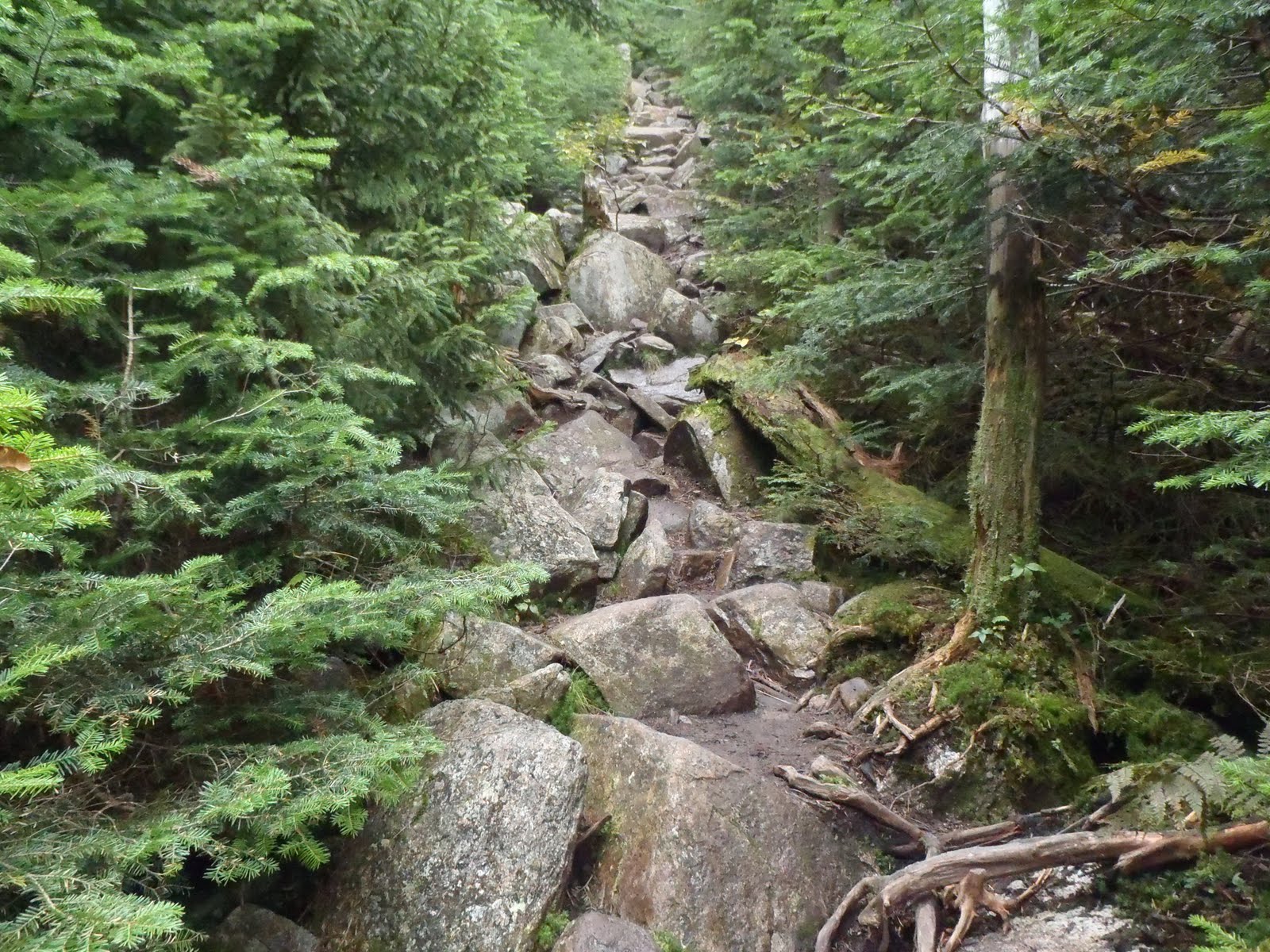
Lincoln Woods Trail between Osseo and Franconia Falls
I really enjoyed hiking this loop. It would have been nice to have a bit of clearing somewhere along the way for some views, but I've already experienced the summits in some condition, so the loop as a whole and the sections of trail I had not been on before were the points I was most looking forward to. I was also curious about the storm damage from Irene, and there was visible damage in just about every section. It's amazing what the water can do to the ground, and there were broken trees everywhere. I feel like I've really worn out the Pemi Wilderness lately, but the truth is there is so much to do. There are so many hike variations to enjoy this area, which I'm sure will be bringing me back. I never thought reaching my goal of all 48 for the first time would be easy, but to think back that I just hiked 10 of them again in one day is both crazy and awesome.

Hike Stats
Trails: Lincoln Woods Trail, Osseo Trail, Franconia Ridge Trail, Garfield Ridge Trail, Frost Trail, Twinway, Bondcliff Trail, West Bond Spur, Wilderness Trail, Lincoln Woods Trail.
Distance: 33.5 miles
Elevation Gain: 9,760 ft.
Time: 15:46

To view the full album from this trip, view or click on the slide show below: