Monday, October 24, 2011

The Horn, The Bulge, & Mt. Cabot - 10/22/11

The plan for this hike was a full traverse from the Horn to Starr King where we had left one car Friday night. We drove from Starr King over to the Berlin Fish Hatchery, and the gate was open around 10:30pm, so we proceeded to the trailhead for the Unknown Pond Trail. We relaxed for about an hour and tried to get a quick nap in before setting off.

After getting our gear, food, and everything situated, we started up the Unknown Pond Trail at 11:50pm. The trail was wet from the get-go and muddy along some stretches. Our boots were covered in mud early, but no wet socks yet. The stream roared pretty loudly next to us. Although rugged, the trail was very easy to follow with just headlamps. There was one pretty tricky crossing where there were 3 thin sticks crossing the first section of the crossing. It was really the easiest way across; we had to grab two sturdy sticks so that we could walk across without relying on balance only.
Bill using a birch stick for balance across the stream
But once we got across that section, we were now in the middle and used the two sticks again to help us over the other half of this crossing which was less technical. After this, it was a smooth ascent until we reached the Unknown Pond Tentsite. Along the way, we came across one of the coolest thing I've seen on-trail. We happened to stop, and I looked down, realizing I almost had stepped on it.
A yellow-spotted salamander on Unknown Pond Trail
At Unknown Pond, we took a look around to explore and we shined our lights out over the pond to get a glimpse of it and anything that might be out there swishing around, but there was nothing but silence and complete darkness. After a short break we carried on to the junction with the Kilkenny Ridge Trail and then started towards the Horn.

Along this 1.6 mile section of trail, the conditions were still wet, but there was a little less mud. The fog was starting to increase steadily, reducing visibility, however the trail remained very easy to follow in the darkness. We made it to the spur trail seemingly quick. We were anxious to get a summit under the way. The spur trail was a very narrow trail. As it nears the summit, the trail is a tunnel of scrub and boulders and then emerges onto a rock ledge at the summit. Of course we couldn't see anything, but we're peakbagging, so tonight the goal was the peak, not the view. The fog even made it difficult for picture-taking.
On the summit of the Horn in deep fog at 3:20am
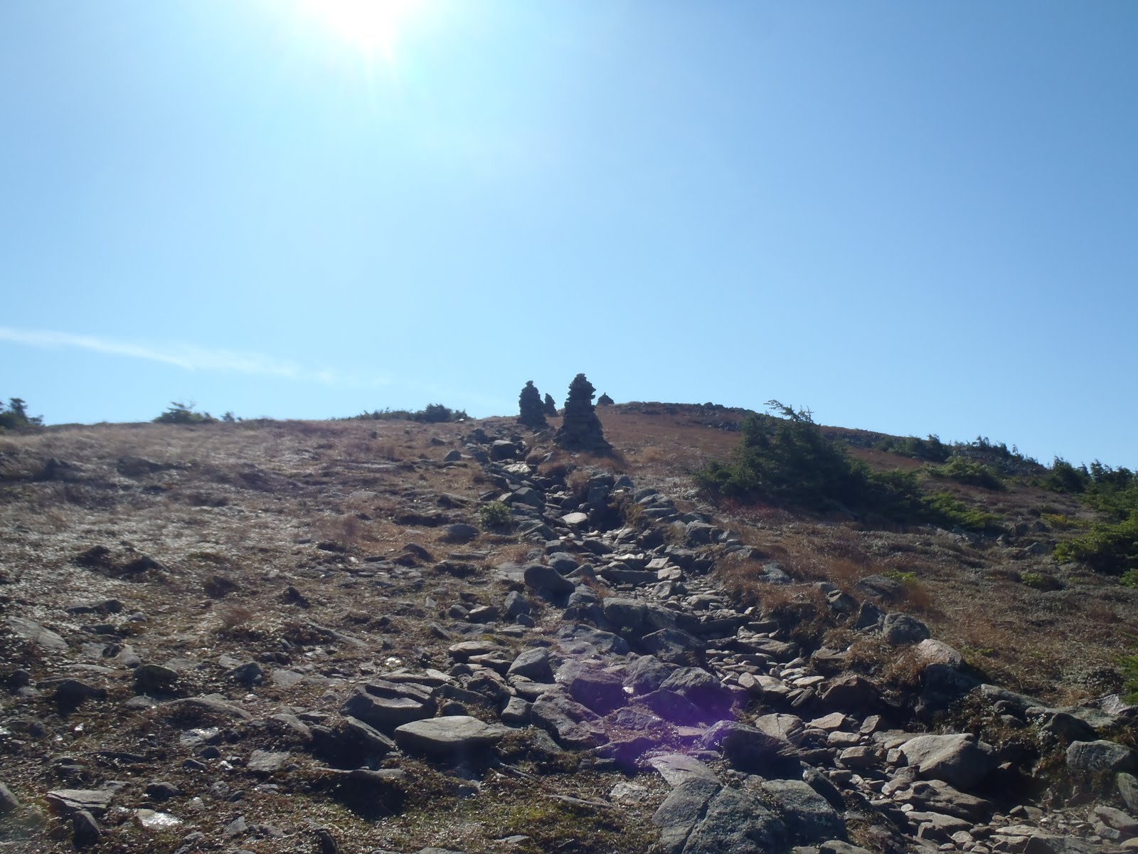
We continued along the Kilkenny Ridge Trail to the Bulge summit. We had to do a double take when we came across the small cairn. It didn't seem like we gained much more elevation. But, there was two New England Hundred Highest out of the way.
Standing next to the summit cairn on The Bulge
Next up was Cabot, another 4000 footer for Bill, and were looking forward to a break and some shelter at the cabin. As we made the approach from the Bulge, I could sense when we were making the final push to the summit, and we then came out at the clearing and found the summit sign.
Bill on Mt. Cabot, his 34th NH 4000-footer
Me on Mt. Cabot for the 2nd time
As we made our way to the other side of the mountain, the wind and fog picked up. We made it to the cabin, which was vacant, so we hunkered down and relaxed on the sleeping pads and snacked on some of our food. Since we hiked through the clouds and wet trail the entire way, our gear had become either damp or wet. After stopping, and even inside the cabin and in our extra clothes, we had a hard time staying comfortable and warm. We arrived at the cabin around 5am, and we ended up leaving sometime after 7am when daylight was breaking.
Foggy daybreak from Cabot Cabin
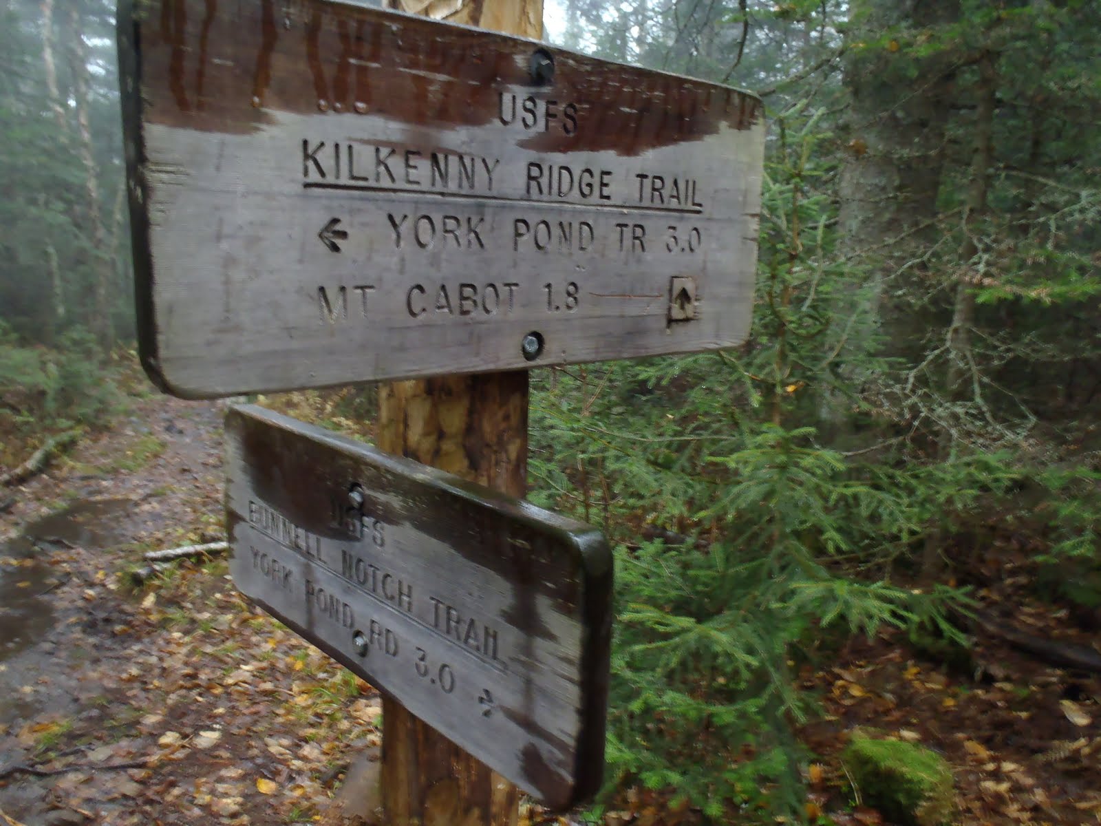
As we stepped off the porch and started down the trail, there was snow and sleet mixed with the rain. Despite that, we were moving quickly and carefully down the trail, arriving at the junction with the Bunnell Notch Trail. Here, we decided that because of the conditions, that we would loop to Bill's car back at the hatchery and shorten this trip. On the way down, I slipped on one of the wooden trail bridges and plunged both feet completely into a puddle up to my shins. I dislike those trail bridges because they are more slippery than anything else on the trail. We made it to York Pond Road just after 10am.
Kilkenny Ridge and Bunnell Notch Trail junction
Fall on the lower Bunnell Notch Trail
Hike Stats
Trails: Unknown Pond Trail, Kilkenny Ridge Trail, Horn Spur, Bunnell Notch Trail
Distance: 11.5 miles
Elevation Gain: 3635 feet
Book Time: 10hrs 20min

To view the full album from this hike, view or click on the slide show below.


Saturday, October 15, 2011

Mt. Major - 10-15-11

No big hike this weekend, but there was still room for a short one, and like any hike, you never know what you're going to get until its all said and done. After doing some outside work at the camp to help close up, we decided to go for a quick hike, and the choice was Mt. Major, a peak of the Belknap Range in Alton, NH.

We started up the trail at 3:30 and the parking lot was jam packed. We opted for the Brook Trail up, assuming it was a little less steep the Mt. Major trail. There were two surprising brook crossings that got the soles of boots wet. The trail is wide, rocky in places, with some loose rocks, so some care is needed in places. There is a nice flat section on this trail though too. Along the way, there were a couple of trail side waterfalls to add to the scenery. Off to the right on the lower portion of the trail there are many large boulders, likely dropped there by glaciers long ago. They make great climbing material and photo ops.
Bill and Kiara on a large rock
Pretty trail
As we ascended, the trail got a bit steeper. Overall most parts of the trail were wet and muddy. I bet its this way quite often, as it looks like water frequently flows down the trails, so I would always be prepared for that on Mt. Major. We passed a sign indicating .4 miles to the summit. Here, the trail breaks from the trees and traverses an open section with the first views of Lake Winnipesaukee. We could see the rain coming down across the lake which was really cool. We continued on going back into the trees once more, and then back out for the final summit push.
Brook Trail near the top
As we climbed up to the high point of the summit, we were greeted with a double rainbow, and a third was seen to the south, by the very end of Alton Bay. It was incredible. Not only that, but the M/S Mt. Washington was in the right place at the right time, cruising into Alton Bay.
Bill, Kiara, and I on the summit with a beautiful rainbow
Looking into Alton Bay
The wind was blowing pretty hard, but for the first few minutes we were focused on the tremendous views. With the sun going down, we hung out for a little bit in the house, out of the wind, waiting for it to do so, and had some snacks and Powerade. Unfortunately, it was a little disapointing to see a bit of trash and wrappers around the summit. I picked up a few wrappers which I could put in my pocket, and Kiara said whoever left them there was a litterbug. Kiara had asked to try a night-time hike, so when the sun was just near the top of the trees, we started back down the same way. We each donned our headlamps at the top of trail and started our descent.
Bill and Kiara with the sunset on Mt. Major
About half way down, the sun was gone for good. The entire way down, we didn't see any other hikers, which was cool. We also did fine heading down, and Kiara got her little night hiking experience. She was a little nervous here and there, but otherwise did great handling the trail in the dark. When we popped out at the parking lot, our car was the only one there, and as we looked up, we could see the milky way and millions of stars in a lucky pocket of clear sky among the mediocre weather we're having this weekend.

Hike Stats:
Trails: Brook Trail, Major-Straightback Link Trail
Distance: 4.8 miles
Elevation Gain: 1,271 ft
Book Time: 3hrs 45min

To view the full album from this hike, view or click on the slide show below. 


Tuesday, October 11, 2011

Mt. Washington, Mt. Monroe, and Boott Spur - 10/9/11

This hike has found its way to the top of the list of my favorite solo hikes. The weather was perfect for our Moosilauke hike on Saturday, and Sunday would be no different. There were several things that made this hike a great one. The only major downside was the crowds. One of the few goals with this hike was to try a different trail up Mt. Washington. I also wanted to get a feel of the trail and surrounding area without snow on it, as the Tuckerman Ravine to Lion Head Trail is the normal route taken during the winter. To make it even better, I planned a loop to bag Mt. Monroe and Boott Spur before descending via Boott Spur Trail.

After a solid hike yesterday, I didn't get up as early as I would have liked to, but I made it to Pinkham Notch and began my hike up the Tuckerman Ravine Trail at 9:50am. There were groups of people everywhere along the lower section making their way up, but just as I would be on the highway, I was in the passing lane moving on up. Once I passed the bridge and the waterfalls, I continued ascending. There was a little break in the crowds, and I began to see commanding views of the rock piles above me, which was beautiful.
View from Tuckerman Ravine Trail
I quickly made it to the junction with the Lion Head Trail, which I took. I did not notice the winter route before Raymond Path, as I would have taken it if I saw it (and if it was not marked as closed). I didn't expect it to be marked, but either way I got the feel of the main Lion Head Trail. The trail was pretty steep and rocky, but not too difficult.
Lion Head Trail
I reached tree line and the views of Tuckerman Ravine were exceptional. I was blown away at how dramatic the landscape is. Still flying up the trail, I passed several groups and continued to just below Lion Head where I stopped for a quick moment and took in the views deep into the ravine. As the views got better, I was more excited to keep on going. I made the climb over Lion's Head which was fun. After Lion's Head, the trail's footing is pretty tricky, and the boulders are quite large. I pushed on and made it to the end of the Tuckerman Ravine Trail at the summit parking lot.
Near Lion Head, overlooking Tuckerman Ravine
I reached the summit in about 2 hours and 15 minutes. I'm not sure what made me so determined to make it that quickly, but it was awesome. This was my 4th time hiking to the summit of Mt. Washington, and in the 3rd different month.
Me on top of New England
I went downstairs to the hiker's room to put on my pant legs and have my sandwich to avoid the packed madhouse upstairs. The wind outside was about 50 mph, and the 15 minute high wind gust was 60 mph. I remember seeing many people leaning into the wind and I was blown off my stride as I made my way into the building. There was no record breaking temperature on Sunday, as it was 1 degree shy of it at 53 degrees. After about 10-15 minutes I headed outside to take in some more of the views. I think one of my favorite vantage points is looking over the southern Presidentials. After a few minutes of that, I was off down the Crawford Path towards Lake of the Clouds.
Southern Presidentials seen from Crawford Path near summit
I didn't stop once during this section (pictured above), navigating the trail with fancy footwork, and arriving at the shore of the lake in 25 minutes. This was a blast! Now, I was about to summit Monroe for the 2nd time. This is where my one year quest for the 48 ended in August. I'm really happy with my choice to end on Monroe, because I love the view of Monroe from Washington, and I also like the views from Monroe of both Washington and the southern Presidentials.

When I got to the summit, there was a guy sitting on the true summit having a seance of some sort, ignoring the several other hikers who would maybe like to touch the summit. Finally, after over 5 minutes, he moved, and a nice couple, who was on a 5-year plan to complete the summits, was able to get an awesome picture of me almost literally blowing off the summit.
Holding strong on Mt. Monroe
I scooted back down the Monroe Loop Trail and back over the side of the hut, which was closed for the season. Here, I took a 10 minute refuge from the wind to indulge in some water and to switch to my base layer shirt and t-shirt, which would be more comfortable, as I anticipated the winds to be less significant the rest of the way, and they were.

Going back up Crawford Path alongside Lake of the Clouds, I came to the Camel Trail junction. This would be another new trail for me, and I am soooo glad that I chose this route, because I was by myself for the entire traverse across the .7 miles of trail between that junction and Davis path. As I neared the middle of this section, I felt like I was the only one on the mountain which was an accepted change on the day. It was here where I realized how awesome this hike was. I was on the southern slopes of Mt. Washington without another hiker in sight, looking off towards Boott Spur, and occasionally looking back at Monroe. The Camel Trail was pretty straightforward with a few sections where rock hopping skills will help you over some large boulders that make up the trail. I took the opportunity to stop behind a wind breaking rock for another break for trail snacks, water and great views.
Approaching Davis Path on the Camel Trail
I took the Davis Path towards Boott Spur, which was basically flat and easy. I came to the Boott Spur Trail junction and then made my way up towards Boott Spur at 5492' which was the main goal for my hike, checking it off my Trailwrights 72 list. The views remained impressive, and here I took a few moments to savor the views, because how often am I going to hike to Boott Spur?
Enjoying the endless view from Boott Spur
I wasn't sure I was ready to descend, but I did, and the views of Pinkham Notch, the Wildcat Range, and beyond remained priceless. I took several photos on the way down. Above tree line, I will say the Boott Spur was a tricky descent, but once below tree line, the footing was much better enabling me to keep a moderate pace. I was extremely happy that I chose this way down because I only passed a few people beyond Boott Spur.
Descending via Boott Spur Trail
Having hiked on Saturday, I think my legs were warmed up and ready to go for this hike, because I was feeling great the entire time, including on the descent. I made it back to Pinkham Notch in 6 hours and 18 minutes to end a hike I now call one of my favorite solo hikes. I had completed a Trailwright peak, 2 more 48x12 grid peaks, experienced new trails, and added to my overall experience on New England's tallest mountain.

Hike Stats:
Trails: Tuckerman Ravine Trail, Lion Head Trail, Tuckerman Ravine Trail, Crawfrod Path, Monroe Loop, Camel Trail, Davis Path, Boott Spur Trail
Distance: 10.6 miles
Elevation Gain: 5,050 ft
Book Time: 6hrs 18min

To view the full album, view or click on the slide show below.

Monday, October 10, 2011

Mt. Moosilauke & South Peak - 10/8/11

The weather this weekend was probably the best it could ever be for October in the White Mountains. I remember a year ago this week we were attempting Mt. Isolation and it was snowing. It was a freezing night at the shelter, and we didn't summit. On Saturday, I met with Owen and his friend Steve for a hike to Mt. Moosilauke, and the weather was far from that of last year's. Owen has a blog about his hiking of New Hampshire's 48, and Saturday he was going for #19. Owen Hikes New Hampshire's 48

To avoid the crowds, the plan was to take the Benton Trail. I don't think any of us realized the road would be closed, but oh well. It was about a mile and half walk down the road, where in places no longer existed. It's hard to imagine how much water was coming down the valley. We came to Benton Trail where we crossed the river and began our ascent.
Tunnel Brook Road storm damage
Fall hiking is the best when there are still plenty of leaves on the trees and just enough on the ground. The Benton Trail provided a crowd-less, moderate, but very enjoyable ascent.
Benton Trail
One of the coolest things about Mt. Moosilaulke is reaching the treeline and making the approach. There's a large cairn at the end of a row of trees marking the entrance to a place with spectacular views. As you walk .4 miles across the top towards the summit, you can see the flatter lands to the west, and to the north and east, you can see the rest of the larger mountains, including Franconia Ridge. The views seem to stretch forever. We arrived at the summit just after 12pm and we found a good spot to get out of the brunt of the wind and had lunch. We feasted on apples, apple cider, cheese, sandwiches, fig newtons, and kit-kats.
Tree line and gateway to awesome views
Approaching the summit of Moosilauke
Mt. Moosilauke, for my 28th TW72 hike
 When we finished eating, we took off towards Moosilauke's South Peak, which is a very easy 1 mile away along the Carriage Road, and a quick 100 feet up the side path.
Me, Bill, and Owen on South Peak; Moosilauke in background
We headed back down using the Carriage Road, Snapper, and Gorge Brook Trails. It was a lot different without snow, but overall the descent was enjoyable. The Carriage Road offers some good views on the way down, and the lower trails have some waterfalls and streams alongside. We made it back to the Ravine Lodge  ending what was a perfect day hike, meeting a fellow blogger, enjoying a couple of peaks and great conversation.

Hike Stats:
Trails: Tunnel Brook Road, Benton Trail, Carriage Road Trail, Snapper Trail, Gorge Brook Trail
Distance: 8.6 miles
Elevation Gain: 3,203 ft
Book Time: 7hrs

To view the full album, view or click on the slide show below.