The weather this weekend was probably the best it could ever be for October in the White Mountains. I remember a year ago this week we were attempting Mt. Isolation and it was snowing. It was a freezing night at the shelter, and we didn't summit. On Saturday, I met with Owen and his friend Steve for a hike to Mt. Moosilauke, and the weather was far from that of last year's. Owen has a blog about his hiking of New Hampshire's 48, and Saturday he was going for #19.
Owen Hikes New Hampshire's 48
To avoid the crowds, the plan was to take the Benton Trail. I don't think any of us realized the road would be closed, but oh well. It was about a mile and half walk down the road, where in places no longer existed. It's hard to imagine how much water was coming down the valley. We came to Benton Trail where we crossed the river and began our ascent.
 |
| Tunnel Brook Road storm damage |
Fall hiking is the best when there are still plenty of leaves on the trees and just enough on the ground. The Benton Trail provided a crowd-less, moderate, but very enjoyable ascent.
 |
| Benton Trail |
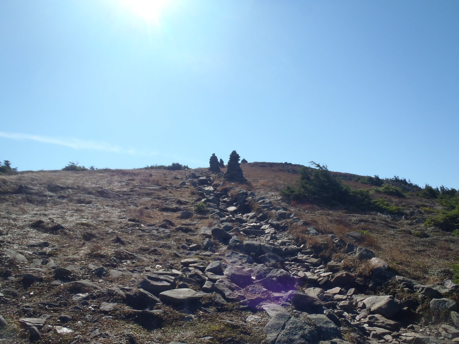
One of the coolest things about Mt. Moosilaulke is reaching the treeline and making the approach. There's a large cairn at the end of a row of trees marking the entrance to a place with spectacular views. As you walk .4 miles across the top towards the summit, you can see the flatter lands to the west, and to the north and east, you can see the rest of the larger mountains, including Franconia Ridge. The views seem to stretch forever. We arrived at the summit just after 12pm and we found a good spot to get out of the brunt of the wind and had lunch. We feasted on apples, apple cider, cheese, sandwiches, fig newtons, and kit-kats.
 |
| Tree line and gateway to awesome views |
 |
| Approaching the summit of Moosilauke |
 |
| Mt. Moosilauke, for my 28th TW72 hike |
When we finished eating, we took off towards Moosilauke's South Peak, which is a very easy 1 mile away along the Carriage Road, and a quick 100 feet up the side path.
 |
| Me, Bill, and Owen on South Peak; Moosilauke in background |
We headed back down using the Carriage Road, Snapper, and Gorge Brook Trails. It was a lot different without snow, but overall the descent was enjoyable. The Carriage Road offers some good views on the way down, and the lower trails have some waterfalls and streams alongside. We made it back to the Ravine Lodge ending what was a perfect day hike, meeting a fellow blogger, enjoying a couple of peaks and great conversation.
Hike Stats:
Trails: Tunnel Brook Road, Benton Trail, Carriage Road Trail, Snapper Trail, Gorge Brook Trail
Distance: 8.6 miles
Elevation Gain: 3,203 ft
Book Time: 7hrs
To view the full album, view or click on the slide show below.


No comments:
Post a Comment