What a year it was! As always, I am extremely fortunate to be healthy and able to experience these unforgettable adventures. This year, 2014, I hiked farther and higher than I did in any of the 3-4 prior years, and that means I pushed and challenged myself even harder over the difficult terrain, and often times through less than favorable conditions. I went on 72 total outings (separate hikes) this year, climbed 208 total mountains (a handful of new ones too), 332,289 feet of elevation gain, and hiked 941 miles. Just like the last few years, I've selected my top ten moments of the year, and have put them in order of some sort of significance to me.
But first, here are a few more stats from 2014:
- Reached the summit of a New England 4000-footer 175 times this year, with 159 being a White Mountain 4000-footer.
- Reached 61 of 67 NE4Ks at the start of 2014 on my way to completing a solo single-winter-season of the NE4Ks (Hiked 6 of the peaks in the last week of December 2013).
- Summited Mt. Washington six times, including once in the winter.
- Completed 6 Presidential Traverses (Including 1 Double Traverse (43.2 mi.) ), A Super-Extended Pemi Loop Overnight in Winter (43.8 mi), and a Mahoosuc Range Traverse (31 mi.).
- Climbed 31 of the White Mountain 4000 footers at least three times in 2014 (many of those 4 times). Climbed Madison, Adams, & Jefferson each seven times this year. I only climbed the Pemi Peaks once in 2014, although climbed them heavily last year.
- Completed Rounds 4, 5, & 6 of the White Mountain 4000-Footers.
- 54 solo hikes out of 72 outings.
- Now for the Top 10 Moments....Enjoy!
(Click on a linked title to open a full trip report including photo album or click on photo album to open a photo album for that hike, if a trip report is not available)
Honorable Mentions:
Bear Pond Bushwhack - August 2014
Although I didn't hike as many Pemi summits this year, I did have one memorable summer overnight trip this year into Bear Pond in Redrock Ravine. Bear Pond is a remote pond nestled deep and upward into Redrock Ravine near the Bonds and Southwest Twin. It's a good 8 miles from the nearest road, including two miles of bushwhacking from the Franconia Brook Trail. Rich in history from the once busy logging days, this was one of the most beautiful and remote spots I've been able to experience in the White Mountains to date. Check out my trip report for more.
 |
Enjoying some remote wilderness with my brother
|
|
 |
Bear Pond (aka Redrock Pond)
|
|
 |
| Possible former site of Logging Camp 14 |
Hut-to-Hut Attempt w/ Winds - July 2014
I had a lot of fun this summer pushing myself to do some fun endurance hikes. A Hut-to-Hut was on my list, so after my Double Presi, I excited myself for this. However, I of course wanted to make it harder than the regular hut-to-hut, so I wanted to attempt the MacPhail route, which includes Pinkham Notch (and surely, I wanted to include the Wildcats). I was aware this could take more than 24 hours. Rain delayed my start by about 8 hours, which normally isn't a huge deal because either way, I'd be hiking 24 + hours anyways...I just needed to start in time to finish before Sunday night. Things started off very well. Left Carter Hut, over the Wildcats to Pinkham, up Jackson Road to Madison Gulf and Osgood, and onto the Northern Presidentials.
 |
| Ominous looking, but not threatening on Osgood Trail |
|
 |
| A nice sunset near Edmunds Col enroute to Jefferson |
|
By Jefferson, the sun was setting, and as I ascended higher, the darker clouds overtook the higher summits. The winds, which were already roaring around 60mph, began to increase to 80 mph as I carefully approached the summit of Mt. Washington. Certainly these night time conditions were a little unexpected (forecast was mostly good), and at this time I knew I had to focus and get to the safety of Lake of the Clouds Hut, where essentially this attempt would be over. As I left Washington in the midnight hour, on my way down the Crawford Path, the wind topped 89 mph per the Observatory, and visibility was pretty much that I could only see my feet on the ground in my headlamp. Eventually, about 30-40 minutes later, I reached Lake of the Clouds where a cold bench awaited for the night.
 |
| 11:40pm, winds over 80mph |
The next morning, I was able to hike out over Monroe, Eisenhower, and Pierce to finish a Wildcats + Presi with an unexpected stay at Lakes. This was one the most intense moments I've had in the Presidentials, a great learning experience, and still a great 35 mile hike over 9 4000-footers. Click on the link to read my detailed trip report.
 |
| The next morning, pretty clouds from Pierce before descent |
10. Presidential Traverse W/ Isolation - December 2014 (Photo Album Only)
 |
| Approaching Madison Springs Hut |
On December 14th, I set out to attempt a Presidential Traverse including an out-and-back of Mt. Isolation, a 26.5 mile adventure over 11,367 ft. of elevation. Fellow hardcore hikers Jay and Andrew joined me for the start and through to the summit of Mt. Washington. Conditions at the start were not great, but manageable. We had made consistent time across the peaks, but not at the speed we are used to moving at in good conditions. It was approximately 4:00pm when I left Jay and Andrew on Mt. Washington to continue my trek out to Isolation. This was a time I did not have a problem with, but it was very close to my cut-off time to abort Isolation. Conditions were improving. It took a while to reach Isolation because I broke trail from the treeline to the Isolation Trail junction in addition to battling a large amount of snowy overhung trees across the trail.
 |
| Traversing in the afternoon towards Clay |
 |
| Now solo, I head to Mt. Isolation along Davis Path at sunset |
Once on the summit of Isolation, although a little wet, I realized I was standing there under clear skies, and then just a minute later the Geminids Meteors started their show. I left quickly, moving faster now with my tracks on the way back up Davis Path. It was after 9:00pm when I was approaching Lake of the Clouds Hut and Mt. Monroe. Conditions were still great, and I was still seeing stars. Although my GPS battery was already dead, and my phone was almost dead, I called home as I ascended Monroe. I reported that I was doing great, skies were clear and I would hopefully finish soon after Pierce. After traversing Mt. Franklin, some freezing fog rolled in, and visibility was reduced to just 10's of feet. Following cairn to cairn, I thought I knew where I was descending to, but after about 10 minutes of fighting spruce (more than I thought I was going to pass through) I realized that I could no longer see which direction I was going in. Therefore, with no GPS and no cell phone, and to prevent myself from going anywhere further in the potentially wrong direction, I decided to stop and hole up until daylight. I was able to get a successful text out (by warming my IPhone with hand warmers) that stated that I was off trail and stopped until daylight.
 |
| Mt. Monroe, 10:00pm. No fog yet. |
I dug a thin trench with my snowshoe. I stuck branches in the top of the sides of the trench, and made an arch, which a I topped with a SOL Emergency Blanket. I removed my boots, and changed into a dry pair. I got in, and I sat on my rear all night, and stayed warm by rubbing my feet, legs, and arms often. Thankfully it was only near freezing that night, and doing just that was much more comfortable than trudging on without a great sense of direction, and wasting energy.
 |
| Sunrise the next morning, after climbing 2hrs back to the ridge |
The next morning, I began to retrace my steps back to above treeline. Once I could see,I noticed my mistake, and instantly I realized I had made a excellent decision to stop, otherwise I might have been battling all night to to find the Crawford Path or Mt. Clinton Rd. Once back to treeline, I also realized that I was so darn close to that pesky Eisenhower trail junction near Edmands Path. It had taken me 2 hours to crawl back up through and on the trees to the Crawford Path where I went astray. Although a little tired, it took me two hours to reach Eisenhower, Pierce, and descend to my car. At about 9:40 am Monday morning, I finally reached home to let them know I was out.
 |
| Mt. Eisenhower summit the next morning, with a brocken spectre atop the shadow |
This was certainly a great learning experience (and test for for my family, haha ;) ). Conditions changed the fastest I've ever seen them change, and just after telling my parents I was going to be good, I was lost, with no cell phone juice. Stopping was the right thing to do, and I knew had the equipment on me to do it. This incredible learning experience smack in the middle of a Presidential Traverse w/ Isolation that included an amazing sunset, clear skies, shooting stars, and fun hiking, was a top 10 moment. I hope to share a little more about this experience in the future.
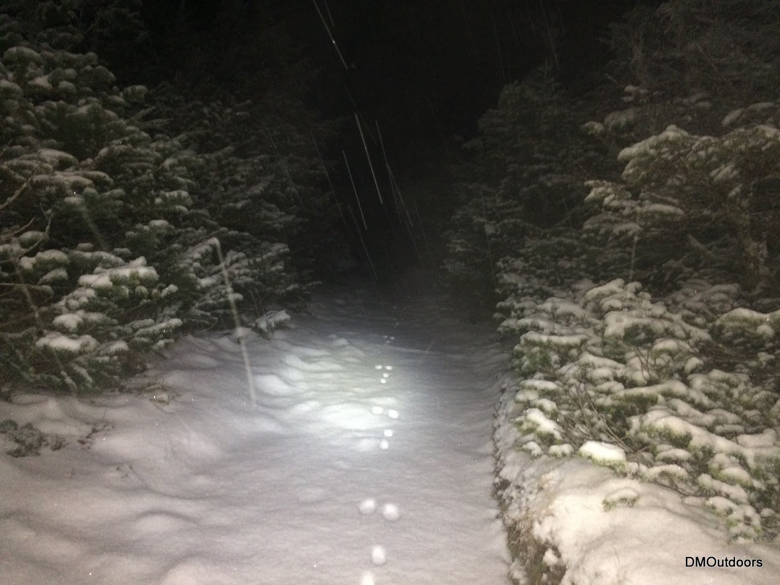
9. Night hiking this Fall - September thru December 2014 (Photo Album Only)
Trail conditions have not been easy this fall, as I would have to say its been quite snowy and tougher than expected. I have not done as much hiking in fall as I have this year, but in pursuit of the grid, I reached 19 4000-footers during the night-time hours in the fall months (9/21-12/21). By night, that means starting after sunrise. I had a couple of hikes with a nice moon, and one in particular, Tom, Field, and Willey - the snow sparkling in the moonlight was just magical. The best part about hiking at night is that you can pull up to one of the most popular trails in the White Mountains, hike a 10 mile loop over 3 peaks, and not see a soul. The same went for the rest of the 16 4000-footers I did at night, except for being with one other person on a couple of those hikes. Cruising through the snowy woods at night in the falling snow and breezy trees is just as exciting as traversing a ridge on blue-bird day. I love being prepared for everything, and hiking at any time of the day is a great way to test your ability to be prepared for anything. This fall was a lot of fun, and it certainly had me worked out and ready for this winter.
8. Mahoosuc Range Traverse - September 2014 (Photo Album)
This September, along with some friends, we set out to take on the mighty Mahoosuc Range Traverse, which is a grueling 31 miles across some of New England's toughest terrain. We witnessed the sunrise on Old Speck, crossed the border into NH, sunset from somewhere along the the trail in NH, and battled arguably the hardest hike I did all year. The hardest mile, through the notch was indeed hard. This was the last of the main White Mountain Traverses for me to do, and it was a memorable hike for 2014.
 |
| Pre-sunrise from Old Speck |
|
 |
| Speck Pond |
|
 |
| The "Hardest Mile" on the AT, Mahoosuc Traverse |
|
 |
| Beautiful fall scenery seen from the alpine zone |
|
 |
| Sunset in the Mahoosuc Range with still 10+ miles to go.... |
7. Super Extended Overnight Pemi Loop in Winter - February 2014
In February of this year, in the midst of my attempt to reach the 67 in a single Winter season, I wanted to attempt and had planned a 13-peak winter Pemi Loop, over 40 miles and 15,800 feet of elevation gain. I packed a sleeping bag, pad, stove, and tarp, with the anticipation of possibly stopping to set up a quick camp for the night, if needed. I battled varying trail conditions, mostly tough, to finish this monster of a hike in approximately 26 hours. This was the most fun I've ever had on a Pemi Loop, and was one of the funnest adventures of the year. Be sure to read my detailed trip report by section!
 |
| Franconia Ridge |
|
 |
| Mt. Lafayette |
|
 |
| South Twin |
|
 |
| Franconia Ridge from South Twin |
|
 |
| Mt. Hale Summit |
|
 |
| Looking to Zealand on the Twinway |
|
 |
| Unbroken Twinway |
|
 |
| Someones's been to Zealand, but not human |
|
 |
| Panorama from Guyot |
 |
| On the way to Bondcliff to end an incredible hike |
6. Double Presidential Range Traverse - May/June 2014
 |
| The Great Gulf from the Gulfside Trail |
After two previous attempts extending back to last year, this summer, I finally completed a Double Presidential Traverse. Although not just any double, I set out to reach each of the 8 peaks in two different months and two different days by attempting it on the 31st and 1st of the month (I also wanted to complete it under 24 hours). It also meant that I could not leave the first summit on the return trip until midnight - I call it the Grid inspired Double Presidential Traverse. Although I did not complete it under 24 hours, I was successful in completing it as needed for the Grid. I had closed out two months of the Presi's in one hike. This was an incredible challenge, one of the hardest I've done, and it was tremendously fun! Good luck to anyone who dares to try the grid inspired Double Presi!
 |
| Gulfside Trail between Mt.. Jefferson and Clay |
 |
| Mt. Washington at sunrise, and for the 2nd time in less than 24 hours |
5. North Brother for Winter 67 Finish - March 2014 (Photo Album)
North Brother mountain in Maine is one the hardest mountains to get to of all the New England 4,000-footers. It is the visited the least of them all, especially in winter, which means the trail is often unbroken all of the way. Earlier in the winter, I had to turn back on my way in on the first planned attempt. Because of that unsuccessful attempt, this March attempt of North Brother would end up being the last one I needed to completed the New England list in winter. It was also the next biggest obstacle in my single season goal. I really challenged myself on this one attempting it as an overnight. After seeing a familiar face on the way in, I was treated to mostly great conditions, which afforded me the opportunity for success. It was basically the first time I ever camped out solo in winter. It was cold, and it was a great experience. The feeling of accomplishment overrode the pain of carrying a heavy load and sore muscles. Reaching North Brother, a place that is so hard to get to in winter, and having been to every 4,000-footer in New England in winter, and also to each one at least once solo in winter, was a fulfilling moment.
 |
| North Brother |
|
 |
| North Brother |
|
 |
| Ascending the Marston Trail |
|
 |
| Taking a moment to reflect before summiting |
|
 |
| The view from my Winter 67 Finish, North Brother |
 |
| North Brother Summit Picture |
4. Mt. Rainier with RMI - September 2014 (Photo Album)
On Labor Day weekend I reached the summit of Mt. Rainier on a guided climb with RMI Expeditions. Our ascent was capped when we reached the summit crater at 14,XXL feet. On a day where no other parties reached the top, our teams battled strong winds and blowing snow as we traversed the massive crevassed glaciers that you read about. And Like I dreamed about, I watched the sunrise above an under cast while sitting at high break above 14,000 feet. With uncertainty about whether we would be able to continue, the guides determined that our teams were strong enough to go for the summit. Due to the extreme cold (around 8 degrees, with below zero wind chill) the guides did not take us to Columbia Crest, however consider the summit crater as a successful summit. I still am unsure of how I feel about that per se, all I know is that I'm proud of my accomplishment, and it's the most exciting alpine climbing adventure I've ever done. I look forward to going back as soon as I can. Look forward to my trip report, which I have not yet done. In the meantime, check out the full album
here.
 |
| Sunrise from above 14,000' |
|
 |
| Summit Photo |
|
3. Mt. Jefferson - Aurora Borealis - 9/7/14
 |
| Popping through an under-cast after sunset while ascending Caps Ridge Trail |
With a highly anticipated forecast of a high chance of northern lights, my brother and I chose Mt. Jefferson for the event. We ascended Caps Ridge where we broke above the under-cast just at sunset, and minutes later, the aurora began to the north. We continued, and summited Jefferson as the northern lights show had just begun. We enjoyed several hours on the summit cooking a meal, watching the stars and the northern lights. I was impressed to see the northern lights, full moon, and so many stars all at once. I always wanted to see the northern lights, and this was the first and likely the best ever. If there is a chance to see them, drop everything and go - it will be a top 10 moment!
2. Mt. Katahdin Solo in Winter - January 2014
Coming in as my 2nd top moment of 2014 was my solo 4 day expedition to Mt. Katahdin and Hamlin Peak in January. With good trail conditions, and a stellar summit day, the whole trip was incredible, and perfectly executed per my trip plan. I was the first to reach the summit of Katahdin in 8 days, which was very exciting. By far it was the most thrilling winter summit arrival I've ever had. Knowing how hard it is, the logistical challenge, as well as the physical effort required to reach the summit in winter, it was one of the most rewarding adventures I've ever done. Be sure to read the trip report for more photos and videos!
 |
| Pulled the pulk approximately 30 miles |
|
 |
| Ascending Hamlin Ridge Trail at sunrise |
|
 |
| Traversing the Saddle to Mt. Katahdin |
|
 |
| Approaching the summit of Mt. Katahdin |
|
 |
| Mt. Katahdin |
|
 |
| The Katahdin Bowl |
|
 |
| Nice and cozy using the bunkhouses |
1. Mt. Isolation - Solo Single Season Winter 67 Finish - March 2014
Lastly, my top moment of the year goes to my finishing hike to reach Mt. Isolation to complete a solo single-winter season of the New England 4,000-footers. I've talked about this endeavor quite a bit all year long. Undoubtedly, it was one of the hardest things I've ever done. Not only is hard to physically reach every summit in winter, but the prolonged dedication to planning every hike, driving to every mountain, and reaching every summit is what makes this accomplishment far more than just another mountain experience. To accomplish this feat, I spent almost a half year of my life planning, packing, driving, climbing, breaking trail, shoveling trail heads, writing trip reports, keeping records....the list goes on. This is why I'm so proud of this accomplishment, and hence it was all around the best experience of 2014.
My finish on Mt. Isolation
was no easy feat. I broke a trail all the way summit, essentially bushwhacking it head on from the Rocky Branch through the deepest snow I have ever encountered. It felt only right that, that I would battle another one of the most remote mountains in New England, and fight through tough conditions to get there. This accomplishment will be a top 10 for my entire life.
|
|
Just after I left the Rocky Branch Trail
|
|
|
|
The next time I took a picture on this hike...
|
|
|
|
|
|
The final summit photo on Isolation
|
|
- - -
As always, thank you to all of my family, friends, Facebook followers, Twitter Followers, YouTube subscribers, and everyone else for following my adventures this year, and sharing the great outdoors. It was an incredible year! I wish for everyone a wonderful 2015 full of epic adventures, good health, and quality time with loved ones! Hike On and Stay Safe!
All the Best in 2015!
-
Dan McGinness