Monday, January 30, 2012

Back to Skiing - Gunstock - 1/28/12

Hi everyone, this is not a hiking trip report, this is a ski outing report! Well, the plan for Saturday was to hike Whiteface, East Sleeper and Passaconaway, but when you wake up two hours later than planned, it certainly makes a difference when it comes to winter hiking, and we would be up against time all hike. In addition, two friends of mine need these peaks, so we opted for skiing and snowboarding at Gunstock.

I can remember the first time I was going skiing with family at Sunday River, fifteen or more years ago. I did not take lessons that day because Sunday River required the students to wear a balloon on their head. Even at ten years old, I would not be seen with a balloon on my head, so I sat in the lodge and never learned to ski that day. I skied one other time at Nashoba Valley when I was a young teenager, and then the last time I skied was about seven or more years ago at Ragged Mountain in NH with family. I remember doing well that day, but still was a little nervous. 

Over the last couple of years, I have been trying to teach myself how to snowboard. I've tried about four times at places like Sunday River, King Pine, and Gunstock, and can remember two being good trips of decently controlled snowboarding, but I can not seem to get the technique down to where its fun for me. Therefore, I decided that its time to see about skiing again, so instead of two plus hours late for our hike, we we're at Gunstock after an hour drive for opening!

I tried snowboarding once here last year, so I went through the rental process pretty quickly, and was provided with some decent equipment in good condition from the manufacturer Head. I met Bill outside, and we were off to the summit of Gunstock via lift haha!


The weather was great, it was around freezing all day, I'd say; the sun took a while to poke through the clouds, but was present and it provided for great conditions. Those ground conditions were basically groomed loose granular and not very icy until it was noticeably icier at the top on my last two runs. The low amount of skiers there made it a pretty enjoyable day for a place with such short runs. Early in the day, we had unobstructed views to the beautifully white-covered Mt. Washington with Lake Winnipisaukee in the foreground.

When we were on the lifts, the trees were thickly coated with ice and the trees were shedding that ice in the bright sunlight as we made our way up the lift each time, which sounded like very heavy objects crashing onto the crusty snow. How was hiking on the trails yesterday with all of this falling ice? Did anyone have any close calls? We almost did as we stopped along-side the ski trail once. Yikes!

I definitely picked skiing right back up, I didn't fall all day long, which was sweet. I loved zig zagging and whizzing past everyone so I could get to the bottom and go do it all again. I picked up some amazing speed at some points, and one time I had enough speed coming down one side, I was able to sort of cross-country ski across the base of the mountain to get to the far lift! My last two runs of the day were sweet, and both had a combination of all 3 levels, including a couple of black diamonds, Middle Trigger and Redhat, which were steep and icy at the end of the day. With the headphones cranking all-day, I was whizzing down the mountain as fast as I can like Bode Miller.
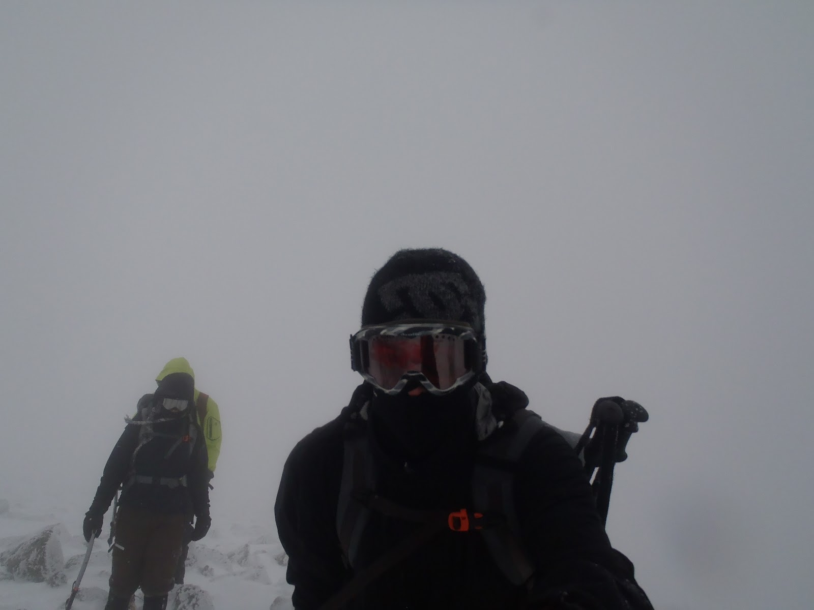
Bill did just as well as me on the day after a 2-year hiatus 
A bistro chicken sandwich, fish and chips and a couple of Samuel Adams' for lunch filled in the day in between at the Pistol Pub in the main lodge. We departed around 5pm with the desire to ski more this year! I'm ready to buy some skis!

Later, I will post a video of a few clips on the day. Look for that on my YouTube channel.

A quick blurb on the value of going to Gunstock. Gunstock is a smaller easy-to-get-to peak, and is ideal for beginners. After waking late, we didn't want to drive too far north on Saturday, so this was the best choice, plus we're familiar with it, but in the future, I'm going to consider going to the larger mountains slightly more north, such as Loon, because the price is only approximately ten dollars more. This really makes Gunstock's prices seem pretty high. Thankfully it was a great day, and it was justified. Its time to invest in some skis now to cut down the long term costs! :)

Costs:
Adult Prime Time Lift Ticket - $72
Skis, Boots, and Poles Rental -$38
Bistro Chicken Sandwich and Sam Adams - $20 including tip
Total Cost - $130

Tuesday, January 17, 2012

Mt. Washington via Tuckerman Ravine 1/16/12

After some sweet hikes lately, I've been feeling rather adventurous. If I'm going to be a hardcore mountain climber, I have to start somewhere! jk Having done Lion's Head three months in a row, I've had Tuckerman Ravine on my to-do for several weeks. It's always a must to take advantage of a long weekend when you have it. My adventure was chosen, and the weather gods provided me with the best weather I could have asked for.
Looking up to the ravine from near Hermit Lake 
At the base of Tuckerman Ravine
The lower Tuckerman Ravine trail is becoming like the Lincoln Woods trail to me. Its all packed out nicely. I was at the base of the Ravine in about two hours. It was quiet as a mouse there, and I peered up above me to be overcome with a very quick thought and feeling of HOLY SHIT! After about 30 seconds that was gone, and then I was taking my time, enjoying the view from lunch rocks as I put on my crampons. There is truly nothing like standing at the base of the Ravine and looking up with no one around.
Close-up at the base of Tuckerman Ravine
Right-middle of Tuckerman Ravine
For several minutes, I watched the rangers and realized they were going up to do some testing. I looked for the safest looking route on the right side, and I believe it was the sluice section that I was climbing or climbing near. I started up. After that, it was go time for the craziest thing I've ever done. Rather than have me explain the most real and intense all-or-nothing moments I have ever experienced, you can watch below, and re-climb it with me.
Looking down at the two snow rangers
Yup, follow the footstep


The adrenaline of climbing it lasted for the rest of the hike. When I reached the trail and saw the cairns leading the rest of the way to the summit, I was filled with excitement. The day was perfect, and with still a half mile to go,  I had witnessed and experienced the pure magnitude of the impressive, breathtaking, and no doubt about it, dangerous Tuckerman Ravine.
Looking down while climbing
Glove in the way, but no time for a re-take
From the spot where I finally reached a cairn on the trail
The views were endless as I ascended the summit cone. When I reached the end of the trail, the summit and every apparatus was rimed beautifully in a coating of bright white. Other groups walked nearby the summit. Several people were enjoying the summit and the Lions Head route.
Lion Head & Tuckerman junction
Wildcat ski area from before the start of summit cone
Wildcat and beyond
I reached the summit for the 7th time, and this one required pure effort, adrenaline, will, and guts. Another feat off my to-do list.
My 7th successful climb to Mt. Washington
Views from the Top
The stairs don't actually look bad in this picture!
After a solid break in the sheltered corner near the building entrance, I geared up for a increasingly windy descent. It was very gusty all of the way to Lions Head. I descended rather quickly, and took a break at Lion's Head to de-layer. I was sweating from skipping down the trail quickly. Below Lion's Head the trail is completely packed out and was a walk in the park. I got several nice glissades in again, and others were doing it too. I descended to Pinkham Notch Visitor Center in approximately 1hr and 30 min.
Along the Lion Head Trail while descending
A break at Lion's Head with gusty winds
This was the most dangerous, yet exciting thing I have ever done. I don't recommend anyone go out and do this solo. It's not the best decision, but I was content with it, and felt that my prior experience was sufficient enough to do it. I feel that it was, minus the avalanche training, which I want to do. I do not undertake any hike, especially one like this or above tree-line without a lot of thinking, reading, researching, and route planning. The next holiday I'm thinking about is Presidential day, oops I mean Presidents Day.

Hike Stats
Trails: Tuckerman Ravine Trail, Sluice (I think), Tuckerman Ravine Trail, Lions Head Trail (summer), Tuckerman Ravine Trail
Distance: 8.1 miles
Elevation Gain: 4,300 ft
Book Time: 5hrs 50min


Spot Adventures Trip Link

Monday, January 16, 2012

Mt. Osceola, East Peak & Mt. Osceola 1/14/12

It was another frigid adventure yesterday, this time back to where my 2011 Quest for NHs 48 all started for me about exactly a year ago on the Osceola's. I joined my friend Mike for this one, as we did some peakbagging shenanigans. He is working on the 48, and oddly, it was his 31st and 32nd on round 1 while this was number 31 and 32 on my second round, and my 38th Trailwright.

We started up the Greeley Ponds Trail and it was a pleasant 1.3 mile stroll to the junction. The powdery snow snow was trampled from a couple of groups before us, but not packed solid. It was still nice walking, until my foot slipped off of a two plank bridge and I was in up over my thigh. That was pretty funny, and then it turned into an adventure. (I have this on video, its hilarious, I'll post it later)
Greeley Pond Trail
At the junction we could see the East Peak above which was impressive. At this point, I was already enjoying it because last time, it was snowing all day, and I couldn't see anything at all, just a steep trail. Now on the Mt. Osceola Trail, the trail steepened after leaving the open woods. Microspikes and our ice axes were doing the trick as we continued to climb. The powdery snow made it tough in some areas to climb without hand support.
East Peak from the junction
We encountered an older couple having a tough time at the open slide area. We assisted them from that area to the outlook near the summit. While Mike and I second guessed giving them assistance, we went along with them, offering assistance based on both of their willingness to continue. We were concerned about them going down, but I said to Mike, "we're all out here hiking our own hike, and you and I are prepared with the equipment we need." The gentleman had poles and yaktrax, and the woman had yaktrax and no poles.


Almost to East Peak from the viewpoint
We left them at the outlook after taking in the view together. I'm glad they got to experience the great view before heading back. I was excited to be able to see from the outlook this time. Osceola has some great views while ascending. We then made it to the rather view-less summit though, of East Peak. Another hiker was on his down from there. As we started to walk away, I said to Mike, "there's enough people out here, we can't worry about them, let's go". We carried on, and the chimney awaited.
#31 Round 1

#31 Round 2
Once there, I don't think there was any other option. The bypass looked way too easy, so the crampons went on with rather quickness and I was ready for the chimney. As I approached it, I sunk up to my hips in the snow. When I got to it, I tried going to the left, and getting enough grip to swing my body up over the first wall of ice, but I then went to the right, and used the tree to help me get over that section. I left my sure hold on the tree, and for about 30 seconds I was on my crampon points and my ice axe hold, leaning my body against the ice. I swung my ice axe a little left on the above ice and shifted left twice quickly, and the tough part was over. (I have to describe, it since Mike somehow didn't have the video working, even though I pressed record, otherwise you would simply watch me climb it) After the visible ice, it climbs another 15-20 feet or so through deep drifted snow. Here I still had to be extremely cautious with each step. I reached the top successfully, and it was a freakin' blast.
Mike followed suit, but he skipped the powdery snow section and came out just above the ice. We continued on, through the winter wonderland. We finally came to the summit, and before we came out of the trees, it looked like we had reached the gates of heaven. We popped out onto the summit to amazing views which I had not seen from here before. The Trips look mighty impressive, and Washington looks as just good from anywhere. A steady wind with chills down to -20 left us not hanging around too long, but the beaming sun and views were such a great reward for the steep effort.
About to get a great view from Osceola
A sweet view and a steep ledge
Mike celebrates #32 with some sort of ice axe pose
A couple of other favorites from this trip...
Mt. Washington in the distance
The beautiful Pemi
Now began the descent which was one of the best butt-sliding descents ever.


Hike Stats
Trails: Greeley Ponds Trail, Mt. Osceola Trail
Distance: 7.6 miles
Elevation Gain: 3,100 ft
Book Time: 6hrs 40min


Tuesday, January 10, 2012

DMOutdoors - Top 10 Moments of 2011

2011 was full of awesome hikes, accomplishments and special moments. It's impossible to fit all of the great moments into this post, but I wrestled with this list for a while, changed it a few times, but here it is...the DMOutdoors Top Ten Moments of 2011. 
We picked up some MSR Ascent Lightning snowshoes and set off for the Osceola's on my quest for the 48. We were rookies then. The hike took us well over 10hrs, and it snowed from dawn to darkness, and we battled -30 wind chills and frigid temps. We climbed the by-pass in snowshoes for the first time. We couldn't have our gloves off at all, it was tough, What the heck did I get myself into? Bill even slid 15 feet on a sheet of ice at a steep grade and nearly went flying off the mountain. The snow was beautiful shimmering in our headlamps though, so that was enough to keep hiking that year.
One of the most epic photos of Bill in winter.

On July 4th weekend in 2011, we set off for a traverse of the Wildcats, Carters, and Moriah. This is a strenuous traverse, and we planned to camp halfway. After descending Wildcat to Carter Notch, then up Carter Dome, we were spent, and Zeta Pass was the ideal spot, however signs prevent camping there. We walked towards Middle Carter and then bushwhacked into the woods towards the east, well beyond the trail and through the pass. We set up our 3-hammock camp early in the afternoon, relaxed, and even took a nap before dinner. We ate our meals, drank some Glenlivet, and were in our hammocks drifting away as we saw the light fading through the trees. Well into the woods, no one knew we were there. This was a great overnight hike, and was the second time ever camping out in the White Mountains.
Our three hammock setup with two rain flys
Nice sunrise view from the hammock on the Carter Range
8. Jackson & Webster on September 11th for Flags on the 48 Day
Me, my brother, and seven year-old (at the time) niece Kiara set off for Webster and Jackson, with a special trip planned to search for my long lost camera from the spring. In addition,  we got to see the flag at the summit for Flags on the 48. The views were tremendous and Kiara hiked the fairly rugged trail like it was nothing, and it was an overall great day (except for not finding my camera). Kiara hiked two 4000 footers in 2011 and was a companion on both me and my brother's Quest's for the 48! I know my brother enjoyed this one too, so it makes the top 10 no problem.
Lookin' out from Jackson
Remembering 9/11 above 4000' with my niece - we brought flags too!
7. Bushwhackin' Bill leads us to Owl's Head
I successfully did a Black Pond Bushwhack in July of 2011, and in September, my brother needed the Owl's Head, so it was his turn to lead the way with the map and compass. He lead the way perfectly to the campsite, and on the way back, successfully came out, as hoped, at the "End of Trail" sign to Franconia Falls. Along the bushwhack, we saw an awesome spot we'd like to go back to. Bill's bushwhackin' skills had us feeling real confident after this one, and the scenery and sense of remoteness was spectacular.
Bill checks the bearin', no pressure
One of my favorite pictures of me lookin' like a wilderness maniac
Did we really just end up at the sign perfectly?
Feelin' pretty accomplished and confident at this point
6. Standing on Bondcliff
Standing on Bondcliff is one of the highlights of hiking the 48. Bondcliff is one of the most remote peaks in the White Mountains, and its cliff is pretty impressive to say the least. A fall from it would mean certain injury and or death, but its beauty pulls most to stand atop it. I stood on the cliff twice on our hike of the Bonds in July and once solo in September. I've also walked up to it at 5am in pitch blackness with some light blowing snow! (1:30 of this video)Its overall insanity factor puts this 2011 "moment" in the middle of the pack at number 6.

Bill on Bondcliff in the morning
Me on Bondcliff in the afternoon
5. Ascending Mt. Lafayette in February
On President's Day, February 2011, a wind chill advisory was up for the day, and the average wind speed on Mt. Washington was 64mph. It was snowing hard at the start and it was deep from the get-go at Old Bridle Path. There was blowing snow as I rounded the steep ridge of Walker Ravine on the way towards the hut. As I broke from the trees, and strong winds blew at my back as I ascended the cone of Lafayette, requiring me to go to all fours a few times. Although it only lasted about 20-30 minutes, it was the heaviest wind and most exposure that I had experienced to date at the time. After Lafayette, the winds let up considerably, but it was still a thrill until I was back in the trees. A small strip of exposed skin missed by balaclava shed from my cheek the next day.
Lafayette, toughest time the first time
The ridge that day
4. Hiking the Grafton Loop Trail
This incredible 40-mile overnight hike was one that was not so easily overshadowed by my New Hampshire endeavors in 2011, which is why it makes number 4 on the top ten. This trail, which links with the AT for a small portion has some of the most beautiful stretches of trail I have ever hiked. I battled Old Speck, Sunday River Whitecap, Puzzle Mountain, Long Mountain, East Baldpate, West Baldpate, thick overgrown trail, beautiful streams, incredible ledges and views. The list is endless, the memory of it endless...I will be back here.
Am I in Avatar??
Old Speck Summit, my only Maine 4000 footer in 2011
Grafton Notch wilderness maniac again
This was my tent site, down the hill from the trail
On Long Mountain - worth the side trip to the summit
E. Baldpate - had one of the most impressive 360 degree views ever

3. Reaching the summit of Mt. Washington in winter, on New Year's Eve 2011
If anyone didn't take notice, my hikes of Mt. Washington in October and November 2011 were mainly practice and scouting for my planned hike on New Year's Eve 2011. It turns out that the winter route was still closed, so all the better, it was my third time up the summer Lion's Head Trail in 3 months. Having hiked over 90 mountains in 2011, this was a pretty easy hike. With my friends Mike and Nicole, we cruised with ease to top using my new crampons and ice axe. I was on the summit of Mt. Monadnock for the end of 2010, and early on, I was planning this to end my first year of hiking. It was my first winter ascent of Mt. Washington, and already the sixth time I had claimed the summit.
Low visibility once after Lion Head
Me approaching on the summit cone
Mt. Washington - New Year's Eve 2011
2. Franconia Ridge Christmas Completion: My brother's completion of the 48
This hike over the 4 Franconia Ridge peaks to complete my brother's 48 on Mt. Lafayette remains one of the most spectacular hikes we've done together. We survived the Flume Slide Trail ascent (really fun), and approached Flume in dense fog and blowing snow. We were tested above treeline, and had to break the Franconia Ridge Trail towards Lafayette. Above treeline, we were treated to some of the most spectacular views featuring a setting sun and waves of undercast. It was unlike anything else we have ever witnessed. Oh wait, and then we saw the Earthshine crescent moon and Venus, and that too was unlike anything we ever saw. Bill had managed to also successfully complete the 48 in less than a year. This hike will always have a special meaning to both of us, especially him, so it made #2 in 2011.
Ascending to Flume
Liberty for us all


Mt. Washington as seen from between Lincoln and Lafayette
Bill on Mt. Lafayette, 48th peak
1. Moonlight Presidential Traverse to complete the 48 on Mt. Monroe
It's very difficult to say that this hike was better than any of the others in 2011. It is ranked at #1 in 2011 not just because it was my finish of the 48, but mainly because of the difficulty and the amazing moments that were a part of it. I had never done a Presi Traverse before, never mind one in the moonlight. So many things went into the planning of this hike. It was winter, and I was just a few hikes into my quest, when I had it planned that I would actually finish in just 7 months with a Moonlight Presidential Traverse.  On Saturday, August 13, 2011 there was to be a full moon. As the date got closer, I learned it was the peak of the Perseid Meteor showers, AND then I learned that the space shuttle would be visible as it passed by around 9:15pm. Before we even started, we had all this awesome stuff to anticipate, and were just hoping and praying for good weather. While this hike was a tremendous challenge, looking back, my brother and I executed this amazingly considering our experience (and of course, we were lucky ducks with the weather - every presidential traverse is lucky). Standing on Mt. Washington's summit with the full moon and sunrise at the same time continues to leave me speechless. The joy and happiness within me as I approached an alpen-glow capped Mt. Monroe for #48 remains indescribable.
Into the traverse between Madison and Adams

Mt. Washington, very early sunrise on my left
Mt. Washington, a perfect full moon on my right
And over here we have more jaw dropping sunrise
47 down, one more to go, and its glowing...
A great feeling, an unforgettable hike
Thanks for reading everyone!

Cheers,

Dan