When you think about doing a hike such as the Presidential Traverse, you can only hope and wish for good weather on the date of your hike. Try hoping and wishing for months. Even before I was halfway done with the list, I was thinking about taking care of the Presidential's as a traverse, after all I tried before. I had been looking for full moon dates around that time and there was only August and December with a full moon on a Saturday. August 13th it was. My brother was ready...having done the Wildcat, Carters overnight, Bonds, and Trips with me in the weeks leading up to it. At about two weeks before, I started looking up the sunset times, sunrise times, moonrise, moon set, twilight, all of it. I looked up the weather history for August so to know the extremes, the possibilities...Only a week or so before did Bill inform me that it would be the day after the peak of the Perseid Meteor showers, and also that the International Space Station would be visible.
Being able to start in the afternoon enabled us to eat a nice breakfast, a bacon and cheese omellete made by Bill. Then, we got our stuff together, hit the road, and stopped into camp at Winnisquam for a half hour to say hi to Mom and Dad, then we were off again. We were in separate cars, leaving mine at Mt. Clinton Road and then heading to Appalachia. We arrived at Appalachia around 3pm. It was great having time. We were in comfortable clothes right to the parking lot. After changing into our gear and getting the last couple of items in our light packs, at 3:30pm we were off up the Valley Way Trail. We had been hearing word of the incoming front, but at camp, and from looking at the higher summits forecast, we learned the front had been delayed, lessening the chance of incoming weather on Saturday but if you know anything about Mt. Washington, you have to be prepared for the possibility of some snow and heavy winds, you never know.
I was sure bad at remembering the Valley Way, it was a gradual tough ascent for a while long before I saw the winding section I had remembered and thought went for much longer!! We had planned out a sneak attack from the back to Mt. Madison by opting for the Watson Path instead of staying on the Valley Way. This would allow us to continue moving forward rather than an up and back from Madison Hut. The Watson Path was beautiful, Its rocky, rooty, has large boulders and is pretty steep. This beautiful waterfall pictured to the side greeted us along the way, you can see the steepness. After the waterfall it continued steeply through shortening trees for a little bit and then eventually into the scrub. As we passed the last of the trees, it was around 6:00pm. There was the late afternoon haze casting rays over the ridge, and it was really calm.
Last minutes of the sun on 8/13
Mt. Madison has really large boulders near its summit, its not an easy ascent, and I remembered this. It was to be Bill's halfway point, so he lead the way to the summit. It was just minutes after 7pm when we arrived, and we were taking in the incredible views to the valley and Mt. Washington. It was a great start, fair weather, light breeze, feeling good. We left on the Osgood Trail down to the hut, over the large boulders. We got the last glimpse of the sun before sunset, shown to the left, around 7:45pm.
Full moon against the sharp boulders
We arrived at Madison Hut, and the place was bustling like the local bar downtown at happy hour. We walked in to fill up our water. We also drank 16oz each while there, and filled up again. Light was fading fast, and as we were leaving the hut, just minutes after we got there, the group of older adults sitting outside of the hut asked what our plan was, and when we answered, they said, "Good luck with thaat" in that kind of sarcastic way you've probably heard. Well just as we started up the Gulfside Trail, the moon was rising in the east. It was incredibly impressive against the deep blue sky. Although the sun out of sight, its light stayed until we were on the way up Airline to Mt. Adams. As we made our approach, the only light we had was the moonlight, and it was still more than enough. We reached the summit of Mt. Adams at exactly 9pm, and it felt like the moon was right there. We quickly sat against a rock and had a snack. At the same time we began to look to the sky. Immediately, I saw the first meteor, and then just minutes later, we saw a star that was the brightest in the sky, close to the moon. Bill pointed it out, and I looked and saw, we turned our heads, and then it was gone. We are certain that it was the ISS because it was going to be viewable for only a few minutes starting at 9:07pm. Its not like anything amazing happened, it was just there and then gone. We also saw Venus following the moon the entire night. After a good break and summit pictures with the moon, we were heading towards Thunderstorm Junction.
Me on Jefferson, #46
Clouds and moon from Jefferson
As we approached the junction, still using only the moonlight as our aid, we saw a group camped out in sleeping bags taking in the beautiful night. If you don't pay close attention, its very easy to end up on Lowe's Path going in the wrong direction. I did this last year with my crippled knee, and vowed not to do the same. We veered left and got the Gulfside Trail again. This section up to Edmands Col seemed to take a long time. There's some pretty steep sections right here before approaching the cone of the Jefferson, even some loose dirt and rocks. As we continued up Mt. Jefferson, the moon was always visible against the black sky, and there was always only a small portion of the stars blocked by moving clouds. Once on the Jefferson Loop Trail, we occasionally needed additional light to look for the cairns. Some of the cairns are just a few rocks on top of a flat rock. When you reach the top, there is a large tall cairn, and to the right, about 30 more feet up is the summit. We could see lights flashing down on route 2, and some sort of signal light, and of course, the moon was bright, and at this point, clouds were teasing a little bit with the moon, but it was still bright enough. A solo north bounder doing the same as us (except with a full pack and sleeping gear) met us on the summit of Jefferson for a quick chat, and then we parted ways.
Sunrise?.....or
......Moonlight?
Next up was Mt. Clay, it was still a bit cloudy as we passed over the summit, but then after that, the clouds dissipated and it became clear and calm. As we ascended the last part of the cone of Mt. Washington, it was dead silent and hardly a breeze. We approached from the rear of the Tip Top House and climbed the boulders to the summit marker; (besides the people in the building) we were the only ones on the summit. This was #47 on my 2011 quest, and my third time to the summit of Mt. Washington. Bill enjoyed his first summit of Washington. What an experience to have the bright and clear full moon to the west and dark, early sunrise to the east when reaching the summit. We hung around for about a half hour at the summit to watch the sunrise. It was about 48 degrees, but it felt much cooler.
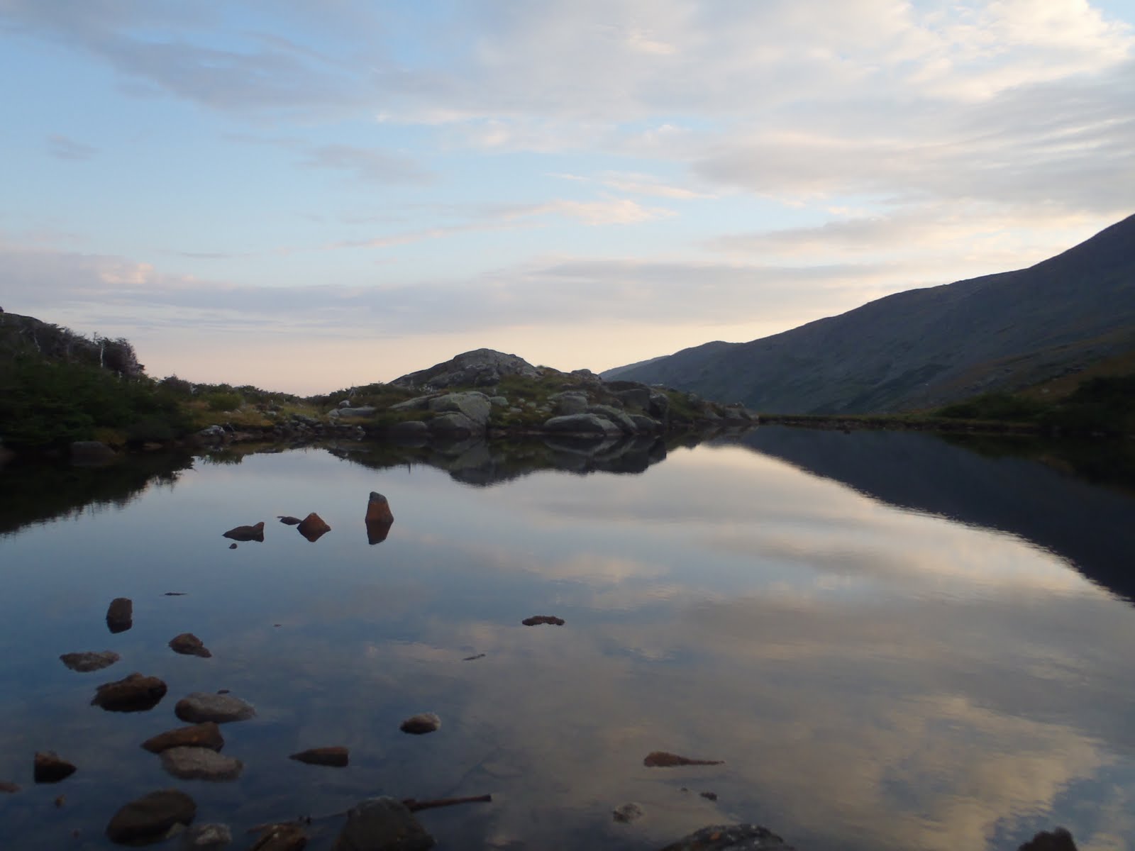
It was starting to lighten quick, but as we descended Mt. Washington on the Crawford Path the sun was blocked by the mountain. Down below, I could see the hut, and just beyond it, was Mt. Monroe. I was approaching my last peak of the 48. There was a golden glow over the summit with Washington casting its shadow on the lower cone. As we got closer, we could see the people bustling at the hut. Lake of the Clouds looked as amazing as ever. We parked at the hut, drank water, and refilled our water and ate a breakfast muffin we bought at the store. Thankfully it was beaten to crumbs.
Lake of the Clouds
As we left the hut, it was hard to grasp that I was actually finishing this. Having come down Crawford Path before, Monroe had never looked so good. I lead the way up the fun summit cone. It's an easy path but it was pretty fun climb. I thought about all of the summits before as I took in the moment while nearing the summit marker. Bill captured some great shots of me getting the summit. I really lucked out with all of the planning and the weather. I couldn't have asked for a better way to finish this, a moonlight Presidential Traverse.
Approaching the summit of Mt. Monroe
Me on Monroe, my 48th summit
Bill on Eisenhower
After Monroe, our legs were pretty tired. We passed over Mt. Franklin and took in the nice view of the Dry River Wilderness, with the Presidents getting taller over our shoulders. Eisenhower was a struggle, but we made it. I was telling Bill not to worry, the rest wasn't that bad. It was clouding up, but the views were still great from Eisenhower. Getting across to Pierce was not bad. I was able to get my summit picture on Pierce, since my first one is on my lost camera. We were happy to get Pierce, and all of the Presidents, so we opted to leave Jackson and Webster for another trip. (We'd have more energy to look for my camera)
We slowly made our way down the Crawford Path with our legs burning. It started to rain, so on went the rain jackets. The rocks started to get slippery, and the Crawford Path is not bad when dry, but wet is a different story. Either way, its a pretty trail.
This trip was certainly one to remember. The weather turned out perfectly, and all of the planning paid off and I don't know what could have made it better. Besides the people at the huts and the few we saw, it felt like we were the only ones on the mountain, and on such a special trip to complete the 48, it was more than I ever expected.
Hike Stats
Trails: Valley Way Trail, Watson Path, Osgood Trail, Gulfside Trail, Airline Trail, Jefferson Loop, Clay Loop, Monroe Loop, Eisenhower Loop, Crawford Path, Webster Cliff (for Pierce)
Distance: 19.5 miles
Elevation Gain: 8,500 ft
Click on the slide show below to see the full album. Also below is a compilation of video footage from the trip, including me finishing on Monroe.
Congratulations Dan! I've been looking forward to this write-up. What an incredible way to finish your quest! Your entire journey has been impressive, motivating, and a lot of fun to follow. I'm about to watch the video. Thanks for bringing us along for the trip!
Hi Owen, Thank you very much. The journey has certainly been impressive and motivating for me personally, and it makes it more special that so many people enjoyed following along.


Congratulations Dan! I've been looking forward to this write-up. What an incredible way to finish your quest! Your entire journey has been impressive, motivating, and a lot of fun to follow. I'm about to watch the video.
ReplyDeleteThanks for bringing us along for the trip!
Hi Owen, Thank you very much. The journey has certainly been impressive and motivating for me personally, and it makes it more special that so many people enjoyed following along.
ReplyDelete