Thursday, June 18, 2015

Kinsmans & Cannon - 6/6/15


After a fun and fast mid-afternoon bush whack hike to Owls Head, I grabbed a chicken parmesan sub in Lincoln before heading on over to Lafayette Place.  I was excited to continue hiking into the night as it would be my 8th round finish on Cannon.  It was a beautiful night with warm temperatures, a breeze, and little bugs.  The Kinsmans and Cannon are my least frequented peaks, at this point in the journey for the grid, which means I'll be visiting them in each of the next few months, and will also finish 9th round on Cannon.
Lonesome Lake Trail
A nice tribute and quote to live by.
The hike up to Lonesome Lake was pretty easy going.  It's only been a couple of times now that I've gone up the Lonesome Lake Trail to start this loop.  As I walked around the pond, I read the nice quote in honor of David Copestakes, which was followed immediately by a breathtaking view of the Lafayette and Lincoln from the boardwalk at Lonesome Lake.  I walked up to the side of the hut, and could see the open door with the noise of everyone busy and chatting at dinner.  Still to this day, after passing it at least 9 times, this remains the only hut I've yet to step foot inside.  It seems fitting that perhaps in my very near future I could plan to enjoy a quick visit...perhaps at the end of a Hut-to-Hut Traverse (we'll see).  I never really stopped to ponder about going in, and kept on my way up the steep and rugged Fishin' Jimmy Trail.
Lonesome Lake Hut Entrance
Fishin' Jimmy Trail
Sunset was taking place as I approached the Kinsman Ridge and Kinsman Junction. The color was bright orange with a bunch of scattering pink, which motivated me to reach North Kinsman and enjoy a really nice evening twilight view out over Franconia Ridge.  Arriving at South Kinsman, the sun had since dipped below the horizon offering a dark landscape topped with the deep orange glow of the set sun. The Kinsmans have never been an exciting pair of peaks to bag, but on this beautiful night it was a nice scene making for one of my favorite visits.
Sunset from the Kinsman Ridge Trail
North Kinsman Summit
View from South Kinsman after Sunset
Summit of South Kinsman after sunset
After South Kinsman and the loss of light, was the rugged traverse along the Kinsman Ridge Trail and over the Cannonballs to get to Cannon. The trail was a little muddy but at all times easy to follow.  It's up and down with a lot of tough footing, but hiking at night allows a different type of focus to keep going at a fast pace.  I had one of the most interesting animal encounters along this stretch.  Wearing headphones, I stopped for about 30 seconds or more, looking down, playing with my phone, sending out a text. While doing so, I caught movement out of the top of my eye coming towards me at a pretty quick pace. My immediate reaction had me yell, "hey!", and in response, it darted in the other direction after making it to just a foot or so away from me.  Turns out, it was a little bunny running full speed at me. I was pretty startled!! Thank the heavens it was not a bobcat or mountain lion or lynx or something! After the scare, I continued on, battling the steepest parts of this section to get onto Cannon.
Kinsman Ridge Trail at night ended route to Cannonballs
It was a little bit cooler as I made my way up to the tower observation deck.  There was no one else around of course, and it was nice to complete my 8th Round atop Cannon looking down on the lights of Littleton and other nearby towns. I head over to begin my descent of the Hi-Cannon Trail, but not before taking a lovely break atop the cliff where I saw the almost full moonlight rising over Lincoln and Lafayette.  In a matter of a few more minutes, I was jogging my way down the Lonesome Lake Trail back to my car.  What a great day it was to hike Owl's Head and the Kinsmans and Cannon. After the fun day, I head over to Ferncroft, where the next morning, I'd tackle Whiteface and Passaconaway.
Nighttime lights from Cannon's summit.
8th Round Finish summit photo atop Cannon
Hi-Cannon Trail ladder at niget. 

Almost full moonlight over the ridge while descending.
Highlights:
Kinsmans - 9th Round
Cannon - #48 of 8th Round
Did not see another person (except the noise emanating from the hut as I passed)

Trail Conditions:
Overall there were decent conditions and no hazards that I recall.  Most of the Kinsman Ridge Trail between South Kinsman and Cannon was damp or wet, but not that bad.  The other parts, well they were pretty steep and dark, especially over the Cannonballs.
Lonesome Lake Trail 
Fishin' Jimmy Trail 
Kinsman Ridge Trail
Hike Stats
Trails: Lonesome Lake Trail, Fishin' Jimmy Trail, Kinsman Ridge Trail, Hi-Cannon Trail
Distance: 12 miles
Elevation Gain: 5,326 ft.
Actual Book Time: 5:57
Garmin Adventure Link (Upload later)

Tuesday, June 9, 2015

Owl's Head with East Bushwhack Descent - 6/6/15


Oh the dreaded but awesome Owl's Head! Still after twelve summits, its one of the most fun of the 48 in my book, and never the most dreaded.  On this day, I was rewarded with spectacular weather and great views, which I had not experienced on Owls Head in quite some time.  The previous 4 summits in 2015 were winter conditions or at night, or at night in the pouring rain, so it was exciting to have good weather, and it made me a little frisky for an extra challenge.
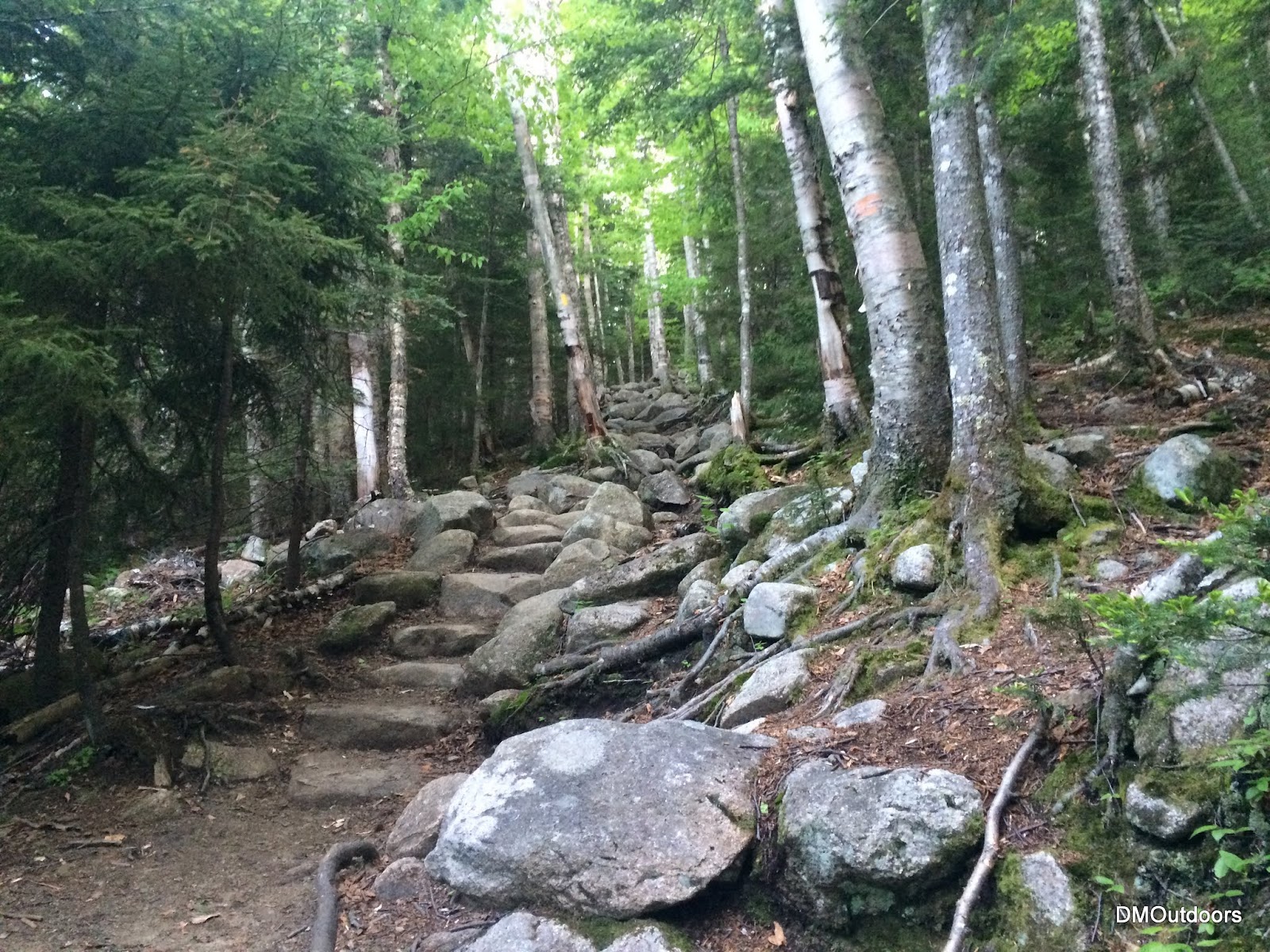
Black Pond Trail 
The front of Owl's Head from just before Black Pond 
As I started from Lincoln Woods at noontime, the National Forest rangers had their information tent up. I couldn't walk by without them asking, so I said I was heading out to Owls Head.  As the gentleman looked at his wrist, I said that it would be 12th time out there, to which he replied, "your a better man than I". At the bridge, I started my GPS track, and I was off, with plans to hike the Kinsmans and Cannon later that night.
The view from Black Pond. There was a beautiful breeze and cool clouds shooting up over the Bonds, and no one around. 
The trek through Black Pond Trail and into the bushwhack was so peaceful with no one around. Having done Owls Head four times previously in this year by way of the bushwhack, its almost unnecessary for me to check my map, compass or GPS in this stretch. Its really fun. This time, I came out a little short of the clearing, maybe 100 yards, which has been the case most of the recent times, but it all works out.
Somewhere along the Black Pond Bushwhack
Lincoln Brook, Pemigewasset Wilderness 
I saw a couple on the Lincoln Brook Trail who were having trouble keeping the trail towards 13 Falls. After some short conversation with me, it looked like they were going to give it another shot towards 13 Falls. It was warm out as I made my way up the slide, but there was a cool breeze and it was not as humid...all around beautiful day and it was hard not to take it that opportunity for views from the slide.
Franconia Ridge from the Owl's Head Slide 
Selfie action shot with my favorite peak in back 
Moving very quickly up the slide, I caught up with a younger pair of hikers in sandals (sigh).  Then literally moments later, I passed someone who asked me if I've seen a missing shoe.  I then catch up to the one with a missing shoe. She was just about to summit Owls Head with only one shoe. That's amazing! Another hiker and a young boy were with her.  They were having some challenges, including the need to get back to 13 falls.. with a shoe-less girl and a water-sandal problem with the little boy. I encouraged them to stick to the trail, as there was the other couple heading that way. They had come from 13 Falls. On a more positive note it was a joy to listen to the little boy call his dad from the summit of Owl's Head. I hope they had a great experience this weekend.
Girl summits Owl's Head with one shoe! Congrats!
Owl's Head Summit 
Some of you may remember the hike I did in 2013 with my brother called the Cross Pemi Bushwhack, which included a bushwhack down the east side of Owl's Head.  Since then, I've had an itch for a while to go for it solo, and today was the day. The name of the game is to stay up on the descending ridge and avoid getting down into one of the ravines. Between about 3,400' and 2,800' is a steep ravine to the right, and basically the steepest part of the descent. In 2013, we dipped into it a little bit and had to correct ourselves, but this time, I kept inching left as the ridge curves slightly right, and I avoided all trouble. I did jam my finger bracing myself when I fell through a hole, but even with a light pack, I still had some first-aid to take care of it.
Leaving the summit directly behind the cairn 
Broke some skin, shed some blood, falling into a mossy covered hole 
Even with a drastically reduced pack, never forget the essentials... 
Absolutely beautiful bushwhacking 
Not many people have ever seen this view.... 
Getting flatter and closer to Franconia Brook 
All of the river crossings so far were not a problem, and I didn't imagine any problems with Franconia Brook.  Often times the river looks passable, but there is a deep channel on one side.  When I made it to the river, within view, I couldn't find a spot to hop across, but there was a spot where I could walk across.  At the same time, it would be nice to dip my feet, so put two together, and I made the quick decision to remove my boots, strap them to my pack, and walk across.  I used an extra shirt to dab my feet dry, put them back on, and in just a few minutes, I found the Franconia Brook Trail.
I waded across Franconia Brook with boots off in this area, felt so good.... 
I couldn't believe that it had only taken 4 hours to hit the summit, and reach the trail by bushwhack. This motivated me even more, and I jogged the approximately 6 miles back to Lincoln Woods in just one hour and fifteen minutes, finishing in 5:17.  Even though it was done quickly, this hike was a journey with a lot of great parts to it, especially views, the personal challenge, and the success. As I push for my November goal and get closer and closer, this is all just becoming more motivating, fun, and exciting, and I feel like I'm in the best shape possible.  ....that's why when I finished, I grabbed a chicken parm sub before heading over to Lafayette Place to ready for my hike of the Kinsmans and Cannon to finish my 8th Round.
Beautiful view from the beaver pond along Franconia Brook Trail 
Returning to Lincoln Woods at the Pemi suspension bridge
Highlights:
Owl's Head - 12th Round
5th Summit of Owl's Head in 2015
Beautiful views from the slide, and of the Bonds from the bushwhack and Franconia Brook Trail
Personal fastest time to Owl's Head, even with the Black Pond bushwhack and east bushwhack descent.
Owl's Head - 12th Summit
Trail Conditions:
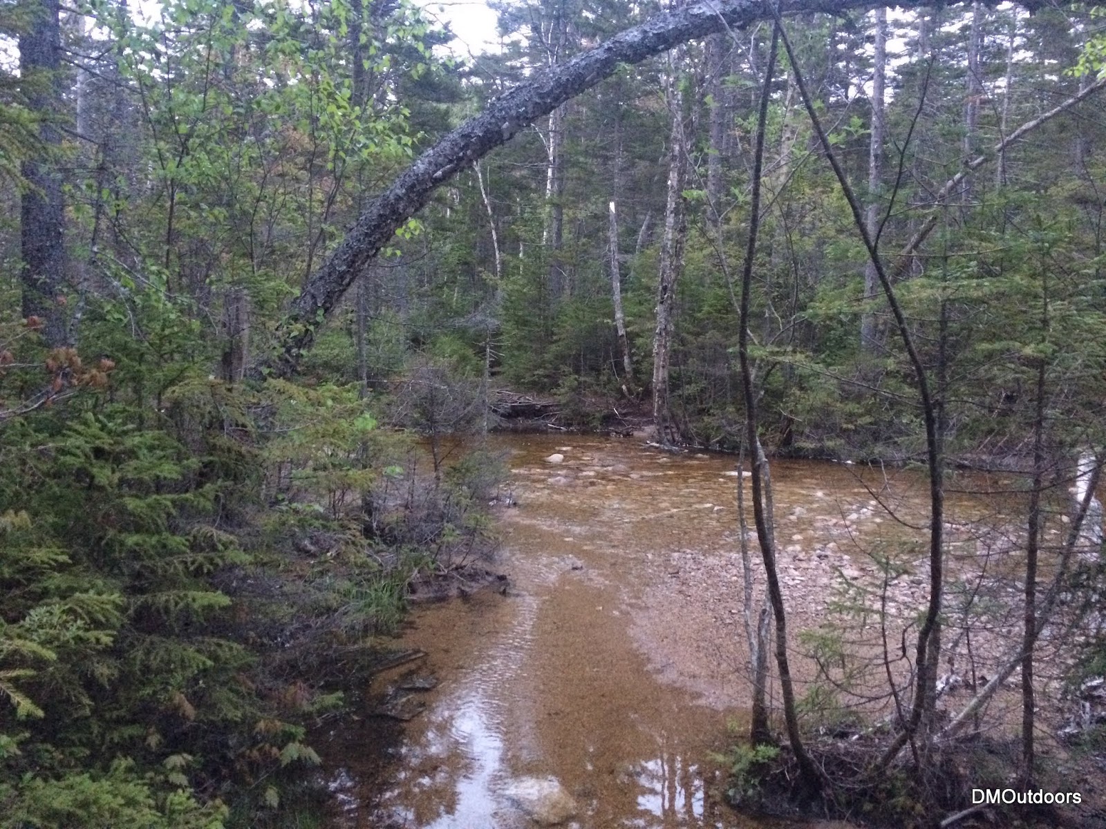
All of the trails on this hike were mostly dry, except for the typical muddy spots along the river and from runoffs. The streams after the Black Pond Bushwhack were low enough to rock-hop, and are pictured below.  After Owl's Head, I descended down the east side of the peak.  While it is very steep, the terrain was mostly dry and solid. There are numerous mossy covered holes which can be deep and leg swallowing, but other than that, the woods are tame to travel through. Rather than waste time finding a decent location to cross the Franconia Brook, I removed my boots and went across a shallow section. The rest of the trails out were dry and smooth sailing for jogging out.


Black Pond Bushwhack 
One stream crossing...
The other.... 
Owl's Head Slide
Hike Stats
Trails: Lincoln Woods Trail, Black Pond Trail, Black Pond Bushwhack, Lincoln Brook Trail, Owl's Head Path, bushwhack, Franconia Brook Trail
Distance: 15.8 miles
Elevation Gain: 3,056 ft.
Actual Book Time: 5:17
Garmin Adventure
Photo Album Link

Friday, June 5, 2015

Hancocks, Osceolas, & Mt. Tecumseh - 6/3/15


With 17 4,000-footers to hike this month for my goal. On Wednesday night, I set out for my usual mid-week night hike to kick off June, and for this night I decided on the Hancocks & Osceolas.  I decided on the Hancock's first so that I could get a good daylight glimpse of the multiple crossings in case they were higher than the norm (see below for river crossing photos).  At 7:44pm, I was off and headed up the trail.
Starting the hike to the Hancocks     
Almost to the Hancock Loop Trail 
Last light approaching the South Hancock Summit
It was nice to have some stars out, but it seemed to cloud up as I traversed the ridge to North Hancock. I descended quickly, and motored along the trail non-stop until I was finished.  When finished, I noticed a thorn had got me good on my knee when I had to scoot along the edge of one river when I crossed. Didn't notice until the end.
North Hancock Summit 
Night time river crossings!
A fairly deep gouge for a thorn
About 15 minutes after arriving at the car from the Hancocks, I moved over to the Greeley Ponds Trail head and started my way to the Osceolas.  It was comfortable out, about 50 degrees. I had changed my shirt, and was ready for another steep battle. Once I got to the ridge, I was in the clouds, and in a dense fog bank which penetrated the trees onto the trail corridor.
Greeley Ponds Trail head 
Steep trail to East Osceola 
Dense fog on Mt. Osceola Trail\ 
East Osceola Summit
After the summit, I made fairly quick work to the chimney and bypass section.  As fun as it is, there's no need to ascend the chimney myself in the dark, so without hesitation I scooted up the bypass and continued on my way. Arriving at the summit of Osceola was pretty ominous as the fog cover was very thick.  After a very short break, I headed back, reaching my car in amazing one hour and fifty-six minutes, the quickest I've ever hiked the Osceolas.
The bypass to the chimney at night 
Arriving at the Osceola Summit 
Osceola Summit Marker 
Heading back down the bypass 
Since it was only 2:00am, and I had thoughts all night about such, I decided that I had just enough time to go get Tecumseh before I had to be at work.  Without much hesitation, I hopped in the car and drove Tripoli Road to the Waterville Valley Ski area.  At 3:45am I was on my way up Tecumseh for my 5th 4,000-footer of the night.  Just like the Osceola's the dense fog was settled over the mountain creating an eerie atmosphere. One foot in front of the other, I reached the summit in a little over an hour.  This was my 10th summit of Tecumseh.  On the summit, the birds started to chirp meaning sunrise was approaching.  I made my way down, finishing in just under two hours, with plenty of time to get back to MA and arrive timely for work.  Its amazing that I can pull up to three different trail heads and do five 4,000-footers without ever seeing another person. The total for the night was 21.3 miles and 8,712' of elevation gain in 8 hours total trail time, which is comparable (in distance and elevation gain) to a Presidential Range Traverse or climbing Mt. Rainier.  

Mt. Tecumseh Trail 
Going to be a socked in summit 
Mt. Tecumseh Summit around 4:30am 
Highlights:
Hancocks - 11th Round
Osceolas- 10th Round; new personal fastest time
Tecumseh - 11th Round; #476/576 for Grid. 100 to go between now and November.
Did not see another person all night.
3rd time to each peak in 2015

Trail Conditions:
I was a little worried about the difficulty of the crossings on this night, but they were actually already pretty low after rain this week.  I got my feet a little damp making my way out to the Hancocks, especially on the last couple crossings.  I was able to find rocks to hop across, a couple of them being submerged. The trail was a little muddy in a few spots, but not bad at all. The crossing on the way to the Osceolas was no problem. The trail was a little damp, but there were no hazards other than the dense fog.  For Tecumseh, the trail was damp, and the stream crossings were no problem.

Hancocks 
Hancocks 
Hancocks, wide but shallow here 
Hancocks
Oscecola's crossing
Hike Stats - Hancocks
Trails: Hancock Notch Trail, Cedar Brook Trail, Hancock Loop Trail
Distance: 9 miles
Elevation Gain: 2,961 ft.
Actual Book Time: 3:10
Garmin Adventure

Hike Stats - Osceola's
Trails: Greeley Ponds Trail, Mt. Osceola Trail
Distance: 7.6 miles
Elevation Gain: 3,092 ft.
Actual Book Time: 1:56
Garmin Adventure

Hike Stats - Tecumseh
Trails: Mt. Tecumseh Trail
Distance: 5 miles
Elevation Gain: 2,280 ft.
Actual Book Time: 1:55
Garmin Adventure
Photo Album Link (all three)