"Have Fun With That", is what I was told about three years ago the time me, my brother, and a couple of friends were kayaking on the Ipswich River. Let's face it, the plan was to go as far as we could, but, of course, I thought we could make it to the ocean. So that's what some guy said that time when I answered where we were going, with "the ocean!". Have fun with that is what I did on Saturday, and it was the motivation for this paddle. It was total awesomeness. Back then, I knew I could do it, I just wasn't ready for it, but the way the guy said it that day, I knew I would come back and do it; I had been talking about it ever since then.
On the way home from work on Friday night, I scouted my original starting point at Ipswich River Park in North Reading. As I drove by Russell Street in Peabody, there was only a trickle and exposed rocks; the river was incredibly low from this drought. That is right after the significant dam (and falls) near the old Bostik Plant, so I was concerned immediately. As I drove Route 62 through North Reading, I couldn't see the river behind the houses (which is a marshy area, and would be torture with no water). At Ipswich River Park, it didn't look anything like I've seen it. Concerned about the water level in N. Reading, I decided to cut my plan short, which was approximately 10-12 miles shorter than I had intended. I wanted to do almost all of the 34 or so miles. The ensuing paddle would be 25.8 miles from South Middleton to THE OCEAN!
Ready to go!
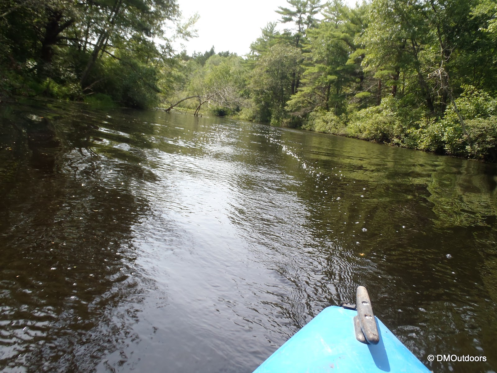
I decided to put-in at South Middleton, along Route 114. Since I cut off that distance, I didn't need to start at 6am, but I was on the river at 8:30. The weather was hazy most of the morning hours. It took over an hour for the heat to come through, but the conditions were not overly hot. The river conditions were obviously low, but thankfully it wasn't bad to start so I got going. The river from here meanders through a marshy area, making a 90-degree turn on on occasion as it makes its way further into Middleton.
Ipswich River - Middleton, MA
After I got going good, I did have to finally maneuver over a couple of beaver dams. The first one was small, and the second one was a little trickier, but I was able to remain in the boat.
A mile or so later, I came upon the popular swimming spot at Thunder Bridge in Middleton on East Street. It was quiet, and there is always a small line of rocks right after the beach to contend with. In normal water, its a nice little dip with a boost. Other than that, this section of paddling didn't throw to many issues at me as a result of the low water. I quickly passed I-95, and continued at a good pace. The river meanders quite a bit after I-95, so in higher water, it can be slightly more confusing. With the low water, it was easier, at times, to see which way the flow was going.
"Thunder Bridge" or "Thunder Hole" - Middleton, MA
Paddling underneath I-95 going into Topsfield
On the other side, I passed the Topsfield Fairgrounds. After smooth sailing for a while, I ran into few shallow spots again. As you float by, you pass some really nice homes. Before I knew it, I was already at the Wildlife Sanctuary.
A US Flag hangs randomly on the far side of the river
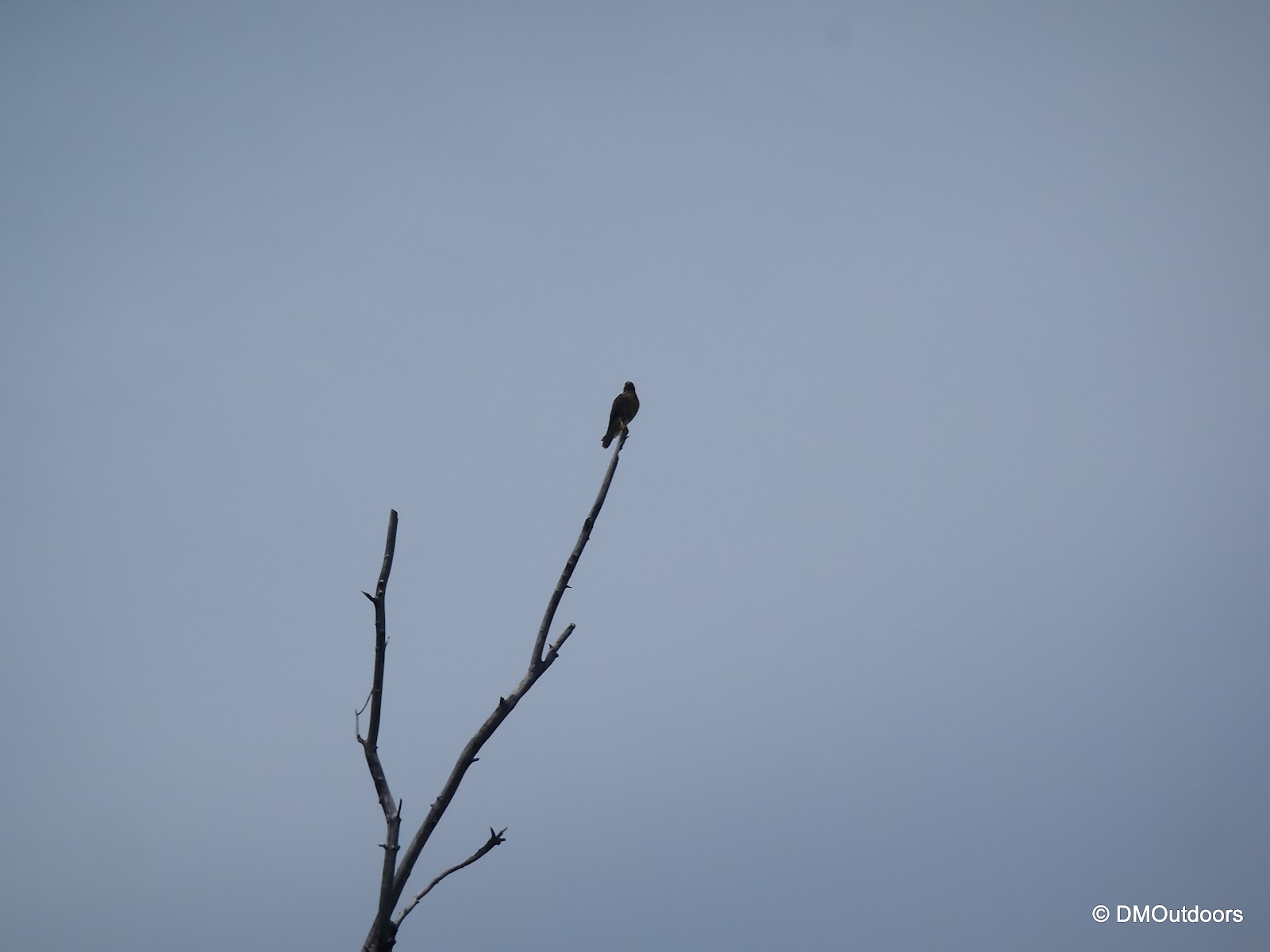
You know when your close to the Ipswich River Wildlife Sanctuary when you pass the Grand Wenham Canal or also known as the Salem/Beverly Canal. Don't go down there, that's not the river. There's always something doing in the sunny skies over the Ipswich River, like a cloud formation or plane exhaust lines. It seems to happen every time. I continued on, and as I paddled through here, which was pretty full, the animals were out and about. Turtles, snakes, blue jays, cardinals, blue herons, red-tail hawk and more. I slowly passed beneath the hawk as it sat on the dead tree, it then flew away across the way revealing the definitive red-tail feathers. The snake actually came towards me and past me about an arm's length out from my boat. It was definitely a surprise, and was easily over 3 1/2 feet in length.
Grand Wenham Canal on Ipswich River
A turtle sunning on the Ipswich River
Large Northern Water Snake
Red-tail Hawk
A nice section of flowering lilies
Continuing right on into Ipswich!
At the Willdowdale Dam, I exited to the right. There is a small path on the right side next to the fish ladder. I had to take the kayak past the first dam because there is another small one. This was my first real break, other than getting out of the kayak once to pull the kayak over a downed log. I grabbed a snack and powerade. As I was about to put-in, I noticed this bold blue heron standing right next to where I was headed. He would move eventually when he heard my boat scraping against the ground since the water was extremely shallow here.
Willowdale Dam - Ipswich River
Fish Ladder at the Willowdale Dam
Blue heron on Ipswich River
Now past the Willowdale Dam, there was still a good ways to go in Ipswich before reaching the ocean. Onward I went, but I was definitely slowed a bit by low water, but I just wanted to get past the next big portage. Although it was not the first time I had to do this, I found my self pushing myself along sandbars with my paddles. I had to maneuver slowly over the dam of rocks you see below. Before I got to the Ipswich Dam, (formerly known as Sylvania Dam) downtown Ipswich, I passed the Ipswich River Watershed Association's dock.
Mill Road Bridge
Ipswich River Watershed Association dock on Ipswich River
As I approached the dam, I thought the spot to take out was going to be a little more obvious, as it had in the past. I know it was pretty early right, but the best spot I could find (after circling a few times both right and left) was a small raised landing to get out on the right, but it required me to lift my kayak over my head and a stone wall. On top of the wall was a shared driveway with a multi family and a road-front business. I hauled the kayak over my head onto the driveway and secured my gear for the lift and carry across downtown Ipswich. As I went to lift it up, this guy comes out of the house and says something like, "Hey, if my landlord was here he'd have the police down here in a second." I said, "I'm sorry, this was the safest spot I could see to get out." He said, "Well don't do it again." Are you serious?? Give me a freakin' break buddy. So, after being heckled, I picked up my kayak with gear and all, and hauled it up the street to County Street, where I found a nice put-in spot. Ahh the ocean, but I wasn't done just yet.
Ipswich Dam
A public spot along County Street
High tide was set to be 6pm. I figured it would be around this time I'd end up on the neck, but I was a little early. I knew I wouldn't have any tide issues though other than a couple of tough spots of paddling maybe. I passed the first no wake marker, and eventually I was paddling next to huge motorboats busy going in and out. It was the afternoon, so a lot of speeding boats were coming in. I stayed to the right and out of the way as best I could while still trying to cut nice lines. I was making it. The waves from the incoming tide and boats going through the channel were splashing on deck, but that was nothing. I exited the channel, and took a wide left around the neck following the flow, somewhat, because the waves were crashing against the rocks and I didn't want to get caught up in that. I took a straight line in with the tide to the sandy beach on the left where there is a parking lot and I got out before. It took me 9hrs to paddle 25.8 miles on the Ipswich River from Middleton to the ocean. It was from the same spot we put it in that day three years ago when I said we were going to the ocean. Today, it was done, for that guy who said, "Have fun with THAT!"
No wake marker in Ipswich River
Ipswich River Bay
Looking back at the incoming tide and river mouth
A dear grazes in the marsh as I wait for my ride at Little Neck
Paddle Stats:
Distance: 25.8 miles
Book Time: 9hrs 3min
Wildlife Seen: White Perch fish, Turtles, Blue jays, Cardinal, Blue Herons, Red-tail Hawk, Geese, Ducks, Frogs, Toads, Eastern Water Snake, Deer
Hi everyone! Fall's a-coming, which means new TV shows, but better yet, new stuff for the blog. Since late 2009, when I started to really get into fishing, hiking, and paddling, I've completed some great adventures - some easy, tough, difficult, and some insane. Many of them have, in one way or other, led to goals accomplished or lessons learned. All of them are memorable in some way, and inside of every adventure was either another small adventure in itself or a moment that captivated me or was just simply hilarious and unforgettable. When you hike as much as I do, it is easy to look back at the photos and remember who was with you, or something memorable that happened that day as if it just happened yesterday. The memory comes back as if it human nature for it to happen, but really its nature itself and the views one sees from the trail, in the woods, and from mountaintops that instill this trait in outdoor enthusiasts. (Picture Above: On the Ipswich River October of 2008. I call this photo fall reflections, one of only a few favorite paddling photos (photo by my brother Bill)
Coming this fall, I will write a new series on DMOutdoors called Inside The Moments, where I will go back to the start and reflect on particular moments from my adventures. If you've read many of my trip reports, you'll see a whole new perspective on the meaning of some of my previous adventures and will hopefully be able to see, on a more personal level, the enjoyment and happiness that has come to me from my adventures and these certain moments.
On the way to Owl's Head in early Fall of 2011
I intend for most of these posts to be relatively short, describing a specific moment, but for certain topics, you will see some facts and supporting information, and I don't doubt that I will get carried away on some moments.
If you have read any of my hikes and adventures and there was a certain moment or part of it that you would like to know more about, or you wondered what the hell I was thinking, let me know here and leave a comment! Maybe it will create a great topic for this series! Maybe I already have that moment chosen!
Posts will be done weekly on Friday and will all be listed on a separate page in the navigation bar on the top of my page. I expect to publish my first "episode" in a few weeks or around the first day of Fall. This is going to give everyone something a little bit different than the weekly trip report that goes inside the adventures. Until then, plenty of more New England hiking to do before winter! Hopefully you too have some exciting stuff planned for the outdoors this fall.
For a quick glance of what you can expect to see in my first few episodes, check out the Inside The Moments page now for the first few titles!
On Saturday, August 18th, I set out on an attempt to complete a one-day extended Pemi Loop. The "Pemi Loop", short for Pemigewasset Loop, is an amazing and difficult traverse of the mountains surrounding the Pemigewasset Wilderness in the White Mountains. The "basic" loop is 31.5 miles over eight of the AMC White Mountain 4000 footers, but this would be a 38.6 mile jaunt including four additional 4000 footers, for a total of twelve in one day. My thought process for choosing this hike: 1) I needed all of the 12 peaks for July, 2) I'm planning the same hike in winter as a 2 day trip, but also adding Hale (maybe) and 3) because I LOVE THE PEMI and waking up early for a summit sunrise and the chance of a beautiful afternoon finish on the Bonds - why not?!
I had been thinking about this hike for a while, so I was very prepared. My pack was 14.1lbs without water and contained all of my regular day hike stuff, plus a hammock, emergency bivy, emergency tarp/blanket, extra socks, and a pant and shirt base layer. If i needed to stop and rest or just wanted to stay the night, my Spot messenger would have let my family know. Before any large adventures, I always make it a point to be sure I hydrate well the day before, which I did.
On Friday afternoon, I came home from work and had a nice steak dinner. After that, it was time for bed. my pack was already ready. I arrived at Lincoln Woods just after 2AM. I was crossing the bridge in the darkness at 2:30am. The air was heavy, damp, and a little misty. I was off to a good start with long strides and occasional jogging, but not too fast so not to run into any night time surprises on the trail. Its funny that I've hiked the Osseo Trail twice, but never in daylight. The Osseo Trail is a really nice ascent to the Franconia Ridge. I made it to the summit of Flume in two hours. It was pitch black, and I could only see the lights down in the notch without my headlamp. With my headlamp, I could see the fog hanging there. My sleeve-less shirt was already pretty wet from hiking through the fog as reached the ridge. With not much to see yet, I was quickly off to Liberty.
Mt. Flume summit
Mt. Liberty summit (did someone just build this cairn in last few weeks?)
As I popped out onto Little Haystack, the light was up. The Pemi was socked in on my right, and to the left there were fast moving clouds that occasionally dissipated reveling a sweet undercast with the sun glowing a yellow-orange on the horizon. Wow what a great start, I'm just getting to the exposed ridge for this sight.
Little Haystack summit
Franconia Ridge Trail about to leave Little Haystack
From near the summit of Little Haystack
The clouds broke more as I made my way over Lincoln, North Lincoln, and then to Mt. Lafayette. This is where I got the best view of the undercast. As I looked over towards Cannon it looked as if a huge glacier was actively moving down from behind it. I had to stop for a quick moment here to just watch what was happening around me. It took me four and a half hours to get to Lafayette.
Really white cloud looked like a moving glacier
Lafayette for the 6th time
I left Mt. Lafayette, and now started the most difficult sections of the Pemi Loop. I looked towards Garfield and to my right, and the clouds still had everything socked in....except for the tip of Mt. Garfield, which was my next destination. That was pretty cool, except it was pretty cold real quickly, so I had to put on my jacket here until I got moving again in the trees, but that didn't come as quickly as I was thinking. I still had the shoulders of Lafayette to contend with. Oh yeah, I forgot about this section, because last time I was lost on it in the middle of the night. My hands were even getting cold here, which was reminding me that fall is coming, but I didn't need to put on my gloves.
Now starts the Garfield Ridge Trail (love how this one came out)
Mt. Garfield summit and beyond surrounded in clouds
The Garfield Ridge Trail is 6.6 miles and 1,700 feet of elevation gain over gnarly rocky trail which is often wet. Despite that, I feel the final ascent of Garfield is easiest from this way. I made the summit of Mt. Garfield around 9am, and at the summit I couldn't see much. I remember taking a 5 or so minute break to rest at the summit.
Garfield Ridge Trail
Garfield Ridge Trail
Mt. Garfield summit
As I started to descend, I saw the first hikers of the day. The waterfall section off Garfield was going really good and required a good amount of attention. The trail (the entire day) was wet, and a wet Garfield Ridge Trail is not an easy trail. It goes up and it goes down, which is probably why my knees are still screwed up 5 days later. I still managed at the time though to give you all a thumbs up for halfway done ;)
Next up was Galehead Hut and Galehead Mountain. I was now sort of between the clouds looking out into the PemiGalehead for the 5th time. Quickly, I was back at Galehead Hut, and re-filled completely without even taking my pack off. I was empty. Dreadfully, I continued jumping on the Twinway up to South Twin - no breaks here. I've always disliked this section of trail, but for some reason, it went by more quickly this time, and it wasn't as big of a deal. On South Twin, for the 5th time in five different months, it just wasn't making it out of the clouds yet.
I didn't drop the pack for North Twin. I was surprised that I was still on pretty decent time, but I wanted to push it through these out and back and get to the Bonds with time to play with. I had made it from South Twin out to North Twin, and all the way back and over to the Bondcliff junction in about two hours, which is 4.6 miles over the North Twin Spur and the Twinway.
From North Twin summit view point
For Zealand, I dropped my pack at the sharp corner on the trail after a sharp descent from Guyot. I clipped the Spot to me and took my half-filled water bottle and got to the summit of Zealand. A kind couple took my photo, but I thanked them and was off so quickly, I completely realized that I forgot to ask if they wanted a photo, I'm sorry! I was back at my pack, and then just that bit of elevation gain later, I was back on Guyot, above treeline, the sun was shining, and I could see that it was shaping up to be a spectacular Bonds traverse!
Zealand summit!
I passed several hikers on Twinway and Bondcliff Trail. It's active in the late afternoon because of hikers going to the Guyot Tent Site. I dropped my pack at the West Bond junction, grabbed my cameras, and continued to West Bond. The view was absolutely amazing, and the weather was just awesome. Another hiker was enjoying the afternoon there when I arrived. West Bond is truly an awesome remote peak. It's hard to get to, so its good to enjoy for a few minutes, and that I did.
On West Bond summit - 4th time, 4th month
The ridge from Bond to Bondcliff from West Bond
Shortly after, I was back on the Bondcliff Trail and walking up to the summit of Mt. Bond. The view from here provided another amazing lift to the energy and spirits. You can't see anything but mountains, no roads, nothing but clouds, shadows, mountains, birds, and exposed ridge-line at your feet. There was just a light breeze.
Summit of Mt. Bond
On my way to my last peak of the day - Bondcliff
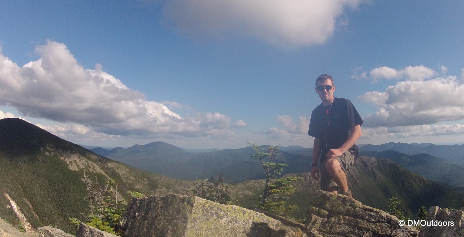
The descent down from Bond to the flatter part of the ridge was torture. Just this short section is rock hopping irregularly placed rocks that just kills the legs. Then you get to where the picture above is taken and its a little easier. I was tired as you could imagine. My legs actually started to get real sore around Galehead, but now it was mounting up on the legs. Despite that, I reached Bondcliff, my 12th 4000 footer of the day, and essentially success with only the 8+ mile jaunt out remaining. I slowly walked right out onto the cliff, one of the most magical spots to be in all of the white mountains.
What a day!
Bondcliff overlooking the Pemi Wilderness
Bondcliff
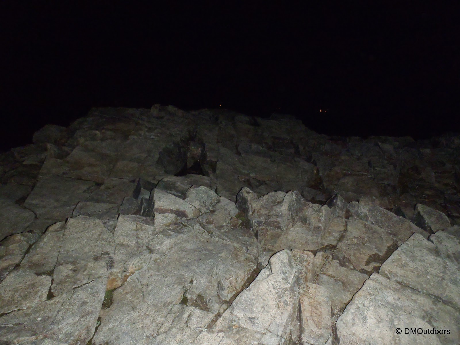
Descending the Bondcliff Trail was just brutal on my legs. They were hurting, and I slowed tremendously. I was still on for my target time. As I was within the trees, the light of day faded. I passed maybe 5 or more people on the Bondcliff Trail camping out with fires ablaze. I was surprised, but after that, I needed my flashlights and head lamp. It was incredibly dark, and it was a long torturous walk out, trying to stay on the flattest path possible because the railroad ties were just busting my legs. It was sort of a surreal moment to realize how prepared I thought I was, and when I went to change the battery in my flashlight, the extra battery wasn't there like it always is. Both my headlamp and flashlight were dimming as I made my way past the Osseo Trail. I knew I was going to make it before they completely died, but if you haven't hiked at night in the mountains, you have no idea how dark it gets. Double check your batteries, and always bring more than one source of light. I made my way over the Pemigewasset River footbridge some 20 hours and 10 minutes, and 12 mountains later, and as I looked up on this beautiful night, safely with my lamps off, I saw the milky way and potentially the most stars I've ever seen from this very spot at night. I hobbled to my car and went straight to McDonald's. My knees hurt so bad in the car, and I was falling asleep after eating, so I pulled over to get some quick sleep. Eventually I woke, and arrived home at 4am. A totally kick ass hike and experience if you ask me! Now lets see if I can do this bad boy in the winter plus Hale, even if it takes all weekend.
Bondcliff Trail
Please, I do not recommend anyone attempt this hike in a day unless you bring all of the gear necessary for a possible night out. Hike Stats