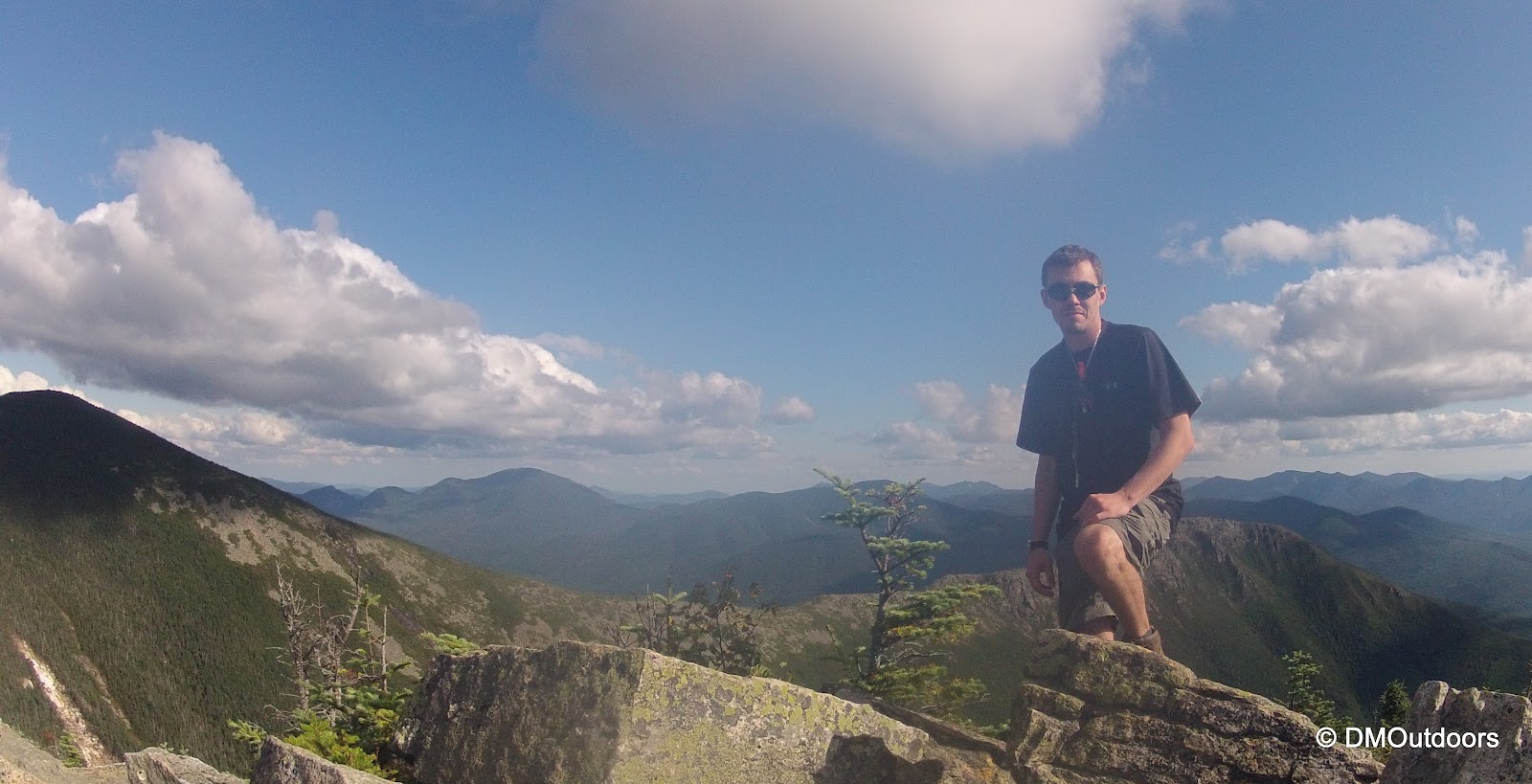
On Saturday, August 18th, I set out on an attempt to complete a one-day extended Pemi Loop. The "Pemi Loop", short for Pemigewasset Loop, is an amazing and difficult traverse of the mountains surrounding the Pemigewasset Wilderness in the White Mountains. The "basic" loop is 31.5 miles over eight of the AMC White Mountain 4000 footers, but this would be a 38.6 mile jaunt including four additional 4000 footers, for a total of twelve in one day. My thought process for choosing this hike: 1) I needed all of the 12 peaks for July, 2) I'm planning the same hike in winter as a 2 day trip, but also adding Hale (maybe) and 3) because I LOVE THE PEMI and waking up early for a summit sunrise and the chance of a beautiful afternoon finish on the Bonds - why not?!
I had been thinking about this hike for a while, so I was very prepared. My pack was 14.1lbs without water and contained all of my regular day hike stuff, plus a hammock, emergency bivy, emergency tarp/blanket, extra socks, and a pant and shirt base layer. If i needed to stop and rest or just wanted to stay the night, my Spot messenger would have let my family know. Before any large adventures, I always make it a point to be sure I hydrate well the day before, which I did.
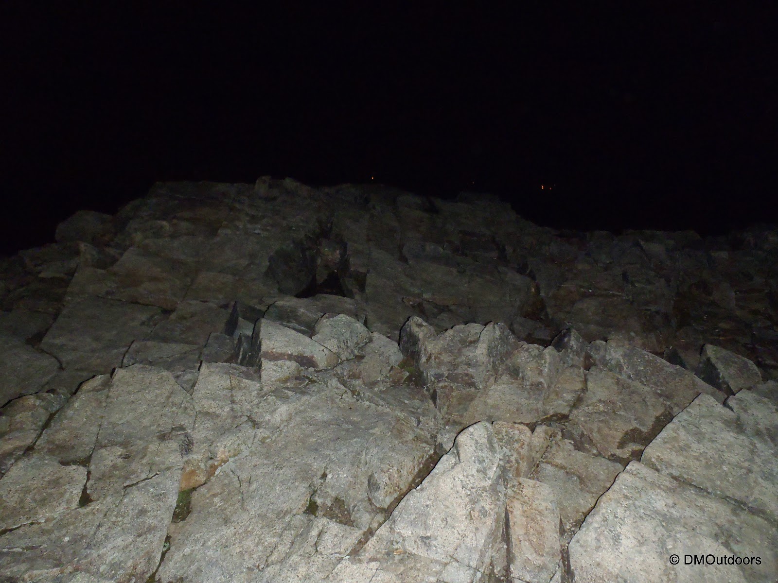
On Friday afternoon, I came home from work and had a nice steak dinner. After that, it was time for bed. my pack was already ready. I arrived at Lincoln Woods just after 2AM. I was crossing the bridge in the darkness at 2:30am. The air was heavy, damp, and a little misty. I was off to a good start with long strides and occasional jogging, but not too fast so not to run into any night time surprises on the trail. Its funny that I've hiked the Osseo Trail twice, but never in daylight. The Osseo Trail is a really nice ascent to the Franconia Ridge. I made it to the summit of Flume in two hours. It was pitch black, and I could only see the lights down in the notch without my headlamp. With my headlamp, I could see the fog hanging there. My sleeve-less shirt was already pretty wet from hiking through the fog as reached the ridge. With not much to see yet, I was quickly off to Liberty.
Mt. Flume summit
Mt. Liberty summit (did someone just build this cairn in last few weeks?)
As I popped out onto Little Haystack, the light was up. The Pemi was socked in on my right, and to the left there were fast moving clouds that occasionally dissipated reveling a sweet undercast with the sun glowing a yellow-orange on the horizon. Wow what a great start, I'm just getting to the exposed ridge for this sight.
Little Haystack summit
Franconia Ridge Trail about to leave Little Haystack
From near the summit of Little Haystack
The clouds broke more as I made my way over Lincoln, North Lincoln, and then to Mt. Lafayette. This is where I got the best view of the undercast. As I looked over towards Cannon it looked as if a huge glacier was actively moving down from behind it. I had to stop for a quick moment here to just watch what was happening around me. It took me four and a half hours to get to Lafayette.
Really white cloud looked like a moving glacier
Lafayette for the 6th time
I left Mt. Lafayette, and now started the most difficult sections of the Pemi Loop. I looked towards Garfield and to my right, and the clouds still had everything socked in....except for the tip of Mt. Garfield, which was my next destination. That was pretty cool, except it was pretty cold real quickly, so I had to put on my jacket here until I got moving again in the trees, but that didn't come as quickly as I was thinking. I still had the shoulders of Lafayette to contend with. Oh yeah, I forgot about this section, because last time I was lost on it in the middle of the night. My hands were even getting cold here, which was reminding me that fall is coming, but I didn't need to put on my gloves.
Now starts the Garfield Ridge Trail (love how this one came out)
Mt. Garfield summit and beyond surrounded in clouds
The Garfield Ridge Trail is 6.6 miles and 1,700 feet of elevation gain over gnarly rocky trail which is often wet. Despite that, I feel the final ascent of Garfield is easiest from this way. I made the summit of Mt. Garfield around 9am, and at the summit I couldn't see much. I remember taking a 5 or so minute break to rest at the summit.
Garfield Ridge Trail
Garfield Ridge Trail
Mt. Garfield summit
As I started to descend, I saw the first hikers of the day. The waterfall section off Garfield was going really good and required a good amount of attention. The trail (the entire day) was wet, and a wet Garfield Ridge Trail is not an easy trail. It goes up and it goes down, which is probably why my knees are still screwed up 5 days later. I still managed at the time though to give you all a thumbs up for halfway done ;)
Next up was Galehead Hut and Galehead Mountain. I was now sort of between the clouds looking out into the PemiGalehead for the 5th time. Quickly, I was back at Galehead Hut, and re-filled completely without even taking my pack off. I was empty. Dreadfully, I continued jumping on the Twinway up to South Twin - no breaks here. I've always disliked this section of trail, but for some reason, it went by more quickly this time, and it wasn't as big of a deal. On South Twin, for the 5th time in five different months, it just wasn't making it out of the clouds yet.
I didn't drop the pack for North Twin. I was surprised that I was still on pretty decent time, but I wanted to push it through these out and back and get to the Bonds with time to play with. I had made it from South Twin out to North Twin, and all the way back and over to the Bondcliff junction in about two hours, which is 4.6 miles over the North Twin Spur and the Twinway.
From North Twin summit view point
For Zealand, I dropped my pack at the sharp corner on the trail after a sharp descent from Guyot. I clipped the Spot to me and took my half-filled water bottle and got to the summit of Zealand. A kind couple took my photo, but I thanked them and was off so quickly, I completely realized that I forgot to ask if they wanted a photo, I'm sorry! I was back at my pack, and then just that bit of elevation gain later, I was back on Guyot, above treeline, the sun was shining, and I could see that it was shaping up to be a spectacular Bonds traverse!
Zealand summit!
I passed several hikers on Twinway and Bondcliff Trail. It's active in the late afternoon because of hikers going to the Guyot Tent Site. I dropped my pack at the West Bond junction, grabbed my cameras, and continued to West Bond. The view was absolutely amazing, and the weather was just awesome. Another hiker was enjoying the afternoon there when I arrived. West Bond is truly an awesome remote peak. It's hard to get to, so its good to enjoy for a few minutes, and that I did.
On West Bond summit - 4th time, 4th month
The ridge from Bond to Bondcliff from West Bond
Shortly after, I was back on the Bondcliff Trail and walking up to the summit of Mt. Bond. The view from here provided another amazing lift to the energy and spirits. You can't see anything but mountains, no roads, nothing but clouds, shadows, mountains, birds, and exposed ridge-line at your feet. There was just a light breeze.
Summit of Mt. Bond
On my way to my last peak of the day - Bondcliff
The descent down from Bond to the flatter part of the ridge was torture. Just this short section is rock hopping irregularly placed rocks that just kills the legs. Then you get to where the picture above is taken and its a little easier. I was tired as you could imagine. My legs actually started to get real sore around Galehead, but now it was mounting up on the legs. Despite that, I reached Bondcliff, my 12th 4000 footer of the day, and essentially success with only the 8+ mile jaunt out remaining. I slowly walked right out onto the cliff, one of the most magical spots to be in all of the white mountains.
What a day!
Bondcliff overlooking the Pemi Wilderness
Bondcliff
Descending the Bondcliff Trail was just brutal on my legs. They were hurting, and I slowed tremendously. I was still on for my target time. As I was within the trees, the light of day faded. I passed maybe 5 or more people on the Bondcliff Trail camping out with fires ablaze. I was surprised, but after that, I needed my flashlights and head lamp. It was incredibly dark, and it was a long torturous walk out, trying to stay on the flattest path possible because the railroad ties were just busting my legs. It was sort of a surreal moment to realize how prepared I thought I was, and when I went to change the battery in my flashlight, the extra battery wasn't there like it always is. Both my headlamp and flashlight were dimming as I made my way past the Osseo Trail. I knew I was going to make it before they completely died, but if you haven't hiked at night in the mountains, you have no idea how dark it gets. Double check your batteries, and always bring more than one source of light. I made my way over the Pemigewasset River footbridge some 20 hours and 10 minutes, and 12 mountains later, and as I looked up on this beautiful night, safely with my lamps off, I saw the milky way and potentially the most stars I've ever seen from this very spot at night. I hobbled to my car and went straight to McDonald's. My knees hurt so bad in the car, and I was falling asleep after eating, so I pulled over to get some quick sleep. Eventually I woke, and arrived home at 4am. A totally kick ass hike and experience if you ask me! Now lets see if I can do this bad boy in the winter plus Hale, even if it takes all weekend.
Bondcliff Trail
Please, I do not recommend anyone attempt this hike in a day unless you bring all of the gear necessary for a possible night out. Hike Stats
Thanks Don, I greatly appreciate the compliment! Love your recent kayaking adventures. Since my legs are still hurtin', I'm thinking of getting the kayak out this weekend...we'll see.
Awesome! The PL is tough, let alone adding every last one of the extra peaks. Pictures are spectacular as always and really capture the varied weather and scenery of the route.
Thanks Summer - it certainly is tough, and no matter what Pemi Loop you make it, its always a challenge. Looking back, I couldn't have asked for the weather to be any different. It was cool at the start, a little bit warmer in the middle, and in the afternoon, I couldn't break a sweat, yet it was warm, sunny and perfect for the finish on Bondcliff.
Congratulations! Enjoyed reading the post. Awesome pictures too. I have been interested in doing the Loop for some time. I have done all of the mountains along the Pemi loop but never in one trip. I haven’t been on the Osseo trail, the section between Franconia Ridge and Garfield, or the section from South Twin to the Twinway. What are these sections like? I would like to do the same extended 12 peaks loop over two days staying at either Guyot or Garfield shelters. Do you have any recommendations on the direction, clockwise or counter clockwise?
Hi - Thank you for reading it! The Osseo Trail ascends from Lincoln Woods Trail at an easy grade, so whether starting or ending here, its not much to worry about. The Garfield Ridge Trail from Lafayette to Garfield goes over Lafayette's shoulders and down to Garfield Pond. A decent portion of this trail is exposed as you leave Lafayette. It's rocky trail just like the Franconia Ridge Trail, but rockier path and descending until you dip in the trees and to Garfield Pond. The Twinway from South Twin to Bondcliff Trail junction is a nice section, has some bog bridges. Not too difficult.
I think most feel the clockwise loop is easier. I agree, but it depends on the timing, particularly for an overnight. Counter clockwise - ideally you'd want to get Zealand out of the way on the first day, come back to Guyot, then Twins and the rest the following day. Clockwise, if you can fit a long day in to start and get to South Twin in early afternoon, you could decide whether to do Zealand that day or head to Guyot camp. If you need to get to Guyot Camp because its getting late, do it, and then do out and back to Zealand in AM, and then back over the Bonds and out. I think it depends how far you can make it the first day. Even breaking this up is two really challenging day hikes. Good luck, and if you're doing this in the near future, remember the days are getting shorter.


Wow! Very impressive...you are in a class by yourself!
ReplyDeleteThanks Don, I greatly appreciate the compliment! Love your recent kayaking adventures. Since my legs are still hurtin', I'm thinking of getting the kayak out this weekend...we'll see.
DeleteAwesome! The PL is tough, let alone adding every last one of the extra peaks. Pictures are spectacular as always and really capture the varied weather and scenery of the route.
ReplyDeleteThanks Summer - it certainly is tough, and no matter what Pemi Loop you make it, its always a challenge. Looking back, I couldn't have asked for the weather to be any different. It was cool at the start, a little bit warmer in the middle, and in the afternoon, I couldn't break a sweat, yet it was warm, sunny and perfect for the finish on Bondcliff.
DeleteCongratulations! Enjoyed reading the post. Awesome pictures too.
ReplyDeleteI have been interested in doing the Loop for some time. I have done all of the mountains along the Pemi loop but never in one trip. I haven’t been on the Osseo trail, the section between Franconia Ridge and Garfield, or the section from South Twin to the Twinway. What are these sections like? I would like to do the same extended 12 peaks loop over two days staying at either Guyot or Garfield shelters. Do you have any recommendations on the direction, clockwise or counter clockwise?
Hi - Thank you for reading it! The Osseo Trail ascends from Lincoln Woods Trail at an easy grade, so whether starting or ending here, its not much to worry about. The Garfield Ridge Trail from Lafayette to Garfield goes over Lafayette's shoulders and down to Garfield Pond. A decent portion of this trail is exposed as you leave Lafayette. It's rocky trail just like the Franconia Ridge Trail, but rockier path and descending until you dip in the trees and to Garfield Pond. The Twinway from South Twin to Bondcliff Trail junction is a nice section, has some bog bridges. Not too difficult.
DeleteI think most feel the clockwise loop is easier. I agree, but it depends on the timing, particularly for an overnight. Counter clockwise - ideally you'd want to get Zealand out of the way on the first day, come back to Guyot, then Twins and the rest the following day. Clockwise, if you can fit a long day in to start and get to South Twin in early afternoon, you could decide whether to do Zealand that day or head to Guyot camp. If you need to get to Guyot Camp because its getting late, do it, and then do out and back to Zealand in AM, and then back over the Bonds and out. I think it depends how far you can make it the first day. Even breaking this up is two really challenging day hikes. Good luck, and if you're doing this in the near future, remember the days are getting shorter.