The Ipswich River, located on the North Shore of Boston, is 35 miles long in its entirety. The river supports dozens of communities along its banks. One can pass over the Ipswich River on bridges in many different towns, but to experience the river in its entirety, between all of those bridges is a completely unique experience. Whether you paddle it in a small section, all at once, or even multiple times, the river seems to always be enjoyable.
In August of 2012, I did a solo paddle from South Middleton to Little Neck, where the Ipswich River empties into the Atlantic Ocean. This was a total distance of 25.8 miles. It was a dry time of year, and the river was extremely low. However, I was fortunate enough to make it without any problems, got to see an abundance of wildlife, which is good. With the river as low as it was, I didn't want to take the chance of running aground in the marsh in Middleton, one of the most inaccessible areas from nearby riverbank.
Despite that being quite an epic paddle for me, I had not done it as completely as I wanted. This time, I was back with my brother to paddle it completely, and this would be the first time I've paddled since August 2012, and my brother even longer. Would we be able to do this in one day?
The actual start of the Ipswich River is located off of Woburn Street in Wilmington, MA. The only available parking is down the street on a cul-de-sac, so launching here is tough unless you're doing a short paddle. We needed to leave our car all day and get picked up in Ipswich. We opted to put-in at the Ipswich River Park in North Reading, instead of there. This is the furthest easy-to-park launching spot to launch a full length paddle of the Ipswich River. We didn't want to be parking in a cul-de-sac, unloading kayaks at 5:30am in the morning. This leaves the very first 1.5 miles of the river technically un-paddled, but its most often un-passable in a boat.
With that out of the way, at sunrise we unloaded the car, and put-in to the calm, but flowing river in North Reading, and off we were for a loooong journey to the ocean. The first leg of the paddle was just a little bit over 5 miles to the Bostik Dam. This is always a definite portage. The take out is on the left, before the concrete pad. You can put back in anywhere after the drop. From here, the quickwater provides a nice little push to get back going again as it flows through the corner of West Peabody and into Middleton.
Just starting near Ipswich River Park in North Reading
Approaching the "infinity river" at Bostik Dam
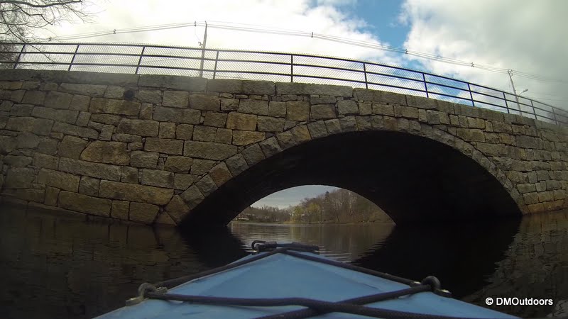
Bostik Dam near the Middleton and West Peabody line
From Russell Street in Peabody to Route 114 in Middleton is one of the lesser paddled sections of the river. Just after the bridge on Russell Street, while I was still riding the quickwater, I noticed two deer off to my left in the woods, camouflaged well. They were tough to see, but were pretty close as I floated by. Once the walking path disappears from the right, the river winds through the wet land area in South Middleton. In this section, we came across two different white herons and many other birds. We pulled into the South Middleton launch, where we took a break.
A small deer is alerted as I paddle by
A White Heron in flight over the wetlands
Takin' a quick break, but ready to keep on goin'
The wetland area as seen from the South Middleton boat launch
The next section is the rest of Middleton. It passes under several bridges, winds behind neighborhoods, and passes around a peninsula containing a gun range, leaving you to hope that nothing goes astray over the fences. There are lots of twist and turns in the river through Middleton.
Redwing blackbirds dominated the river morning to afternoon
Paddling at 3mph for 33 miles
Hey, can I get a high five?!
A large Blue Heron takes flight in front of us
A different Blue Heron hanged off to the side as we passed
Leaving Middleton and heading into Topsfield, the river continued to present lots of sights to see. As we paddled under the bridge to Route 1, on the right there is always runoff from a natural accumulation of water that pools off to the side. It even added to the flow, allowing us to cruise right through Topsfield. Beautiful estates and couple of pretty bridges are just a couple of things among many others to see. For our next break since Middleton, we stopped at Sally's Landing.
Sally's Landing on Ipswich River
Beached at Sally's Landing for a break and stretch
From here, the river leaves Topsfield and enters Ipswich for the rest of the way to the ocean. The first attraction in Ipswich is the Ipswich River Wildlife Sanctuary and then there is Bradley Palmer State Park. Once you pass the Wenham-Beverly canal or also called the Grand Wenham Canal, you're into the sanctuary, and a flurry of birds can be heard the entire time until you come back towards Ipswich Road. This is one of the best sections of the river, and the section I recommend you paddle through if you're looking for a short paddle. (High Street to Ipswich Road)
The Wenham-Beveral Canal or the Grand Wenham Canal
Ipswich River Wildlife Sanctuary
A hawk (usually Red-tail Hawk) flies high above
Willowdale Dam
At the Willowdale Dam and Foote Brothers Canoe, we took out to the right for the portage around the two-level dam. Shortly after putting back in, we passed a backyard field and came across four deer. I've now seen deer several times along the Ipswich River, in just about each section. Onward and ocean-bound, we came to our last portage at the Sylvania Dam in downtown Ipswich. The proper location to exit the river is directly across from the first corner of the building, in a public field by a small pond, which is called Ipswich Reservoir.
Deer on the Ipswich River
Approaching Sylvania Dam in Ipswich
Ipswich Reservoir
From here, the portage is left around the little pond, and then out to Main Street, and down County Street to the public landing, which I believe is called Street Landing. We rested the arms after the tiring portage through the bustling intersection, and at that point we were now in ocean waters! When planning any paddle beyond downtown Ipswich, its best that the tide is going out, so you have to plan this in advance. Fortunately, we only battled some wind and slightly choppy water in the bay for our last two miles, and we pulled into the beach on Little Neck having paddled the entire river in 11 hours. My dad was there waiting to give us a ride back to North Reading. It was a great day, a success, and to the guy who way back when mocked me when I said I was paddling to the ocean (attempting to), I now officially consider it done!
Green Street Bridge, last bridge
Paddling around Little Neck, to Little Neck Beach
(I recommend clicking Bigger Map and changing to satellite imagery)


No comments:
Post a Comment