The fall months are such a busy time of year at work for me, and never mind the fall birthdays, and there's all of life's little hassles too. While I like to keep bagging 4000 footers for the grid :) my brother keeps me in check to make sure we do some of the classic hikes, and he's been persuading that we start focusing on some of the 100 highest and different, unique hikes. The last few hikes together have been cool, because we each added to our individual peak lists and list of trails red-lined, it the addition was different for both of us (except bagging Clay directly together!). After considering several options, we decided that on September 29th, we would take a new to us route to Mt. Isolation via the Glen Boulder Trail, with the primary goal of summiting Slide Peak (aka Gulf Peak) for the Trailwrights...oh yeah, and we were shooting for sunrise!
 |
| Glen Boulder Trail 4AM |
 |
| Direttissima-Glen Boulder Junction |
We started our hike at 4am from the Glen Ellis parking area. The Glen Boulder Trail was pretty rocky, and yes it was pretty steep! The temperature was pretty cool enough for Bill to have gloves on, and me my hat, but the trail warmed us pretty quickly, and eventually they went into our pockets temporarily. We passed the Direttissima Trail and kept making our way up until we started to enter lower scrub. Before Glen Boulder was a steep section, and once above the trees, it took a few minutes for the outline of the boulder to become visible, but it was still pitch black as we passed the boulder.
 |
| Glen Boulder before sunrise |
 |
| The Wildcats and pending sunrise behind Bill as ascends Glen Boulder Trail |
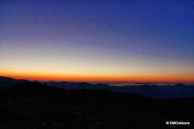
As we continued to climb, and about an hour before actual sunrise, the east horizon began to glow a beautiful orange. This made me think of the sunrise we saw on Mt. Whitney, and of course the many sunrises we've witnessed elsewhere. Its hard to describe, but its pure excitement, and all about being in the moment of an amazing sunrise. Sharing silence but with wide grins about the amazement, we made it to Slide Peak (4,807') in advance of sunrise. This was my 59th Trailwright. We stayed nearly an hour on the summit of Slide Peak taking in the sunrise. It was cold sitting around, but we tested out the Esbit Emergency Stove to make us some hot chocolate to add to our enjoyment. YUM Sunrise and Hot Chocolate.
 |
| Esbit Emergency Stove, boiling water for hot chocolate |
Here are the views as we waited for our Slide Peak sunrise....(they are not in precise order - and believe it or not, not all pics are in the post, so check out the album)
 |
| The Wildcats-Carter Range! |
 |
| Low fog in the valleys, but not above tree-line |
 |
| Morning over the Presidential Range-Dry River Wilderness |
 |
| Bill finally getting a chance to put his new camera to work above tree-line |
Mesmerized by the approaching sunrise's glow, and the awesome morning view down the spine of the Montalban Ridge, in the corner of my eye I noticed it was here...there it was, rising....and fast so we quickly readied our cameras and ourselves, and continued to take it all in...They say watching the sun rise from the horizon like this can bring lots of positive energy your way. Who knows if that's true, but it surely
It was super chilly hanging around for so long, but it was so well worth it. We were still early on in the hike, and had plenty to look forward to. So far, this was all to ourselves. We packed up, and started up the trail towards the junction with the Davis Path. Before we left though, we couldn't help but notice the alpenglow on the summits of Eisenhower and North Isolation!
 |
| Alpenglow on Mt. Eisenhower |
 |
| Alpenglow on North Isolation |
Along the way up, we passed a bunch of mountain cranberries, including a frosty patch too. They tasted OK, but not great. Not sure whether its past time or too early. We had tried a bunch of them two October's ago on Mt. Moosilauke with someone who knew about them. We made the junction with the Davis Path, and were happy to get a break, as we would be ascending a while for the next leg of hike towards Mt. Isolation.
As we started to hike down the ridge, the views from this location are sweeping and most certainly awesome!


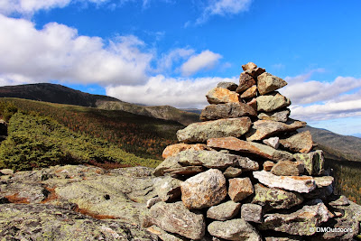
We poked around for the North Isolation summit. I had been here before, but Bill used this hike to check North Isolation on his Trailwrights. Interestingly, if your hiking towards Isolation, we found piles of rocks on both sides of the summit. One pile was about 20 yards off to left under a stump, and then there was another pile of rocks, more resembling a small cairn on the right. After checking them both out, we continued on, passing the junction with the Isolation Trail West and then East. A while ago, I remember seeing there was an opening to adopt the Isolation West trail. If you read my last report to Clay, I was planning to hike this trail, but its closed (and I completely forgot). Although we've never hiked it, Bill and I would consider adopting this trail and/or helping when repair efforts whenever they should get underway. Since I will be needing some Trailwright work, maybe some sort of connection could be made next summer.
 |
| View from North Isolation back to Mt. Washington |
 |
| Isolation Trail West and Davis Path junction |
Next up was Mt. Isolation. Mt. Isolation will always be an adventure for us, because of our first attempt at it. This was my 4th time to Mt. Isolation, and Bill's 2nd. We arrived to the vacant summit with amazing morning views. It was great to be back to this beautiful and remote spot.
After enjoying the summit for a while, another group arrived. We took our photos and began the trek back. By this route, there is about 1,500 feet of elevation gain on the return trip, which is what makes this the more strenuous route to Isolation. The beautiful views automatically provided us more frequent and longer breaks than usual hikes, and it was pretty much smooth sailing and pure enjoyment of the rest of the hike.
Anyone who is looking to hike Mt. Isolation for their second time should consider taking this route on a nice day. This was one of the best leisure hikes Bill and I have done, and is certainly up there with some of our favorites.
Hike Stats
Trails: Glen Boulder Trail, Davis Path, Mt. Isolation summit spur
Distance: 12 miles
Elevation Gain: 5,050 ft.
Actual Book Time: 11:15 (including at least 2+ hours in stoppage)
*Noted as an more strenuous approach for Mt. Isolation in The 4000 Footers of the White Mountains, by Steve Smith.


No comments:
Post a Comment