On the way back to Las Vegas on June 20, 2012, which was the day following our summit of Mt. Whitney, we took a tour of Death Valley and many of its sights along the way. Death Valley was such a desolate place, an amazing place, and I was able to get a sense of how it is place where it is tough to survive.
We left Lone Pine on Route 136/190 towards Panamint Springs. Then on Route 190, we made our way towards Stovepipe Wells.
Stovepipe Wells Visitor Center
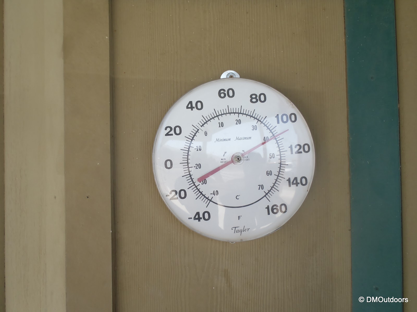
At the visitor center, we went into the store to buy Gatorades and water and see what the gift shop was all about, and we were looking how to pay our entrance fee. The girl at the counter directed us to the ranger station which was in the lot next to the store and gas station. Here, we met a ranger inside who took our fee and provided us with a map and permit for our vehicle, and we were on our way. Man it was hot outside.
 |
| Stovepipe Wells Ranger Station |
 |
| Thermometer outside of Stovepipe Wells Ranger Station |
Mesquite Sand Dunes
Very quickly after the visitor center lies the Mesquite Sand Dunes where there are pull-offs on the road, and its not too much of a signed area, but we pulled of, wanting to take a walk towards them off the road, watching for snakes as we passed each bush. We were now expanding this incredible trip into an even greater adventure I never expected. Later, I'd read that these sand dunes have been used in Hollywood films such as Star Wars.
 |
| Mesquite Flat Sand Dunes |
 |
| Bill exploring Death Valley |
 |
| Me in the middle of the desert!!!! |
Continuing East on Route 190, the next major town is Furnace Creek. After Furnace Creek, in order to experience this grand tour, don't miss the turn onto Badwater Road, Route 178. It starts and ends on 190 between Furnace Creek and Shoshone, driving south, at the base of the Black Mountains to the left. Very quickly, we saw our next destination of choice, Golden Canyon.
Golden Canyon
At Golden Canyon, there is a large parking lot, and a trail head information sign. It looks like a wall of mountains with a path leading into a Canyon. I didn't know what to expect reading the sign, but we grabbed our cameras and water and took off up the trail. There were several other people exploring, as well. The trail winds up the canyon, and we looked all around to see impressive rock formations displaying many layers of rock. I am not sure how long the path winds up the canyon, but we only went about a third of a mile before turning around and heading back to the car, but so far I've hiked off the road into the desert and also into a canyon a little bit, this is crazy!
Artist's Drive and Palette
Around 6 miles south of Golden Canyon was our next interesting feature to explore, which was Artist's Drive and Palette. The sign said "No Vehicles longer than 25 feet", but we were all set. The reason is because the road to and from this spot has such severe dips so that if you have a long car, you could get stuck by your front and rear bumpers, haha! From the highway you can see the attraction, which is a display of layered rock in several colors, which is caused by oxidation of certain metals in the rock. This area was highly volcanic thousands of years ago. The road is a few miles long and is just as fun as seeing the main attraction.
 |
| Artist's Palette seen from the viewpoint on a hill a short stroll away |
We have to give it up to our GMC Terrain, which we chose as our rental out of the available fleet from National Car Rental of McCarran Airport in Vegas. It struggled in terms of power and sometimes acted weird, but it was new and looked pretty good everywhere we went. Having this rental was an added element for me, being in control, doing whatever the hell we wanted miles and miles away from home. This is something that I've wanted to do, and want to do. Just get on a plane or in the car and go, and experience first-hand new places and going at it with no holding back.
 |
| Our GMC Terrain rental car and Artist's Palette |
Natural Bridge
Just the name itself was reason to make this a definite stop. We arrived, and went over to look at the trail head sign. It was a 1 mile hike to the Natural Bridge through Natural Bridge Canyon. Would we do it? Would we ever get to do this again? Hike 2 more miles in the desert? Of course we did it. It was blazing hot still, now around 110-115 degrees as we were getting closet to the lowest elevation. We checked our water supplies, put on sunscreen and grabbed our hats before setting off with a steady pace and deep breaths. It was just like Golden Canyon, but a little bit wider. Quickly, we noticed that it didn't seem that bad, as we could see the bridge, which was mighty impressive. We got a little bit closer and noticed that a mountain is visible above looking through underneath it. It offered a little bit of shade for us too. The trail extends much further past the bridge, allowing for more hiking, but another one mile back to the car, which would be enough satisfaction for us after being able to see the Natural Bridge.
 |
| Looking at the trail ahead from the near the lot. |
 |
| Walking into Natural Bridge Canyon |
Badwater Basin
Next, was our most anticipated destination on this journey, Badwater Basin. Badwater Basin is 282 feet below sea level, and is the lowest place in the United States and in all of North America. We had just come from the highest elevation in the lower United States to the lowest in North America. This was such an amazing experience. Badwater Pool is fed by a spring nearby, and up on the side of the mountain, across the road was a sign labeled "sea level." That was pretty cool. I can't count how many times I've heard about this place, and now I've been here, after climbing to the highest.
 |
| Badwater Basin |
 |
| Me and Bill at Badwater Basin, -282 below sea level |
 |
| Badwater Pool |
 |
| Sea level sign at Badwater Basin |
The trip lost a little bit of momentum after Badwater Basin as we passed the desolate Mormon Point, where the road rounded about the ridges extending to the desert floor from nearby Smith Mountain, 6000'. We also saw a sign for Manly Lake. Tens of thousands of years ago, the valley we stood in was filled with water to about halfway up the mountains we saw. That was amazing to see and think about.
 |
| Passing Mormon Point |
 |
| Lake Manly - it must have looked amazing way back then |
Ashford Mill Ruins
Our last destination, 30 miles from Mormon Point, was the Ashford Mill Ruins. This place of importance has a rather simple and interesting history. Long story short for you - it was someone else's property left over from the gold rush, and someone came along and found a little bit of gold, and after a dispute it turned out the prior owner didn't keep up on his stuff, so the new guy got to keep it, and then the site changed hands twice and was developed into a mill. The reason it lasted so long was because they accidentally trained in twice the amount of cement needed to build the mill. It was a very pretty place, with nice mountains surrounding it.
After Ashford Mill, the road heads into the Black Mountains where you pass through Jubilee Pass and Salisbury Pass and descend into Shoshone. Salisbury Pass is at over 3000 feet of elevation. After leaving Shoshone, we got stuck at a road work stop for over a half hour. Road work in the desert is a little bit more difficult.
 |
| Waiting for road work after leaving Shoshone |
After that restless ordeal, we were on our way out of Death Valley and out of California. California was an amazing place, and there is much more I want to see, both cities and mountains. We had about the same distance we just drove to go again before getting back to Vegas. There, we would end our amazing and unforgettable trip, having partied it up in Las Vegas with friends, climbed Mt. Whitney camping above 10,000 feet twice, and then just going all out on Death Valley.