Showing posts with label Hancock. Show all posts

Friday, June 5, 2015

Hancocks, Osceolas, & Mt. Tecumseh - 6/3/15


With 17 4,000-footers to hike this month for my goal. On Wednesday night, I set out for my usual mid-week night hike to kick off June, and for this night I decided on the Hancocks & Osceolas.  I decided on the Hancock's first so that I could get a good daylight glimpse of the multiple crossings in case they were higher than the norm (see below for river crossing photos).  At 7:44pm, I was off and headed up the trail.
Starting the hike to the Hancocks     
Almost to the Hancock Loop Trail 
Last light approaching the South Hancock Summit
It was nice to have some stars out, but it seemed to cloud up as I traversed the ridge to North Hancock. I descended quickly, and motored along the trail non-stop until I was finished.  When finished, I noticed a thorn had got me good on my knee when I had to scoot along the edge of one river when I crossed. Didn't notice until the end.
North Hancock Summit 
Night time river crossings!
A fairly deep gouge for a thorn
About 15 minutes after arriving at the car from the Hancocks, I moved over to the Greeley Ponds Trail head and started my way to the Osceolas.  It was comfortable out, about 50 degrees. I had changed my shirt, and was ready for another steep battle. Once I got to the ridge, I was in the clouds, and in a dense fog bank which penetrated the trees onto the trail corridor.
Greeley Ponds Trail head 
Steep trail to East Osceola 
Dense fog on Mt. Osceola Trail\ 
East Osceola Summit
After the summit, I made fairly quick work to the chimney and bypass section.  As fun as it is, there's no need to ascend the chimney myself in the dark, so without hesitation I scooted up the bypass and continued on my way. Arriving at the summit of Osceola was pretty ominous as the fog cover was very thick.  After a very short break, I headed back, reaching my car in amazing one hour and fifty-six minutes, the quickest I've ever hiked the Osceolas.
The bypass to the chimney at night 
Arriving at the Osceola Summit 
Osceola Summit Marker 
Heading back down the bypass 
Since it was only 2:00am, and I had thoughts all night about such, I decided that I had just enough time to go get Tecumseh before I had to be at work.  Without much hesitation, I hopped in the car and drove Tripoli Road to the Waterville Valley Ski area.  At 3:45am I was on my way up Tecumseh for my 5th 4,000-footer of the night.  Just like the Osceola's the dense fog was settled over the mountain creating an eerie atmosphere. One foot in front of the other, I reached the summit in a little over an hour.  This was my 10th summit of Tecumseh.  On the summit, the birds started to chirp meaning sunrise was approaching.  I made my way down, finishing in just under two hours, with plenty of time to get back to MA and arrive timely for work.  Its amazing that I can pull up to three different trail heads and do five 4,000-footers without ever seeing another person. The total for the night was 21.3 miles and 8,712' of elevation gain in 8 hours total trail time, which is comparable (in distance and elevation gain) to a Presidential Range Traverse or climbing Mt. Rainier.  

Mt. Tecumseh Trail 
Going to be a socked in summit 
Mt. Tecumseh Summit around 4:30am 
Highlights:
Hancocks - 11th Round
Osceolas- 10th Round; new personal fastest time
Tecumseh - 11th Round; #476/576 for Grid. 100 to go between now and November.
Did not see another person all night.
3rd time to each peak in 2015

Trail Conditions:
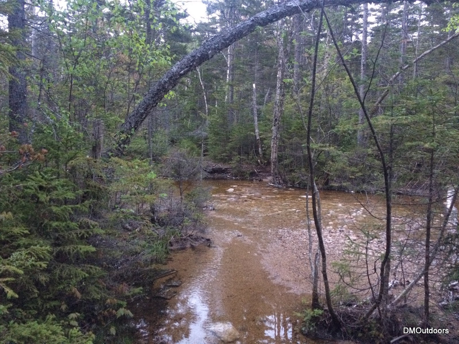
I was a little worried about the difficulty of the crossings on this night, but they were actually already pretty low after rain this week.  I got my feet a little damp making my way out to the Hancocks, especially on the last couple crossings.  I was able to find rocks to hop across, a couple of them being submerged. The trail was a little muddy in a few spots, but not bad at all. The crossing on the way to the Osceolas was no problem. The trail was a little damp, but there were no hazards other than the dense fog.  For Tecumseh, the trail was damp, and the stream crossings were no problem.

Hancocks 
Hancocks 
Hancocks, wide but shallow here 
Hancocks
Oscecola's crossing
Hike Stats - Hancocks
Trails: Hancock Notch Trail, Cedar Brook Trail, Hancock Loop Trail
Distance: 9 miles
Elevation Gain: 2,961 ft.
Actual Book Time: 3:10
Garmin Adventure

Hike Stats - Osceola's
Trails: Greeley Ponds Trail, Mt. Osceola Trail
Distance: 7.6 miles
Elevation Gain: 3,092 ft.
Actual Book Time: 1:56
Garmin Adventure

Hike Stats - Tecumseh
Trails: Mt. Tecumseh Trail
Distance: 5 miles
Elevation Gain: 2,280 ft.
Actual Book Time: 1:55
Garmin Adventure
Photo Album Link (all three)

Friday, August 15, 2014

Hancocks for Sunset - 8/1/14


With July behind us, it was time to see what peaks were needed for August.  This summer has been loaded with family outings, more so than the last few years.  That's been totally awesome, and it's only allowed for hiking on different days, rather than both days every weekend.  With a party for Saturday to attend, my brother and I set out sights on a Friday night sunset hike for the first of August.  Our peak selection was the Hancock's. 

Hancock Notch Trail
A high squirrel doesn't give a sh*t about us
We got there in good time after work, being prepared the night before, as usual.  Bill was excited to get out again after another stint of not hiking much.  For this one, we each brought a beer to enjoy at sunset.  I've been stashing whatever I can to add weight to my packs lately anyways for training purposes so no problem with that.  Immediately after starting up the trail, I nearly stepped on a squirrel that didn't move as it ate something.  You know when you're watching the person's feet in front of you? Well Bill almost saw the squirrel get squished. After we both passed, it moved off the trail in a stumble.  We found that it didn't want to leave the mushroom it was snacking on.  Perhaps it was a funky mushroom. After the funny squirrel, we pushed it up the trail,  because we needed to move to make sunset.

The stream at the bottom of the dip on the North loop
Hancock Loop junction with nice colors
We decided on doing North Hancock first.  It was the best shot at actually seeing the sunset, as South Hancock outlook faces the east.   We kept up the effort up the steep trail, as time was fading to make sunset.

Arrow Slide from the loop trail
Hancock Loop to North Peak
With literally only two minutes before actual sunset we arrived at the summit of North Hancock.  The sky was a nice color.  The clouds seemed to reflect and have some color to them.  The orange ball of the sunset was just visible for a couple of minutes through the trees.  The temperature was nice, it was good, and we cracked open one of the pints and toasted to a nice sunset summit of North Hancock.

View from the North Hancock outlook
Sunset from North Hancock
Have some Mo


Feeling rejuvenated and ready to go, we set off across the ridge.  It was just a perfect weather night, and no one around.  We checked out possible spots to enter from the Captain, since we're headed out there soon, and maybe this winter.  It had just about gotten fully darkas we approached South Hancock, and somewhat thick cloud cover contributed to that.  We went to the lookout, and could see the lights on Route 302, which was a new sight.  In the day,  you don't see any civilization.  We busted out the second pint and enjoyed another 4,000 footer summit.

South Hancock

The hike down was nice and smooth, just like the beer we drank.  What a nice Friday night hike.   It was my 6th time to the Hancock's,  3rd time for my brother and his first time without snow.  We then got a good night sleep before having a great time with cousins and friends at the party on Saturday.

Hike Stats
Trails: Hancock Notch Trail, Cedar Brook Trail, Hancock Loop
Distance: 9.8 miles
Elevation Gain: 2,713 ft.
Actual Book Time: 6:30
GPS Track: Garmin Adventures

Wednesday, January 30, 2013

W48-in-1: The Hancocks - 1/20/2013


This single winter season quest has started out with me climbing 19 straight solo winter peaks.  I was excited to be having my brother along for the Hancocks for this hike. He had not hiked in almost 5 weeks after a bout with some tendinitis in his shoulder. This was going to be a good one, in terms of mileage and elevation gain to get him back going again, especially before our upcoming trip to Baxter. Something unique always seems to happen, and this time it was that this hike was my 20th and 21st of this winter season, and it was my brother's 20th and 21st all time in winter. Here we go!
Sunrise from the Hancock Trailhead parking area
We started our hike just before sunrise, at a more "normal" time, you could say. We started the Spot Tracker, and off we went down the Hancock Notch Trail into the wilderness. As we got going, the temperature was not really all that cold. The sun was splashing some alpenglow on scar ridge to our left, and the skies were looking good as we hiked in at lower elevations. The trail was nicely packed out into a highway for us, and the scenery was simply beautiful. We bare booted ourselves all of the way to the junction for North and South peak. Here we put our snowshoes, and snapped up our televators for the ascent.
Cedar Brook Trail in winter 
Cedar Brook and Hancock Loop Trail junction
I had been on the Hancocks two previous times, including once with my brother. Both times I ascended Hancock, North first. This time, we elected to ascend the south peak first. The trail was broken out well from butt-sliders. Our nice warm-up and televators on the snowshoes provided us no problem with the ascent, except for slowing us a little. That was ok, because of course we had arrow slide, the southern Pemigewasset Wilderness and Franconia Ridge in our view as we went up. Since it was my brother's first winter ascent of the Hancocks, he took the lead as we reached the summit for our respective #20's. There was a wind coming from the west, so the outlook on the west side provided not only a good spot for a summit break, but a great view looking east towards Chocoura.
North Hancock and Pemi Wilderness from Hancock Loop (south ascent) 
Me at Hancock, South Peak summit (3rd Round, and 2nd time in winter)
Bill's first winter ascent of Hancock, South Peak 
View from Hancock, South Peak summit
Enjoying some warm tea as a reward
We took a solid break here, but after a while, the fingers started to "feel it" and it was time to get going across the ridge to North Hancock. We proceeded along the completely well marked and broken out trail. It was noticeably different doing the loop in this counter-clockwise direction. The traverse was incredibly easy for us along this section. So much so, after we stopped to talk to a solo hiker, who turned out to be Matt (see his blog here), we had no idea that in just 10 more steps we were already at the summit of Hancock, North Peak. As opposed to the somewhat fair weather we had on south peak, it was snowing like crazy on the summit of North. It was getting colder by the second, so after a couple of photos, we ducked into the trees.

We did some pretty good butt-sliding/glissading down the trail, and it seemed like we were down super fast. The hike out after summiting the Hancocks is always very pleasant. We had a nice weather morning, some views, some snow, and great scenery - it was a great day for the Hancocks in winter, and the end of another solid 4-peak weekend for me.
Crossing a frozen stream on Cedar Brook Trail 
Bill hikes the Cedar Brook Trail 
The Osceola's from the Hancock Trailhead
Hike Stats
Trails: Hancock Notch Trail, Cedar Brook Trail, Hancock Loop Trail
Distance: 9.8 miles
Elevation Gain: 2,650 ft.
Actual Book Time: 7:05