The plan for this hike was a full traverse from the Horn to Starr King where we had left one car Friday night. We drove from Starr King over to the Berlin Fish Hatchery, and the gate was open around 10:30pm, so we proceeded to the trailhead for the Unknown Pond Trail. We relaxed for about an hour and tried to get a quick nap in before setting off.
After getting our gear, food, and everything situated, we started up the Unknown Pond Trail at 11:50pm. The trail was wet from the get-go and muddy along some stretches. Our boots were covered in mud early, but no wet socks yet. The stream roared pretty loudly next to us. Although rugged, the trail was very easy to follow with just headlamps. There was one pretty tricky crossing where there were 3 thin sticks crossing the first section of the crossing. It was really the easiest way across; we had to grab two sturdy sticks so that we could walk across without relying on balance only.
 |
| Bill using a birch stick for balance across the stream |
But once we got across that section, we were now in the middle and used the two sticks again to help us over the other half of this crossing which was less technical. After this, it was a smooth ascent until we reached the Unknown Pond Tentsite. Along the way, we came across one of the coolest thing I've seen on-trail. We happened to stop, and I looked down, realizing I almost had stepped on it.
 |
| A yellow-spotted salamander on Unknown Pond Trail |
At Unknown Pond, we took a look around to explore and we shined our lights out over the pond to get a glimpse of it and anything that might be out there swishing around, but there was nothing but silence and complete darkness. After a short break we carried on to the junction with the Kilkenny Ridge Trail and then started towards the Horn.
Along this 1.6 mile section of trail, the conditions were still wet, but there was a little less mud. The fog was starting to increase steadily, reducing visibility, however the trail remained very easy to follow in the darkness. We made it to the spur trail seemingly quick. We were anxious to get a summit under the way. The spur trail was a very narrow trail. As it nears the summit, the trail is a tunnel of scrub and boulders and then emerges onto a rock ledge at the summit. Of course we couldn't see anything, but we're peakbagging, so tonight the goal was the peak, not the view. The fog even made it difficult for picture-taking.
 |
| On the summit of the Horn in deep fog at 3:20am |
We continued along the Kilkenny Ridge Trail to the Bulge summit. We had to do a double take when we came across the small cairn. It didn't seem like we gained much more elevation. But, there was two New England Hundred Highest out of the way.
 |
| Standing next to the summit cairn on The Bulge |
Next up was Cabot, another 4000 footer for Bill, and were looking forward to a break and some shelter at the cabin. As we made the approach from the Bulge, I could sense when we were making the final push to the summit, and we then came out at the clearing and found the summit sign.
 |
| Bill on Mt. Cabot, his 34th NH 4000-footer |
 |
| Me on Mt. Cabot for the 2nd time |
As we made our way to the other side of the mountain, the wind and fog picked up. We made it to the cabin, which was vacant, so we hunkered down and relaxed on the sleeping pads and snacked on some of our food. Since we hiked through the clouds and wet trail the entire way, our gear had become either damp or wet. After stopping, and even inside the cabin and in our extra clothes, we had a hard time staying comfortable and warm. We arrived at the cabin around 5am, and we ended up leaving sometime after 7am when daylight was breaking.
 |
| Foggy daybreak from Cabot Cabin |
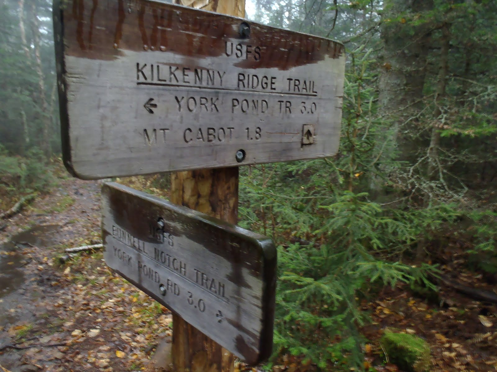
As we stepped off the porch and started down the trail, there was snow and sleet mixed with the rain. Despite that, we were moving quickly and carefully down the trail, arriving at the junction with the Bunnell Notch Trail. Here, we decided that because of the conditions, that we would loop to Bill's car back at the hatchery and shorten this trip. On the way down, I slipped on one of the wooden trail bridges and plunged both feet completely into a puddle up to my shins. I dislike those trail bridges because they are more slippery than anything else on the trail. We made it to York Pond Road just after 10am.
 |
| Kilkenny Ridge and Bunnell Notch Trail junction |
 |
| Fall on the lower Bunnell Notch Trail |
Hike Stats
Trails: Unknown Pond Trail, Kilkenny Ridge Trail, Horn Spur, Bunnell Notch Trail
Distance: 11.5 miles
Elevation Gain: 3635 feet
Book Time: 10hrs 20min
To view the full album from this hike, view or click on the slide show below.